Product successfully added to your shopping cart
There are 0 items in your cart. There is 1 item in your cart.
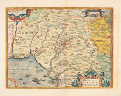
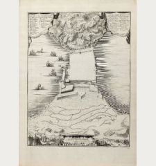
Hispalensis Conventus Delineatio Auctore Hieronymo Chiaves
Abraham Ortelius (*1527 - †1598)Reference 12894
Description
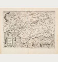
Schöne, altkolorierte antike Landkarte von Andalusien von A. Ortelius. Zeigt Sevilla und seine Umgebung in Andalusien. Mit Córdoba, Écija und Jerez de la Frontera.
Die Karte hebt die wichtigsten Heimathäfen des spanischen Reiches hervor und basiert auf dem Bericht von Geronimo de Chavez, dem leitenden Geographen der spanischen Casa de Contratacion in der Blütezeit des Reiches. Im Mittelpunkt steht eine bildliche Darstellung der ummauerten Stadt Sevilla und ihrer Kathedrale am Fluss Guadalquivir. Cádiz, ein wichtiger Hafen und Heimathafen der spanischen Schatzflotte, ist in der unteren Mitte prominent dargestellt. Auf der Karte ist auch das gebirgige Terrain der Region künstlerisch dargestellt. Vor der Küste von Cádiz findet eine Seeschlacht statt, und in den Gewässern treiben Seeungeheuer ihr Unwesen.
Aus der lateinischen Ausgabe des Theatrum Orbis Terrarum von 1592, lateinischer Text auf der Rückseite.
Details
| Cartographer | Abraham Ortelius |
| Title | Hispalensis Conventus Delineatio Auctore Hieronymo Chiaves |
| Publisher, Year | Plantin Press, Antwerpen, 1592 |
| Plate Size | 35.0 x 46.2 cm |
| Sheet Size | 46.8 x 57.2 cm |
| Reference | Van den Broecke, M.: Ortelius Atlas Maps, No. 28.1; Van der Krogt, P.: Koeman's Atlantes Neerlandici, 6112:31. |
Condition
Cartographer
Images to Download
If you like to download the image of this map with a resolution of 1200 pixels, please follow the link below.
You can use this image for publication on your personal or commercial websites for free if you set a link to this website. If you need photographs with a higher resolution, please contact us.
Spain - Portugal - Ortelius, Abraham - Hispalensis Conventus Delineatio Auctore...

![Tabula nova Hispaniae [Tabula noua Hispaniae] Tabula nova Hispaniae [Tabula noua Hispaniae]](https://www.vintage-maps.com/3236-home_default/fries-spain-portugal-1541.jpg)

![[Canary Islands] [Canary Islands]](https://www.vintage-maps.com/3021-home_default/bordone-spain-portugal-canaries-tenerife-gran-canaria.jpg)
