Product successfully added to your shopping cart
There are 0 items in your cart. There is 1 item in your cart.
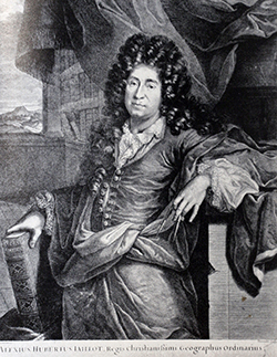
Antique Maps by Alexis Hubert Jaillot (*1632 - †1712)

Atlas Nouveau Contenant Toutes les Parties du Monde
H. Jaillot, Paris, 1692
Title page of the Atlas Nouveau by Hubert Jaillot. At the top the royal coat of arms of France, the gods Mars and Pallas next to the upper columns. Louis the Great and Monseigneur Le Dauphin are...
Atlas Nouveau Contenant Toutes les Parties du Monde
1692 - Alexis Hubert Jaillot
12730Atlas title page from H. Jaillot. Printed in Paris 1692.
650,00 €
Estats de l'Empire du Grand Seigneur des Turcs en Europe, es Asie, et en Afrique / Nova Imperii...
H. Jaillot, Paris, 1696
Old coloured antique map of the Ottoman Empire by Hubert Jaillot. Shows the south-east of Europe, the Middle East and the north-east of Africa. A title cartouche at the bottom centre.
Estats de l'Empire du Grand Seigneur des Turcs en Europe, es Asie, et en...
1696 - Alexis Hubert Jaillot
12480Old coloured map of the Ottoman Empire, Turkish Empire. Printed in Paris by H. Jaillot in 1696.
780,00 €
La Lorraine, qui comprend les Duchés de Lorraine et de Bar, et Les Balliages des Eveschés et des...
Covens & Mortier, Amsterdam, circa 1730
Large antique map of Lorraine after Hubert Jaillot. This is the Covens & Mortier edition. Shows Lorraine, in the north Luxembourg and in the east Alsace, the Rhine with the Breisgau and the Black...
La Lorraine, qui comprend les Duchés de Lorraine et de Bar, et Les...
1730 - Alexis Hubert Jaillot
12482Old coloured map of the Lorraine. Printed in Amsterdam by Covens & Mortier circa 1730.
180,00 €
La Basse Partie du Cercle du Haut Rhein / Circuli Rheni Superioris...
Covens & Mortier, Amsterdam, circa 1730
Antique map of Hesse after H. Jaillot by Covens and Mortier. Shows the area between the Rhine with Mainz in the southwest to Göttingen in the northeast. With Marburg, Kassel, Fulda, Brilon and...
La Basse Partie du Cercle du Haut Rhein / Circuli Rheni Superioris...
1730 - Alexis Hubert Jaillot
12517Old coloured map of Hesse, Germany. Printed in Amsterdam by Covens & Mortier circa 1730.
320,00 €
Provinces Unies des Pays-Bas / Belgium Foederatum
P. Mortier, Amsterdam, circa 1730
Antique map of the Netherlands by H. Jaillot at P. Mortier. Shows the Netherlands with sea battles and sunk ships on the North Sea. To the top left a title cartouche.
Provinces Unies des Pays-Bas / Belgium Foederatum
1730 - Alexis Hubert Jaillot
12526Old coloured map of the Netherlands. Printed in Amsterdam by P. Mortier circa 1730.
420,00 €
Estats de l'Empire des Turqs en Europe / Tabula Nova Imperii Turcarum
Covens & Mortier, Amsterdam, circa 1730
Antique map of the Turkish Empire in Europe after Jaillot. This is the Covens & Mortier edition of the detailed map. With the eastern Mediterranean, the Black Sea, Greece, the Balkans and Italy. A...
Estats de l'Empire des Turqs en Europe / Tabula Nova Imperii Turcarum
1730 - Alexis Hubert Jaillot
12532Old coloured map of Turkey. Printed in Amsterdam by Covens & Mortier circa 1730.
550,00 €
Partie du Cercle d'Austriche, ou sont les Duches de Stirie, de Carinthie, de Carniole / Pars...
H. Jaillot, Paris, circa 1690
Large antique map of the south-eastern part of Austria to the Adriatic Sea by Jaillot. Shows the area between Chiemsee, Neusiedler See and the Western Balkans. With Slovenia, Croatia, Northern...
Partie du Cercle d'Austriche, ou sont les Duches de Stirie, de...
1690 - Alexis Hubert Jaillot
12497Old coloured map of Austria - Hungary. Printed in Paris by H. Jaillot circa 1690.
Sold
Le Cercle Eslectoral du Rhein divise en touts les Estats qui le composent
H. Jaillot, Paris, circa 1690
Large antique map of the course of the Rhine by Jaillot. Shows the Rhine from Strasbourg to Kleve. With Düsseldorf, Cologne, Koblenz, Bingen, Frankfurt, Mannheim and Heilbronn. To the lower left a...
Le Cercle Eslectoral du Rhein divise en touts les Estats qui le composent
1690 - Alexis Hubert Jaillot
12525Old coloured map of North Rhine-Westphalia, Germany. Printed in Paris by H. Jaillot circa 1690.
Sold![Jaillot, America Continent, 1694 (1729): Amerique Septentrionale Divisee en Ses Principales Parties [and] L'Amerique Meridionale Divisee en Ses Principales Parties.]( "Alexis Hubert Jaillot: Amerique Septentrionale Divisee en Ses Principales Parties [and] L'Amerique Meridionale Divisee en Ses Principales Parties.")
Amerique Septentrionale Divisee en Ses Principales Parties [and] L'Amerique Meridionale Divisee...
R. & J. Ottens, Amsterdam, 1694 (1729)
A matching set of two old colored maps of North and South America by Alexis Hubert Jaillot. California is still shown as an island and the Great Lakes are shown with open ends in the West. Separate...
Amerique Septentrionale Divisee en Ses Principales Parties [and]...
1694 - Alexis Hubert Jaillot
11770Old coloured map of the American continent. Printed in Amsterdam by R. & J. Ottens in 1729.
Sold
L' Asie divisee en ses Principales Regions, et ou se peut- voir l' estendue. Des Empires,...
1696
Attractive large map of Asia, by Jaillot and Sanson. Forth state dated 1696.
L' Asie divisee en ses Principales Regions, et ou se peut- voir l'...
1696 - Alexis Hubert Jaillot
10053Coloured map of the Asian continent. Printed in the year 1696.
Sold
Partie du Cercle d'Austriche, Scavoir l'Archduche d'Austriche / Austriae Circuli...
H. J. Jaillot, Paris, 1696
Large antique map of Upper Austria and Lower Austria by Jaillot. Shows the area along the Danube from Braunau and Passau, Linz, Enns, Grein, Ypps, Vienna, up to Bratislava. Below left the Königsee,...
Partie du Cercle d'Austriche, Scavoir l'Archduche d'Austriche / Austriae...
1696 - Alexis Hubert Jaillot
12495Old coloured map of Austria - Hungary. Printed in Paris by H. J. Jaillot in 1696.
Sold
Le Cercle de la Haute Saxe ou sont Compris le Duche et Electorat de Saxe...
H. Jaillot, Paris, 1696
Large antique map of East Germany by Jaillot. Shows the area between Berlin, Prague and Eisenach. With Erfurt, Dresden, Leipzig and Magdeburg. To the upper left a title cartouche.
Le Cercle de la Haute Saxe ou sont Compris le Duche et Electorat de Saxe...
1696 - Alexis Hubert Jaillot
12503Old coloured map of Saxony, Germany. Printed in Paris by H. Jaillot in 1696.
Sold
Principaute de Catalogne ou sont Compris les Comtes de Roussillon et de Cerdagne Divises en leurs...
H. Jaillot, Paris, 1696
Antique map of Catalonia (Catalunya) by Jaillot. Shows the Catalan Mediterranean coast from the Ebro to France. Barcelona in the centre. To the lower right a title cartouche.
Principaute de Catalogne ou sont Compris les Comtes de Roussillon et de...
1696 - Alexis Hubert Jaillot
12542Old coloured map of Catalonia, Cataluna, Catalunya. Printed in Paris by H. Jaillot in 1696.
Sold
Comitatus Flandriae tam Oriet quam Occid
Covens & Mortier, Amsterdam, circa 1715
Antique map of Flanders (Vlaanderen) by H. Jaillot at Covens and Mortier. Shows the coastline of the North Sea between Gravelines and the Scheldt estuary, with Antwerp and Brussels to the east. A...
Comitatus Flandriae tam Oriet quam Occid
1715 - Alexis Hubert Jaillot
12530Old coloured map of Flanders (Vlaanderen). Printed in Amsterdam by Covens & Mortier circa 1715.
Sold
Amerique Septentrionale divisee en ses Principales Parties
1719
Attractive map of North America. By Jaillot and Sanson. California between island and peninsula. Pacific Northwest unexplored. Old outline colour.
Amerique Septentrionale divisee en ses Principales Parties
1719 - Alexis Hubert Jaillot
10051Coloured map of North America. Printed in the year 1719.
Sold
La Suisse Divisée en ses Trenze Cantons - Nova Helvetiae, Foederatarumque...
Covens & Mortier, Amsterdam, circa 1730
Old coloured antique map of Switzerland by A. H. Jaillot. This is the Covens & Mortier edition. Shows Switzerland between Lake Geneva (Genfersee ) and Lake Constance (Bodensee). With a magnificent...
La Suisse Divisée en ses Trenze Cantons - Nova Helvetiae,...
1730 - Alexis Hubert Jaillot
12461Old coloured map of Switzerland. Printed in Amsterdam by Covens & Mortier circa 1730.
Sold
Les Estats de Savoye et de Piemont / Status Sabaudiae Ducis
Covens & Mortier, Amsterdam, circa 1730
Old coloured antique map of Savoy and Piedmont by A. H. Jaillot. This is the Covens & Mortier edition. Shows the area between Lake Geneva and the Mediterranean Sea. From Geneva over the Alps to...
Les Estats de Savoye et de Piemont / Status Sabaudiae Ducis
1730 - Alexis Hubert Jaillot
12462Old coloured map of Savoy, Piedmont. Printed in Amsterdam by Covens & Mortier circa 1730.
Sold
Le Cercle de Westphalie divise en tous ses Estats / Nova Circuli Westphaliae...
P. Mortier, Amsterdam, circa 1730
Antique map of the northwestern part of Germany and the north of the Netherlands after H. Jaillot published by P. Mortier. Shows North Rhine-Westphalia, Lower Saxony and Friesland. To the top right...
Le Cercle de Westphalie divise en tous ses Estats / Nova Circuli...
1730 - Alexis Hubert Jaillot
12498Old coloured map of North Rhine-Westphalia, Germany. Printed in Amsterdam by P. Mortier circa 1730.
Sold
Le Duche de Cleves la Seigneurie de Ravenstein et le Comte de Meurs
P. Mortier, Amsterdam, circa 1730
Antique map of the Duchy of Cleves and the East of the Netherlands after H. Jaillot by P. Mortier. Shows the area between Arnhem and Duisburg along the Rhine. With Nijmegen, Essen, Venlo, Moers,...
Le Duche de Cleves la Seigneurie de Ravenstein et le Comte de Meurs
1730 - Alexis Hubert Jaillot
12505Old coloured map of North Rhine-Westphalia, Germany. Printed in Amsterdam by P. Mortier circa 1730.
Sold
XVII Provinces des Pays-Bas / Belgii XVII. Provintiarum
P. Mortier, Amsterdam, circa 1730
Antique map of Belgium and the Netherlands by H. Jaillot at P. Mortier. Shows the 17 provinces of the present-day Benelux states of the Netherlands, Belgium and Luxembourg. To the bottom right a...
XVII Provinces des Pays-Bas / Belgii XVII. Provintiarum
1730 - Alexis Hubert Jaillot
12527Old coloured map of the Netherlands. Printed in Amsterdam by P. Mortier circa 1730.
Sold
Carte Particuliere des Environs de Mons
Paris, circa 1740
A very detailed plan of the surroundings of Mons in the Province Hainaut by Jaillot. Extremely detailed with forests, fields, roads, buildings and waterways in the vicinity of the walled city of...
Carte Particuliere des Environs de Mons
1740 - Alexis Hubert Jaillot
11139Antique map of Mons. Printed in Paris circa 1740.
Sold


![Jaillot, America Continent, 1694 (1729): Amerique Septentrionale Divisee en Ses Principales Parties [and] L'Amerique Meridionale Divisee en Ses Principales Parties.](https://www.vintage-maps.com/3645-home_default/jaillot-america-continent-1694-1729.jpg "Alexis Hubert Jaillot: Amerique Septentrionale Divisee en Ses Principales Parties [and] L'Amerique Meridionale Divisee en Ses Principales Parties.")


