Product successfully added to your shopping cart
There are 0 items in your cart. There is 1 item in your cart.
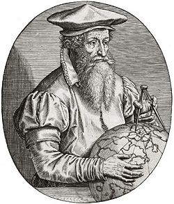
Antique Maps by Gerard Mercator (*1512 - †1594)
![Mercator, Italy, 1589 [1619]: Italia]( "Gerard Mercator: Italia")
Italia
Jodocus Hondius, Amsterdam, 1589 [1619]
Very nice old colored map of Italy by Gerard Mercator. With Sardinia and Corsica. Decorated with a beautiful title cartouche, a galleon and a sea monster.The first edition of the map was...
Italia
1589 - Gerard Mercator
12895Old coloured map of Italy. Printed in Amsterdam by Jodocus Hondius in 1619.
980,00 €
Morea olim Peloponnesus
Jodocus Hondius & Cornelis Claesz, Amsterdam, 1606
Antique map of the Peloponnese by Gerard Mercator. A beautiful title cartouche to the lower left. From the early Latin edition of the Mercator-Hondius Atlas of 1606. Latin text on verso.
Morea olim Peloponnesus
1606 - Gerard Mercator
12572Coloured map of Greece. Printed in Amsterdam by Jodocus Hondius & Cornelis Claesz in 1606.
420,00 €
Galliae tabule geographicae
Jodocus Hondius, Amsterdam, 1606-30
Title page from the French section of the Mercator-Hondius Atlas, published between 1606 and 1630 in Amsterdam.
Galliae tabule geographicae
1606 - Gerard Mercator
12706Title page of the Mercator-Hondius Atlas. Printed in Amsterdam in 1606.
390,00 €
Iutia Septentrionalis
J. Hondius, Amsterdam, 1607-08
Antique Map of Jutland (Jylland) in Denmark by Gerard Mercator. Shows Midtjylland (Central Jutland) between the North Sea and Kattegat with Thisted, Aalborg, Randers, Aarhus, Horsens, Grenaa and...
Iutia Septentrionalis
1607 - Gerard Mercator
11861Coloured map of Jutland (Jylland). Printed in Amsterdam by J. Hondius in 1607.
350,00 €
Walachia, Servia, Bulgaria, Romania
Jodocus Hondius, Amsterdam, 1607-08
Old coloured map of the Eastern Balkans by Jodocus Hondius. Shows the Wallachia, Serbia, Bulgaria and Romania, in the south Macedonia, in the east the west coast of the Black Sea. First published...
Walachia, Servia, Bulgaria, Romania
1607 - Gerard Mercator
12478Old coloured map of the Eastern Balkans with Romania, Bulgaria and Serbia. Printed in Amsterdam by Jodocus Hondius in 1607.
490,00 €
Cornubia, Devonia, Somersetus, Dorcestria, Wiltonia, Glocestria Monumetha, Glamorgan, Caermarden,...
Jodocus Hondius, Amsterdam, 1613-19
Old coloured map of the south-western part of England by G. Mercator. Shows the southwest of England and the south of Wales, Cornwall, Devon, Somerset, Gloucestershire, Herefordshire. With a...
Cornubia, Devonia, Somersetus, Dorcestria, Wiltonia, Glocestria...
1613 - Gerard Mercator
12645Old coloured map of Southwest England, South Wales, Cornwall. Printed in Amsterdam by Jodocus Hondius in 1613.
490,00 €
Macedonia Epirus et Achaia
Henricus Hondius, Amsterdam, 1623
Old coloured antique map of Northern Greece and the Eastern Balkans by Gerard Mercator. With Albania, Macedonia, Corfu and the north of Greece. To the lower left a title cartouche with a skull....
Macedonia Epirus et Achaia
1623 - Gerard Mercator
12571Old coloured map of Greece. Printed in Amsterdam by Henricus Hondius in 1623.
390,00 €
Westphalia cum Dioecesi Bremensi
H. Hondius, Amsterdam, 1628
Old coloured antique map of Lower Saxony by Gerard Mercator. Shows East Friesland with Bremen and Oldenburg. In the north to Holstein and the Elbe. Top left a title cartouche. From the 1628 French...
Westphalia cum Dioecesi Bremensi
1628 - Gerard Mercator
11843Old coloured map of Lower Saxony. Printed in Amsterdam by H. Hondius in 1628.
450,00 €
Anglesey, Garnesay, Wight olim Vectis, Iarsay
Jodocus Hondius, Amsterdam, 1628
Antique map of the Channel Islands by Gerhard Mercator. Showing the islands of Guernsey, Jersey and Wight in the English Channel, and Anglesey in North Wales in the Irish Sea. First published in...
Anglesey, Garnesay, Wight olim Vectis, Iarsay
1628 - Gerard Mercator
12653Old coloured map of Anglesey, Guernsey, Wight, Jersey. Printed in Amsterdam by Jodocus Hondius in 1628.
350,00 €
Fionia
G. Mercator, Duisburg, 1628 or 1633
Old coloured antique map of the eastern part of South Denmark by Gerard Mercator. With Funen (Fyn) and the offshore islands Langeland and Ærø. Below a title cartouche. From the early French edition...
Fionia
1628 - Gerard Mercator
12762Old coloured map of Fyn. Printed in Duisburg by G. Mercator in 1628 or 1633.
320,00 €
Europa, ad magnae Europae Gerardi Mercatoris
Henricus Hondius, Amsterdam, 1628
This map of Europe is from Mercator's Atlas sive Cosmographicae Meditationes de Fabrica Mundi et Fabricati Figura, first published in 1595.The geography depicted on the map corresponds to...
Europa, ad magnae Europae Gerardi Mercatoris
1628 - Gerard Mercator
12766Coloured map of the European continent. Printed in Amsterdam by Henricus Hondius in 1628.
2 700,00 €
Asia ex Magna Orbis Terre Descriptione Gerardi Mercatoris Desumpta, Studio et Industria G.M....
Henricus Hondius, Amsterdam, 1628
A very fine example of Mercator's map of Asia. It is based on the famous 1569 world map by Mercator, was engraved by his grandson and first published in 1595.The map depicts the coasts of...
Asia ex Magna Orbis Terre Descriptione Gerardi Mercatoris Desumpta,...
1628 - Gerard Mercator
12780Coloured map of the Asian continent. Printed in Amsterdam by Henricus Hondius in 1628.
3 000,00 €
Africa Ex Magna orbis terra descriptione Gerardi Mercatoris desumpta. Studio & industria G.M....
Henricus Hondius, Amsterdam, 1628
A very fine example of Mercator's map of Africa. It is based on the famous 1569 world map by Mercator, was engraved by his grandson and first published in 1595.The map has a high degree of...
Africa Ex Magna orbis terra descriptione Gerardi Mercatoris desumpta....
1628 - Gerard Mercator
12781Coloured map of the African continent. Printed in Amsterdam by Henricus Hondius in 1628.
1 900,00 €
China
Johannes Cloppenburch, Amsterdam, 1630-36
Rare antique map of China by G. Mercator. Shows China with the Great Wall of China, Japan, Korea is still shown as an island and in the northeast with Alaska. From the scarce edition of the...
China
1630 - Gerard Mercator
12594Antique map of China. Printed in Amsterdam by Johannes Cloppenburch in 1630.
750,00 €
Persici vel Sophorum Regni typus
H. Hondius, Amsterdam, 1633
A beautiful engraved map of Persia by G. Mercator. Depicting the regions of contemporary Iraq, Iran, and Afghanistan. Notable place-names such as Tabriz (formerly Tauris), Tehran (Taron), Isfahan...
Persici vel Sophorum Regni typus
1633 - Gerard Mercator
12792Coloured map of Afghanistan, Iraq, Iran. Printed in Amsterdam by H. Hondius in 1633.
750,00 €
Morea olim Peloponnesus
H. Hondius, Amsterdam, 1633
Antique map of the Peloponnese by Gerard Mercator. A beautiful title cartouche to the lower left. From the 1633 edition of the Mercator-Hondius Atlas, French text on verso.
Morea olim Peloponnesus
1633 - Gerard Mercator
12794Coloured map of Morea, Peloponnesus, Peloponnese. Printed in Amsterdam by H. Hondius in 1633.
450,00 €
Siciliae Regnum
H. Hondius, Amsterdam, 1633
Beautiful hand colored map of Sicily by G. Mercator. Showing the Mediterranean island of Sicily (Sicilia) with a beautiful title cartouche. Shows the cities of Palermo, Syracuse, Messina and the...
Siciliae Regnum
1633 - Gerard Mercator
12795Coloured map of Sicily, Sicilia. Printed in Amsterdam by H. Hondius in 1633.
750,00 €
Prussia
H. Hondius, Amsterdam, 1633
Early map of Prussia by G. Mercator. Showing the northern part of Poland with Puck (Putzig ), Gdańsk (Danzig) and Elblag (Elbing), the Russian area around Kalingrad (Königsberg ) and the southern...
Prussia
1633 - Gerard Mercator
12799Coloured map of Prussia. Printed in Amsterdam by H. Hondius in 1633.
790,00 €
Udrone. Irlandiae in Catherlagh Baronia.
H. Hondius, Amsterdam, 1633
Beautiful hand colored map of Carlow County in Ireland by G. Mercator. With the prominent the rivers Barrow and Slaney. From the 1633 edition of the Mercator-Hondius Atlas, French text on verso....
Udrone. Irlandiae in Catherlagh Baronia.
1633 - Gerard Mercator
12801Coloured map of Carlow. Printed in Amsterdam by H. Hondius in 1633.
280,00 €
Alsatia inferior
Henricus Hondius, Amsterdam, 1633
Early, beautiful coloured map of the Alsace (Basse-Alsace) by G. Mercator. This west-oriented map provides a depiction of the Rhine River's course, extending from Selz to Schoenau, encompassing a...
Alsatia inferior
1633 - Gerard Mercator
12802Coloured map of Strasbourg, Alsace. Printed in Amsterdam by Henricus Hondius in 1633.
290,00 €
Alsatia Superior cu Suntgoia & Brisgoia
Henricus Hondius, Amsterdam, 1633
Early, beautiful coloured map of the Alsace (Haute-Alsace) by G. Mercator. This west-oriented map shows the course of the Rhine between Basel and Strasbourg, Baden with Breisgau, Upper Alsace and...
Alsatia Superior cu Suntgoia & Brisgoia
1633 - Gerard Mercator
12803Coloured map of the Black Forest, Breisgau, Alsace. Printed in Amsterdam by Henricus Hondius in 1633.
320,00 €
Graecia
H. Hondius, Amsterdam, 1633
Antique map of Greece with the Greek Islands, the Aegean Sea and part of Asia Minor by Gerard Mercator. A beautiful title cartouche to the lower left. From the French edition of the...
Graecia
1633 - Gerard Mercator
12807Coloured map of Greece. Printed in Amsterdam by H. Hondius in 1633.
750,00 €
Candia cum Insulis aliquot circa Graeciam
H. Hondius, Amsterdam, 1633
Early map of the island of Crete by G. Mercator. With six smaller maps in upper panel across the top that provide views of the Greek Islands, including Kerkira (Corfu), Zakynthos (Zante), Milos (a...
Candia cum Insulis aliquot circa Graeciam
1633 - Gerard Mercator
12808Coloured map of Crete, Candia. Printed in Amsterdam by H. Hondius in 1633.
550,00 €
Iutia Septentrionalis
H. Hondius, Amsterdam, 1633
Antique Map of Jutland (Jylland) in Denmark by Gerard Mercator. Shows Midtjylland (Central Jutland) between the North Sea and Kattegat with Thisted, Aalborg, Randers, Aarhus, Horsens, Grenaa and...
Iutia Septentrionalis
1633 - Gerard Mercator
12809Coloured map of Jutland, Jylland. Printed in Amsterdam by H. Hondius in 1633.
390,00 €
![Mercator, Italy, 1589 [1619]: Italia](https://www.vintage-maps.com/4424-home_default/mercator-italy-1589-1619.jpg "Gerard Mercator: Italia")


