Product successfully added to your shopping cart
There are 0 items in your cart. There is 1 item in your cart.
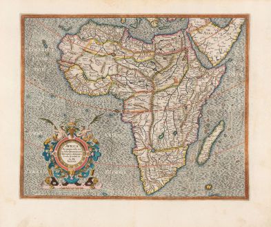
Africa Ex Magna orbis terra descriptione Gerardi Mercatoris desumpta. Studio &...
Gerard Mercator (*1512 - †1594)Reference 12781
Description
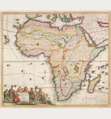
A very fine example of Mercator's map of Africa. It is based on the famous 1569 world map by Mercator, was engraved by his grandson and first published in 1595.
The map has a high degree of accuracy, particularly along the coastlines, surpassing that of any other 16th-century cartographer. The interior of Africa largely follows the conventions established by Ptolemy, featuring the Nile River depicted with two lakes and the Mountains of the Moon spanning across southern Africa. However, Mercator also acknowledges European exploration into the continent's interior. For instance, the map showcases Portuguese exploration along the Cuama (Zambezi) River, penetrating the region of Monomotapa or Benamataxa, as indicated on the map. The placement of Ca. Portogal (the Portuguese Fort) is marked at the confluence of the Spirito and Cuama rivers.
In an attempt to adopt a more scientific approach, Mercator refrained from including the numerous mythical creatures commonly found in maps of his contemporaries. Within Africa, the sole representation is the seated figure of the legendary priest-king, Prester John, positioned in Ethiopia. The decorative cartouche is adorned with fruits and two satyrs, adding an aesthetic touch to the map. The meticulously crafted script is of exceptional quality, and the sea exhibits Mercator's signature moiré pattern.
Details
| Cartographer | Gerard Mercator |
| Title | Africa Ex Magna orbis terra descriptione Gerardi Mercatoris desumpta. Studio & industria G.M. Iunioris |
| Publisher, Year | Henricus Hondius, Amsterdam, 1628 |
| Plate Size | 38.0 x 46.5 cm (15.0 x 18.3 inches) |
| Sheet Size | 47.9 x 56.7 cm (18.9 x 22.3 inches) |
| Reference | Van der Krogt, P.: Koeman's Atlantes Neerlandici, 8600:1A; Norwich, O.I.: Maps of Africa, No. 21; Betz, R. & P., The Mapping of Africa, No. 31 |
Condition
Cartographer
Images to Download
If you like to download the image of this map with a resolution of 1200 pixels, please follow the link below.
You can use this image for publication on your personal or commercial websites for free if you set a link to this website. If you need photographs with a higher resolution, please contact us.
Africa Continent - Mercator, Gerard - Africa Ex Magna orbis terra descriptione...

