Product successfully added to your shopping cart
There are 0 items in your cart. There is 1 item in your cart.
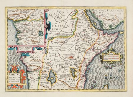
Abissinorum sive Pretiosi Ioannis Imperiu
Jodocus Hondius (*1563 - †1612)Reference 12874
Description
This beautifully coloured antique map of central Africa focuses on the legendary kingdom of Christian Prester John. It follows the cartography style of Ortelius and is based on the travels of Portuguese explorer Francisco Alveres in 1520, who sought the mythical kingdom. The map places Prester John's realm on Amara Mons, in the region where Alveres encountered the Coptic Christian ruler David II.
The inset of the Congo region, influenced by Ortelius, illustrates the travels of another Portuguese explorer, Duarte Lopez. The Nile is traced to its source in the Ptolemaic twin lakes of Zaire and Zaflan, at the base of the Mountains of the Moon.
This map not only visually represents central African geography but also explores historical expeditions and mythical tales that have intrigued explorers for centuries. From the French edition of the Mercator-Hondius Atlas printed in 1633.
Details
| Cartographer | Jodocus Hondius |
| Title | Abissinorum sive Pretiosi Ioannis Imperiu |
| Publisher, Year | H. Hondius, Amsterdam, 1633 |
| Plate Size | 34.1 x 48.3 cm (13.4 x 19.0 inches) |
| Sheet Size | 47.8 x 56.5 cm (18.8 x 22.2 inches) |
| Reference | Van der Krogt, P.: Koeman's Atlantes Neerlandici, 8720:1A. |
Condition
Cartographer
Images to Download
If you like to download the image of this map with a resolution of 1200 pixels, please follow the link below.
You can use this image for publication on your personal or commercial websites for free if you set a link to this website. If you need photographs with a higher resolution, please contact us.
East Africa - Hondius, Jodocus - Abissinorum sive Pretiosi Ioannis Imperiu

![[Maidegascar, Zanzibar, Scorsia, Inebila, Imangla, Scilam, Dondina] [Maidegascar, Zanzibar, Scorsia, Inebila, Imangla, Scilam, Dondina]](https://www.vintage-maps.com/2957-home_default/bordone-east-africa-madagascar-sri-lanka-1528-1565.jpg)
