Product successfully added to your shopping cart
There are 0 items in your cart. There is 1 item in your cart.
Antique Maps by Matthew Flinders (*1774 - †1814)
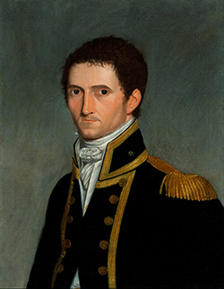
Matthew Flinders was an English navigator, cartographer and captain. He led the first circumnavigation of Australia from 1802 to 1803. Flinders joined the Royal Navy in 1789 and sailed with Captain William Bligh on the Providence to the Pacific. Together with the naval doctor George Bass he explored the islands at the east entrance of the Bass Strait in 1798, crossed the Strait named after Bass and circumnavigated Tasmania (former Van Diemen's Land). On an expedition in 1801 with his ship Investigator he discovered Spencer-Golf and St. Vincent-Golf.
Flinders died in 1814 and was buried at the cemetery St James's Garden in London. His grave was rediscovered during excavations related to the construction of a railway line in 2019.

Kaart van Basses Straat, tusschen Nieuw Zuid Wales en Van Diemens-Land ... Heer Flinders ......
J. and A. Honkoop, Amsterdam, 1801
Very large and rare sea chart of Tasmania and the southern part of Australia with the Bass Strait. One of the first maps showing the discoveries of George Bass and Matthew Flinders in October 1798...
Kaart van Basses Straat, tusschen Nieuw Zuid Wales en Van Diemens-Land...
1801 - Matthew Flinders
12058Coloured sea chart of Australia. Printed in Amsterdam by J. and A. Honkoop in 1801.
1 450,00 €
