Product successfully added to your shopping cart
There are 0 items in your cart. There is 1 item in your cart.
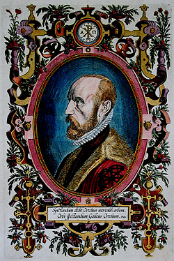
Antique Maps by Abraham Ortelius (*1527 - †1598)

Natoliae, quae olim Asia Minor Nova Descriptio - Aegypti Recentior Descriptio - Carthaginis...
Antwerp, 1570
Coloured copper engraved map of Turkey by A. Ortelius. On right side a map of Egypt and one of Tunis. Three map on one sheet printed from one plate. From the early 1570 Latin edition of 'Theatrum...
Natoliae, quae olim Asia Minor Nova Descriptio - Aegypti Recentior...
1570 - Abraham Ortelius
10853Coloured map of Tunis, Egypt, Cyprus, Turkey. Printed in Antwerp in the year 1570.
420,00 €
Theatre, oft Toonneel des Aerdt-bodems
Gielis Coppens van Diest, Antwerp, 1571/73
Old colour example of the early title page from Ortelius' Theatrum Orbis Terrarum . From the 1571 or 1573 Dutch edition.
Theatre, oft Toonneel des Aerdt-bodems
1571 - Abraham Ortelius
12708Title page from the Ortelius Atlas. Printed 1571 in Antwerp.
490,00 €
Typus Orbis Terrarum, Americae sive Novi Orbis, Nova Descriptio, Africae Tabula Nova, Asiae Nova...
Gielis Coppens van Diest, Christoffel Plantin, Antwerp, 1573-1584
Ortelius' World and Continents from the First Modern Atlas.A fine set consisting of a world map and four of the continents from the first modern atlas Theatrum Orbis Terrarum by Abraham...
Typus Orbis Terrarum, Americae sive Novi Orbis, Nova Descriptio, Africae...
1573 - Abraham Ortelius
12683Old coloured world map and continent maps by Abraham Ortelius. Published in 1573-84 in Antwerp.
18 000,00 €
Thusciae Descriptio Auctore Hieronymo Bellarmato.
Antwerp, 1573
Beautiful original old coloured copper engraved map of the Tuscany by A. Ortelius. From the first modern atlas, the famous Theatrum Orbis Terrarum by Ortelius, first published in 1570....
Thusciae Descriptio Auctore Hieronymo Bellarmato.
1573 - Abraham Ortelius
12893Old coloured map of the Tuscany. Printed in Antwerp in the year 1573.
850,00 €
Basiliensis Territorii Descriptio Nova, Auctore Sebastiano Munstero / Circulus sive Liga Sueviae,...
Antwerp, 1574
Antique map of the northern region of Switzerland and southern Germany by Abraham Ortelius. The two maps are printed from a copper plate and come from the first modern atlas, the famous Theatrum...
Basiliensis Territorii Descriptio Nova, Auctore Sebastiano Munstero /...
1574 - Abraham Ortelius
11257Coloured map of Basel, Switzerland. Printed in Antwerp in the year 1574.
450,00 €
Frisiae Orientalis Descriptio
A. Ortelius, Antwerp, 1579
Very nice old coloured antique map of East Frisia by Abraham Ortelius. From the first modern atlas, the famous Theatrum Orbis Terrarum by Ortelius, first published in 1570. Embellished with...
Frisiae Orientalis Descriptio
1579 - Abraham Ortelius
12934Old coloured map of East Frisia, Lower Saxony. Printed in Antwerp by A. Ortelius in 1579.
790,00 €
Palatinus Bavariae descriptio Erhardo Reych Tirolense Auctore / Wirtenbergensis Ducatus Vera...
Christoffel Plantin, Antwerp, 1579
Antique map of Württemberg and the northern part of Bavaria by Abraham Ortelius. The two maps are printed from a copper plate and come from the first modern atlas, the famous Theatrum Orbis...
Palatinus Bavariae descriptio Erhardo Reych Tirolense Auctore /...
1579 - Abraham Ortelius
12944Coloured map of Bavaria, Wurttemberg. Printed in Antwerp by Christoffel Plantin in 1579.
520,00 €
Candia Insula / Archipelagi Insularum Aliquot Descrip.
Antwerp, 1584
Beautiful original old coloured copper engraved map of Crete with 10 additional islands by A. Ortelius. Showing Crete and the islands Lesbos (Metellino), Kithira (Cerigo), Karpathos (Scarpanto),...
Candia Insula / Archipelagi Insularum Aliquot Descrip.
1584 - Abraham Ortelius
11339Old coloured map of the Aegean Sea, Cyclades, Crete. Printed in Antwerp in the year 1584.
750,00 €
Larii Lacus vulgo Comensis Descriptio / Territorii Romani Descrip. / Fori Iulii vulgo Friuli Typus
Antwerp, 1584
Nice original old coloured map of Lake Como (Lago di Como), Rome (Roma) and surroundings and the region of Udine in the northern part of the Adriatic Sea by Abraham Ortelius. From the 1584 Latin...
Larii Lacus vulgo Comensis Descriptio / Territorii Romani Descrip. /...
1584 - Abraham Ortelius
11351Old coloured map of Udine, Rome, Lake Como. Printed in Antwerp in the year 1584.
600,00 €
Russiae, Moscoviae et Tartariae Descriptio. Auctore Antonio Ienkensono Anglo, Edita Londini Anno...
Antwerp, 1584
Fascinating copper engraved map of Russia by A. Ortelius in stunning original colors. Showing the region from the Baltic Sea, Lithuania and the Black Sea to the Sur River, Tashkent, the Kossack...
Russiae, Moscoviae et Tartariae Descriptio. Auctore Antonio Ienkensono...
1584 - Abraham Ortelius
11358Old coloured map of Siberia, Moscow. Printed in Antwerp in the year 1584.
1 900,00 €
Insularum Aliquot Maris Mediterranei Descriptio.
Antwerp, 1587
Beautiful original old coloured copper engraved map of six Mediterranean Island by A. Ortelius. Showing Malta, Sardinia, Sicily, Corfu, Elba and Djerba. From the 1587 French edition of Theatrum...
Insularum Aliquot Maris Mediterranei Descriptio.
1587 - Abraham Ortelius
11312Old coloured map of Djerba, Elba, Corfu, Sicily, Sardinia, Malta. Printed in Antwerp in the year 1587.
1 100,00 €
Chinae, olim Sinarum Regionis, nova descriptio. Auctore Ludovico Georgio.
A. Ortelius, Antwerp, circa 1587
Ortelius' Stunning Map of China with Old Colour.Old coloured map of China by Abraham Ortelius. The map is oriented to the west, north is on the right side. This is the first map of China ever...
Chinae, olim Sinarum Regionis, nova descriptio. Auctore Ludovico Georgio.
1587 - Abraham Ortelius
11521Old coloured map of China. Printed in Antwerp by A. Ortelius circa 1587.
3 400,00 €
Hispalensis Conventus Delineatio Auctore Hieronymo Chiaves
Plantin Press, Antwerp, 1592
Beautiful old coloured antique map of Andalusia by A. Ortelius. Depicting Seville and its surroundings in Andalusia. With Córdoba, Écija, and Jerez de la Frontera. From the first modern atlas, the...
Hispalensis Conventus Delineatio Auctore Hieronymo Chiaves
1592 - Abraham Ortelius
12894Old coloured map of Seville, Andalusia. Printed in Antwerp by Plantin Press in 1592.
520,00 €
Brandeburgensis Marchae Descriptio
Plantin Press, Antwerp, 1592
Old coloured antique map of Brandenburg by Abraham Ortelius. From the first modern atlas, the famous Theatrum Orbis Terrarum by Ortelius, first published in 1570. Embellished with elaborate...
Brandeburgensis Marchae Descriptio
1592 - Abraham Ortelius
12937Antique map of Berlin, Brandenburg. Printed in Antwerp by Plantin Press in 1592.
490,00 €
Saxoniae, Misniae, Thuringiae, Nova Exactissimaq. Descriptio
Plantin Press, Antwerp, 1592
Beautiful antique map of Saxony and Thuringia by Abraham Ortelius. From the first modern atlas, the famous Theatrum Orbis Terrarum by Ortelius, first published in 1570. Embellished with elaborate...
Saxoniae, Misniae, Thuringiae, Nova Exactissimaq. Descriptio
1592 - Abraham Ortelius
12939Antique map of Saxony, Saxony-Anhalt, Thuringia. Printed in Antwerp by Plantin Press in 1592.
450,00 €
Bavariae olim Vindeliciae, Delineationis Compendium ex Tabula Philippi Apiani Math.
Plantin Press, Antwerp, 1592
Very detailed, antique map of Bavaria by Abraham Ortelius. From the first modern atlas, the famous Theatrum Orbis Terrarum by Ortelius, first published in 1570. Embellished with elaborate details...
Bavariae olim Vindeliciae, Delineationis Compendium ex Tabula Philippi...
1592 - Abraham Ortelius
12940Antique map of Bavaria. Printed in Antwerp by Plantin Press in 1592.
590,00 €
Wirtenberg Ducatus
Plantin Press, Antwerp, 1592
Very detailed, antique map of Württemberg by Abraham Ortelius. From the first modern atlas, the famous Theatrum Orbis Terrarum by Ortelius, first published in 1570. Embellished with elaborate...
Wirtenberg Ducatus
1592 - Abraham Ortelius
12941Antique map of Baden-Württemberg. Printed in Antwerp by Plantin Press in 1592.
520,00 €
Germaniae Veteris, Typus.
Plantin Press, Antwerp, 1592
Rare historical map of Germany and the central part of Europe during antiquity by Abraham Ortelius. With Germany, the Netherlands, Austria and parts of Switzerland, Poland and Hungary. In the south...
Germaniae Veteris, Typus.
1592 - Abraham Ortelius
12942Antique map of Germany. Printed in Antwerp by Plantin Press in 1592.
1 200,00 €
Abrahami Patriarchae Peregrinatio, et Vita
Antwerp, circa 1595
Rare edition of Ortelius' striking map of the Wanderings of Abraham.A rare edition of the historical map of the Holy Land by Abraham Ortelius, unusual without text on verso. Shows the land...
Abrahami Patriarchae Peregrinatio, et Vita
1595 - Abraham Ortelius
11744Historical map of Israel, Canaan with the Wanderings of Abraham. Printed around 1595 in Antwerp.
3 900,00 €
Persici sive Sophorum Regni Typus
Plantin Press, Antwerp, 1595
Hand coloured antique map of Persia by Abraham Ortelius. With a beautiful title cartouche. Covering the area of today Iran with the Caspian Sea and the Persian Gulf. From the 1595 edition of...
Persici sive Sophorum Regni Typus
1595 - Abraham Ortelius
11898Coloured map of the Persian Gulf, Caspian Sea, Iran. Printed in Antwerp by Plantin Press in 1595.
650,00 €
Basiliensis Territorii Descriptio Nova, Auctore Sebastiano Munstero / Circulus sive Liga Sueviae,...
Plantin Press, Antwerp, 1595
Antique map of the northern region of Switzerland and southern Germany by Abraham Ortelius. The two maps are printed from a copper plate and come from the first modern atlas, the famous Theatrum...
Basiliensis Territorii Descriptio Nova, Auctore Sebastiano Munstero /...
1595 - Abraham Ortelius
12945Coloured map of the Lake Constance, Switzerland, Southern Germany. Printed in Antwerp by Plantin Press in 1595.
480,00 €
Leodiensis Dioecesis Typus
Plantin Press, Antwerp, 1598
Antique map of the eastern part of Belgium by Abraham Ortelius. Shows the area from Weert and Roermond to Sedain and from Leuven (Louvain) to Limbourg. With Liège, Dinant, Maastricht and Namur....
Leodiensis Dioecesis Typus
1598 - Abraham Ortelius
11905Coloured map of Belgium. Printed in Antwerp by Plantin Press in 1598.
450,00 €
Schlavoniae, Croatiae, Carniae, Istriae, Bosniae, Finitimarumque Regionum Nova Descriptio,...
Plantin Press, Antwerp, 1598
Old coloured antique map of the Western Balkans by Abraham Ortelius. Showing Croatia with Istria and Dalmatia, Slovenia, Bosnia and Herzegovina with the Adriatic Sea. In the north to Carinthia and...
Schlavoniae, Croatiae, Carniae, Istriae, Bosniae, Finitimarumque...
1598 - Abraham Ortelius
12686Coloured map of Croatia, Adriatic Sea, Western Balkans. Printed in Antwerp by Plantin Press in 1598.
650,00 €
Poloniae, Lituaniaeq. Descriptio.
Antwerp, 1601
Beautiful antique map of Poland by Abraham Ortelius. From the first modern atlas, the famous Theatrum Orbis Terrarum by Ortelius, first published in 1570. Embellished with elaborate details and...
Poloniae, Lituaniaeq. Descriptio.
1601 - Abraham Ortelius
12935Antique map of Poland. Printed in Antwerp in the year 1601.
1 200,00 €


