Menu
- Antique Maps
- Atlases
- Globes
- Cartographers
- Aa, Pieter van der
- Adams, John
- Adrichem, Christian
- Albizzi, Antonio
- Allard, Carel
- Allard, Hugo
- Altmannshausen, Johann Ernst von
- Angelocrator, Daniel
- Anguissola, Leander
- Anonymous
- Bachmann, John
- Bailleul le Jeune, Nicolas
- Barbault, Jean
- Bayer, Johann
- Beaurain, Jean de
- Beek, Anna
- Belleforest, Francois de
- Bellin, Jacques Nicolas
- Bellus, Nicolaus
- Bertius, Petrus
- Bibliographisches Institut
- Bickham, George
- Blaeu, Joan
- Blaeu, Willem Janszoon
- Bodenehr, Gabriel
- Bodmer, Karl
- Boethius, Christoph
- Bonifacio, Natal
- Bonne, Rigobert
- Bordone, Benedetto
- Borgia, Stefano
- Botero, Giovanni
- Bowen, Emanuel
- Bowles and Carver
- Bowles, Thomas
- Braun & Hogenberg
- Breydenbach, Bernhard von
- Brion de la Tour, Louis
- British Admiralty
- Bry, Theodor de
- Bucelin, Gabriel
- Buffon, G.-L. Leclerc de
- Bünting, Heinrich
- Bussemacher, Johann
- Call, Pieter van
- Camocio, Giovanni Francesco
- Caoursin, Guillaume
- Cary, John
- Cellarius, Andreas
- Celtis, Konrad
- Chaffat, Antoine du
- Chapman and Hall
- Clouet, Jean Baptiste Louis
- Clüver, Phillip
- Collins, Greenville
- Coronelli, Vincenzo Maria
- Covens and Mortier
- Curtis, William
- d'Anville, Jean Baptiste
- Danckerts, Justus
- Danckerts, Theodorus
- de l'Isle, Guillaume
- De Pierre
- Delamarche, Charles Francois
- Deroy, Isidore Laurent
- Doncker, Hendrick
- Doppelmayr, Johann Gabriel
- Downing, Alexander
- Drummond, Alexander
- Dudley, Robert
- Duflos, Claude
- Edwards, Sydenham Teak
- Ellis, Joseph
- Elwe, Jan Barend
- Euler, Leonhard
- Faden, William
- Fer, Nicolas de
- Flinders, Matthew
- Fouquet, Pieter
- Fourdrinier, Pierre
- Fricx, Eugene Henri
- Fries, Laurent
- Garden, Francis
- Geographisches Institut Weimar
- Goos, Abraham
- Goos, Pieter
- Greenwood, Christopher
- Haffner, Johann Christoph
- Haupt, Gottfried Jacob
- Holle, Lienhart
- Homann Erben
- Homann, Johann Baptist
- Homann, Johann Christoph
- Hondius, Jodocus
- Hondt, Pieter de
- Hooker, William
- Husson, Pierre
- Jaillot, Alexis Hubert
- Janssonius, Johannes
- Jefferys, Thomas
- Jode, Gerard de
- Johnston, Alexander Keith
- Jombert, Charles Antoine
- Jonston, John
- Julien, Roch Joseph
- Keere, Pieter van den
- Keulen, Johannes van
- Kilian, Georg Christoph
- Kip, William
- Kitchin, Thomas
- Langlois, Hyacinthe
- Laurie & Whittle
- le Clerc, Nicolas Gabriel
- le Rouge, George Louis
- Lempriere, Clement
- Lespinasse, Nicolas Louis de
- Lesson, René Primevère
- Linschoten, Jan Huygen van
- Little, William
- Loots, Johannes
- Lotter, Tobias Conrad
- Magini, Giovanni Antonio
- Magnus, Olaus
- Mallet, Alain Manesson
- Mann, Fred & Helen
- Mannevillette, Jean Baptiste
- Mariette, Jean
- Mayer, Tobias
- Medina, Pedro de
- Megenberg, Konrad von
- Meissner, Daniel
- Mejer, Johannes
- Mercator, Gerard
- Mercator, Michael
- Mercator, Rumold
- Merian, Maria Sibylla
- Merian, Matthäus
- Middiman, Samuel
- Montanus, Arnoldus
- Morden, Robert
- Mortier, David
- Mortier, Pieter
- Mosley, Charles
- Mount & Page
- Münster, Sebastian
- Mynde, James
- Nolin, Jean Baptiste
- Noort, Olivier van
- Norden, Frederick Louis
- Ortelius, Abraham
- Ottens, Reiner
- Owen & Bowen
- Peck, Francis
- Pigeot, Francois
- Pitt, Moses
- Pluche, Noel Antoine
- Poggibonsi, Niccolo da
- Porcacchi, Tomaso
- Porro, Girolamo
- Ptolemaeus, Claudius
- Pufendorf, Samuel Baron von
- Quad, Matthias
- Raigniauld, Henry
- Ramusio, Giovanni Battista
- Rastrick, Gulielmus
- Regnault, Nicolas François
- Reilly, Franz Johann Joseph von
- Renard, Louis
- Riemer, Jacob de
- Robert de Vaugondy, Gilles
- Robert, Nicolas
- Rocque, Barthélemy de La
- Rocque, John
- Rossetti, Domenico
- Rossi, Giovanni Giacomo
- Roy, Bernard de
- Ruscelli, Girolamo
- Russell, John
- Sanson, Nicolas
- Saur, Abraham
- Schedel, Hartmann
- Schenk, Pieter
- Scheuchzer, Johann Jakob
- Schindelmayer, Carl Robert
- Schley, Jakob van der
- Schmidt, Johann Friedrich Julius
- Schotanus van Sterringa, Bernhard
- Schreiber, Johann Georg
- Schwabe, Johann Joachim
- Seale, Richard William
- Seller, John
- Seutter, George Matthäus
- Shaw, Thomas
- Smallegange, Mattheus
- Smith, Charles
- Speed, John
- Stampioen, Jan Janszoon
- Stieler, Adolf
- Stockdale, John
- Stöcklein, Joseph
- Stoopendaal, Daniel
- Sylvanus, Bernardus
- Tallis, John
- Tardieu, Pierre François
- Thornton, John
- Tirinus, Jacobus
- Tirion, Isaak
- Toms, William Henry
- Ughi, Lodovico
- Valegio, Francesco
- Valk & Schenk
- Valk, Gerard
- Verneau, Charles
- Vidal y Pinilla, Felipe
- Visscher, Nicolas
- Waghenaer, Lucas Janszoon
- Waldseemüller, Martin
- Weigel, Christoph
- Weis, Franz Joseph
- Wells, Edward
- Whitbread, Josiah
- Wit, Frederick de
- Wytfliet, Cornelius
- Zenoi, Domenico
- Zoutman, Jan Dirksz
- Graphics
- New Additions
Cart
0 Product: Products: (empty)
No products
Product successfully added to your shopping cart
There are 0 items in your cart. There is 1 item in your cart.
Total products
Continue shopping Proceed to checkout
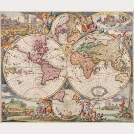
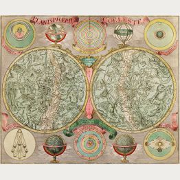
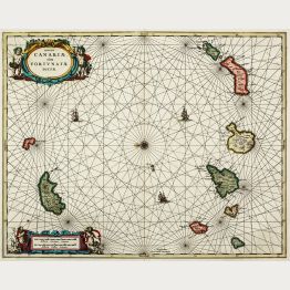
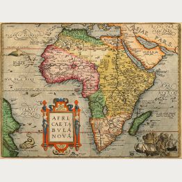
Antique Maps
Authentic antique maps, sea charts, old town views and city plans dating from the 15th to the 18th centuries.
Printed hundreds of years ago.
Printed hundreds of years ago.