Product successfully added to your shopping cart
There are 0 items in your cart. There is 1 item in your cart.
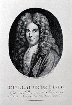
Antique Maps by Guillaume de l'Isle (*1675 - †1726)
- 1
- 2

Carte Particuliere des Postes de France
Covens & Mortier, Amsterdam, circa 1720
Large postal route map of France after S. Sanson. This is the Covens & Mortier edition of the detailed map. Printed on two sheets, not joined. A beautiful title cartouche to the lower left, two...
Carte Particuliere des Postes de France
1720 - Guillaume de l'Isle
12485Old coloured map of Postal Route Map of France. Printed in Amsterdam by Covens & Mortier circa 1720.
430,00 €
La France / Nova regni Galliae in omnes suas Provincias...
Covens & Mortier, Amsterdam, 1721
Old coloured antique map of France after Guillaume de l'Isle. This is the Covens & Mortier edition of the detailed map by G. de l'Isle. Shows France with Corsica in the southeast. A beautiful title...
La France / Nova regni Galliae in omnes suas Provincias...
1721 - Guillaume de l'Isle
12483Old coloured map of France. Printed in Amsterdam by Covens & Mortier in 1721.
240,00 €
Hemisphere Meridional pour voir plus distinctement Les Terres Australes...
Covens & Mortier, Amsterdam, circa 1730
Fine old coloured map of the Southern Hemisphere. First published by Guillaume de L'Isle in 1714, this is the edition by Covens and Mortier printed in Amsterdam around 1730. It shows the complete...
Hemisphere Meridional pour voir plus distinctement Les Terres Australes...
1730 - Guillaume de l'Isle
12444Old coloured map of the Southern Hemisphere, Australia. Printed in Amsterdam by Covens & Mortier circa 1730.
900,00 €
L'Amerique Septentrionale Dressee sur les Observations de Mrs. de l'Academie Royale des...
Covens & Mortier, Amsterdam, circa 1730
Old coloured map of North America after Guillaume de l'Isle. This is the Covens & Mortier version of the important foundation map of North America by G. de l'Isle. California is again correctly...
L'Amerique Septentrionale Dressee sur les Observations de Mrs. de...
1730 - Guillaume de l'Isle
12445Old coloured map of North America. Printed in Amsterdam by Covens & Mortier circa 1730.
1 600,00 €
L'Amerique Meridionale Dressee sur les Observations de Mrs. de l'Academie Royale des Sciences......
Covens & Mortier, Amsterdam, circa 1730
Old coloured map of South America after Guillaume de l'Isle. This is the Covens & Mortier version of the G. de l'Isle map of south America. With the legendary lake Lake Parime or Lake Parima,...
L'Amerique Meridionale Dressee sur les Observations de Mrs. de...
1730 - Guillaume de l'Isle
12446Old coloured map of South America. Printed in Amsterdam by Covens & Mortier circa 1730.
500,00 €
Carte des Antilles Francoises et des Isles Voisines...
Covens & Mortier, Amsterdam, circa 1730
Old coloured map of the French West Indies in the Eastern Caribbean after Guillaume de l'Isle. This is the Covens & Mortier version of the G. de l'Isle map. With the islands Guadeloupe, Dominica,...
Carte des Antilles Francoises et des Isles Voisines...
1730 - Guillaume de l'Isle
12449Old coloured map of the French West Indies, Lesser Antilles. Printed in Amsterdam by Covens & Mortier circa 1730.
750,00 €
L'Afrique Dressee sur les Observations de M. de l'Academie Royale des Sciences...
Covens & Mortier, Amsterdam, circa 1730
Old coloured map of Africa after Guillaume de l'Isle. This is the Covens & Mortier edition of the richly detailed map of Africa by G. de l'Isle. Top right a magnificent title cartouche with an...
L'Afrique Dressee sur les Observations de M. de l'Academie Royale des...
1730 - Guillaume de l'Isle
12450Old coloured map of the African continent. Printed in Amsterdam by Covens & Mortier circa 1730.
800,00 €
Carte de Tartarie Dressee sur les Relations de Plusieurs Voyageurs de Differentes Nations... /...
Covens & Mortier, Amsterdam, circa 1730
Old coloured antique map of Russia with Siberia and Korea after Guillaume de l'Isle. This is the Covens & Mortier edition of the detailed map by G. de l'Isle. Shows the Russian Empire from Moscow...
Carte de Tartarie Dressee sur les Relations de Plusieurs Voyageurs de...
1730 - Guillaume de l'Isle
12453Old coloured map of Russia. Printed in Amsterdam by Covens & Mortier circa 1730.
790,00 €
Carte de Moscovie. Dressee par Guillaume De l'Isle...
Covens & Mortier, Amsterdam, circa 1730
Large, old coloured map of the western part of Russia by Guillaume de l'Isle. The map is printed on two sheets, below size is for one sheet each. If joined, the size of the map is 97cm x 62cm ....
Carte de Moscovie. Dressee par Guillaume De l'Isle...
1730 - Guillaume de l'Isle
12458Old coloured map of Russia. Printed in Amsterdam by Covens & Mortier circa 1730.
690,00 €
Le Royaume de Hongrie et des Pays qui en Dependoient Autrefois / Nova et Accurata Regni Hungariae...
Covens & Mortier, Amsterdam, circa 1730
Old coloured antique map of the Kingdom of Hungary by Guillaume de l'Isle. This is the Covens & Mortier edition of the detailed map by G. de l'Isle. Shows the eastern Balkans, Hungary, Romania,...
Le Royaume de Hongrie et des Pays qui en Dependoient Autrefois / Nova et...
1730 - Guillaume de l'Isle
12494Old coloured map of Austria - Hungary. Printed in Amsterdam by Covens & Mortier circa 1730.
400,00 €
Carte des Pays Bas Catholiques / Belgium Regium
Covens & Mortier, Amsterdam, circa 1730
Antique map of Belgium and Luxembourg by Guillaume de l'Isle. This is the Covens & Mortier edition of the detailed map by G. de l'Isle. A title cartouche to the upper left.
Carte des Pays Bas Catholiques / Belgium Regium
1730 - Guillaume de l'Isle
12529Old coloured map of Belgium. Printed in Amsterdam by Covens & Mortier circa 1730.
290,00 €
Carte de la Grece / Accurata totius Archipelagi et Graeciae
Covens & Mortier, Amsterdam, circa 1730
Antique map of Greece by Guillaume de l'Isle. This is the Covens & Mortier edition of the detailed map by G. de l'Isle. A title cartouche to the lower left.
Carte de la Grece / Accurata totius Archipelagi et Graeciae
1730 - Guillaume de l'Isle
12531Old coloured map of Greece. Printed in Amsterdam by Covens & Mortier circa 1730.
350,00 €
L'Italie, Dressee sur les Observations de Mrs. de l'Academie Royale des Sciences
Covens & Mortier, Amsterdam, circa 1730
Antique map of Italy by Guillaume de l'Isle. This is the Covens & Mortier edition of the detailed map by G. de l'Isle. With Sardinia, Corsica, Sicily and the Balkans. A splendid title cartouche to...
L'Italie, Dressee sur les Observations de Mrs. de l'Academie Royale des...
1730 - Guillaume de l'Isle
12540Old coloured map of Italy. Printed in Amsterdam by Covens & Mortier circa 1730.
400,00 €
L'Espagne Dressee sur la Description qui en a ete Faite par Rodrigo Mendez Sylva ...
Covens & Mortier, Amsterdam, circa 1730
Antique map of the Iberian Peninsula by Guillaume de l'Isle. This is the Covens & Mortier edition of the detailed map by G. de l'Isle. Shows Spain and Portugal with the Balearic Islands and the...
L'Espagne Dressee sur la Description qui en a ete Faite par Rodrigo...
1730 - Guillaume de l'Isle
12544Old coloured map of Spain - Portugal. Printed in Amsterdam by Covens & Mortier circa 1730.
390,00 €
Les Isles Britanniques ou sont le Royaumes d'Angleterre
Covens & Mortier, Amsterdam, circa 1730
Antique map of Great Britain and Ireland by Guillaume de l'Isle. This is the Covens & Mortier edition of the detailed map by G. de l'Isle. With England, Wales, Ireland, Scotland, parts of the...
Les Isles Britanniques ou sont le Royaumes d'Angleterre
1730 - Guillaume de l'Isle
12546Old coloured map of the British Isles. Printed in Amsterdam by Covens & Mortier circa 1730.
350,00 €
Partie Septentrionale de la Souabe
Covens & Mortier, Amsterdam, circa 1730
Antique map of northern Württemberg and Franken by Guillaume de l'Isle. This is the Covens & Mortier edition of the detailed map by G. de l'Isle. Showing the area Hornberg, Nuremberg, Stuttgart. In...
Partie Septentrionale de la Souabe
1730 - Guillaume de l'Isle
12982Old coloured map of Nordwürttemberg, Franken. Printed in Amsterdam by Covens & Mortier circa 1730.
300,00 €
Carte d'Artois et des Environs ...
Covens & Mortier, Amsterdam, circa 1740
Very detailed, antique map of the northwestern part of France by G. de l'Isle. Shows the Département Pas-de-Calais with Lille, Cambrai, Arras, Abbeville, Boulogne-sur-Mer and Calais. Top right a...
Carte d'Artois et des Environs ...
1740 - Guillaume de l'Isle
11821Old coloured map of Pas-de-Calais. Printed in Amsterdam by Covens & Mortier circa 1740.
200,00 €
Carte De La Barbarie Le La Nigritie Et De La Guinee
circa 1700
Detailed hand coloured copper engraving showing North West Africa from Mediterranean Sea to Gulf of Guinea including Canary Island.
Carte De La Barbarie Le La Nigritie Et De La Guinee
1700 - Guillaume de l'Isle
10006Coloured map of Northwest Africa. Printed circa 1700.
Sold An Historical Map of the Roman Empire")
Theatrum Historicum (and) An Historical Map of the Roman Empire
1709
Large map of Europe, the Mediterranean, North Africa and parts of the Middle East. With inset double hermisphere world map. Dated 1709.
Theatrum Historicum (and) An Historical Map of the Roman Empire
1709 - Guillaume de l'Isle
10067Coloured map of Europe. Printed in the year 1709.
Sold
Hemisphere Meridional pour voir plus distinctement les Terres Australes
Paris, 1714
First edition of the important map of the southern hemisphere by de l'Isle in early strong colours, first published in 1714. This early map of the South Polar regions became the standard map for...
Hemisphere Meridional pour voir plus distinctement les Terres Australes
1714 - Guillaume de l'Isle
11296Old coloured map of Australia, South Polar Region. Printed in Paris in the year 1714.
Sold
Carte du Brabant
Covens & Mortier, Amsterdam, circa 1720
A very large old coloured antique map of the duchy of Brabant by Guillaume de L'Isle. Printed in Amsterdam by Covens and Mortier. Shows the northern part of Belgium and the southern part of the...
Carte du Brabant
1720 - Guillaume de l'Isle
12441Old coloured map of Belgium. Printed in Amsterdam by Covens & Mortier circa 1720.
Sold
Les Environs de Paris / Nova Territorii Parisiensis
Covens & Mortier, Amsterdam, circa 1720
Old coloured antique map of Île-de-France after Guillaume de l'Isle. This is the Covens & Mortier edition of the detailed map by G. de l'Isle. Shows the region around Paris between Mantes-la-Jolie...
Les Environs de Paris / Nova Territorii Parisiensis
1720 - Guillaume de l'Isle
12484Old coloured map of Paris, Ile-de-France. Printed in Amsterdam by Covens & Mortier circa 1720.
Sold
Hemisphere Septentrional pour voir plus distinctement Les Terres Arctiques...
Covens & Mortier, Amsterdam, circa 1730
Fine old coloured map of the Northern Hemisphere. First published by Guillaume de L'Isle in 1714, this is the first edition by Covens and Mortier printed in Amsterdam around 1730, still without the...
Hemisphere Septentrional pour voir plus distinctement Les Terres...
1730 - Guillaume de l'Isle
12443Old coloured map of the Northern Hemisphere, Polar Region. Printed in Amsterdam by Covens & Mortier circa 1730.
Sold
Carte de la Terre Ferme, du Perou, du Bresil, et du Pays des Amazones...
Covens & Mortier, Amsterdam, circa 1730
Old coloured map of the northern part of South America after Guillaume de l'Isle. This is the Covens & Mortier version of the G. de l'Isle map. Shows the Amazon region with Brazil, Colombia,...
Carte de la Terre Ferme, du Perou, du Bresil, et du Pays des Amazones...
1730 - Guillaume de l'Isle
12447Old coloured map of South America. Printed in Amsterdam by Covens & Mortier circa 1730.
Sold


 An Historical Map of the Roman Empire")


- 1
- 2