Product successfully added to your shopping cart
There are 0 items in your cart. There is 1 item in your cart.
Total products

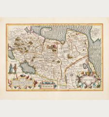
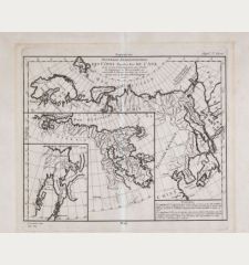
Carte de Tartarie Dressee sur les Relations de Plusieurs Voyageurs de Differentes...
Guillaume de l'Isle (*1675 - †1726)Old coloured map of Russia. Printed in Amsterdam by Covens & Mortier circa 1730.
Reference 12453
Description
Old coloured antique map of Russia with Siberia and Korea after Guillaume de l'Isle. This is the Covens & Mortier edition of the detailed map by G. de l'Isle. Shows the Russian Empire from Moscow to the very east of Siberia. With Korea and parts of Japan. Novaya Zemlya is still connected to the mainland. A beautiful title cartouche to the lower left.
Details
| Cartographer | Guillaume de l'Isle |
| Title | Carte de Tartarie Dressee sur les Relations de Plusieurs Voyageurs de Differentes Nations... / Tartaria, sive magni chami Imperium |
| Publisher, Year | Covens & Mortier, Amsterdam, circa 1730 |
| Plate Size | 48.5 x 60.5 cm (19.1 x 23.8 inches) |
| Sheet Size | 53.0 x 63.0 cm (20.9 x 24.8 inches) |
Condition
An ink stain, lower centrefold backed. Very good condition with old outline colour. Never framed before.
Cartographer
The de L'Isle family was one of the most influential Geographers of the early 18th century in France. Claude de L'Isle, born 1644, had four sons, of which Guillaume was the most notable. Guillaume was born 1675 and became member of the Académie Royale des Sciences with the age of twenty-seven, and was honoured later with the title Premier Géographe du Roi. His largest project, the Atlas de Géographie, was published until 1774 in Paris and Amsterdam (Covens and Mortier). He died in 1726.
Images to Download
If you like to download the image of this map with a resolution of 1200 pixels, please follow the link below.
You can use this image for publication on your personal or commercial websites for free if you set a link to this website. If you need photographs with a higher resolution, please contact us.
Guillaume de l'Isle: Carte de Tartarie Dressee sur les Relations de Plusieurs Voyageurs de Differentes Nations... / Tartaria, sive magni chami....
Old coloured map of Russia. Printed in Amsterdam by Covens & Mortier circa 1730.
Russia - de l'Isle, Guillaume - Carte de Tartarie Dressee sur les...

![Verus Chersonesi Tauricae Seu Crimea Conspectus ... [and] Theatrum Belli Ao MDCCXXXVII ... [and] Explicatio Duarum Tabularum... Verus Chersonesi Tauricae Seu Crimea Conspectus ... [and] Theatrum Belli Ao MDCCXXXVII ... [and] Explicatio Duarum Tabularum...](https://www.vintage-maps.com/2205-home_default/du-chaffat-ukraine-russo-turkish-war-crimea-1740.jpg)
