Product successfully added to your shopping cart
There are 0 items in your cart. There is 1 item in your cart.
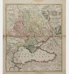
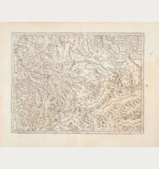
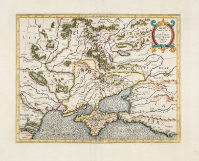
Taurica Chersonesus nostra Aetate Przecopsca et Gazara Dicitur
Gerard Mercator (*1512 - †1594)Reference 12871
Description
This is the first state of Mercator's depiction of Crimea, known in ancient times as Taurica Chersonesus.
Notable places like Moscow, Smolensk, Kiev, and Chernobyl are easily identifiable on this intricately detailed map. However, the main focus is on Russia's dynamic southeastern border with the Crimean Tatars. The border garrisons, such as Ryazan (Rezan on the map) and the Crimea, faced annual assaults from the steppes. Moscow's response, mobilizing tens of thousands annually to patrol this border, played a pivotal role in strengthening the centralized power of the Tsar during the 16th and 17th centuries.
In terms of the maps history, Gerard Mercator engraved it, and his heirs included it in the initial editions of the geographer's atlas. Jodocus Hondius later acquired the plate, featuring it in the Hondius atlas until 1636 when it was replaced by a new map. From the French edition of the Mercator-Hondius Atlas of 1633. French text on verso.
Details
| Cartographer | Gerard Mercator |
| Title | Taurica Chersonesus nostra Aetate Przecopsca et Gazara Dicitur |
| Publisher, Year | H. Hondius, Amsterdam, 1633 |
| Plate Size | 31.4 x 39.7 cm (12.4 x 15.6 inches) |
| Sheet Size | 47.8 x 57.1 cm (18.8 x 22.5 inches) |
| Reference | Van der Krogt, P.: Koeman's Atlantes Neerlandici, 1890:1A.1 |
Condition
Cartographer
Images to Download
If you like to download the image of this map with a resolution of 1200 pixels, please follow the link below.
You can use this image for publication on your personal or commercial websites for free if you set a link to this website. If you need photographs with a higher resolution, please contact us.
Ukraine - Mercator, Gerard - Taurica Chersonesus nostra Aetate...

![Verus Chersonesi Tauricae Seu Crimea Conspectus ... [and] Theatrum Belli Ao MDCCXXXVII ... [and] Explicatio Duarum Tabularum... Verus Chersonesi Tauricae Seu Crimea Conspectus ... [and] Theatrum Belli Ao MDCCXXXVII ... [and] Explicatio Duarum Tabularum...](https://www.vintage-maps.com/2205-home_default/du-chaffat-ukraine-russo-turkish-war-crimea-1740.jpg)
