Product successfully added to your shopping cart
There are 0 items in your cart. There is 1 item in your cart.
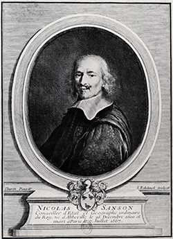
Antique Maps by Nicolas Sanson (*1600 - †1667)

Isle de France, Champagne, Lorraine
N. Sanson, Paris, 1648
Copper engraved map of North France by N. Sanson. Covering the regions of Ile-de-France, Lorraine and Champagne with Paris, Metz and Nancy. With a decorative figurative and allegoric cartouche....
Isle de France, Champagne, Lorraine
1648 - Nicolas Sanson
10498Antique map of the Champagne, Lorraine, Ile-de-France. Printed in Paris by N. Sanson in 1648.
120,00 €
Le Duche de Iuliers...
H. Jaillot, Paris, circa 1680
Antique map of the Duchy of Jülich after N. Sanson by H. Jaillot. Shows the area along the Rhine from Düsseldorf to Bonn, in the west to Maastricht. With Neuss, Cologne, Königswinter, Aachen,...
Le Duche de Iuliers...
1680 - Nicolas Sanson
12508Old coloured map of North Rhine-Westphalia, Germany. Printed in Paris by H. Jaillot circa 1680.
550,00 €
La Moree Et les Isles de Zante, Cefalonie, Ste Maure, Cerigo &c.
H. Jaillot, Paris, 1696
Large and very detailed map of the Peloponnes (Pelopónnisos) formerly Morea by Nicolas Sanson, publish in Paris by H. Jaillot. Printed from two plates and joined. Title cartouche surrounded by the...
La Moree Et les Isles de Zante, Cefalonie, Ste Maure, Cerigo &c.
1696 - Nicolas Sanson
11511Old coloured map of the Peloponnese. Printed in Paris by H. Jaillot in 1696.
700,00 €
Table des Cartes etc. Du Sr. Sanson.
N. Sanson, Paris, circa 1700
Very large old coloured and gold heightened index page of the atlas by Nicolas Sanson and Pieter Mortier. With mythological scenes and figures. Below, a view of a large library with scholars...
Table des Cartes etc. Du Sr. Sanson.
1700 - Nicolas Sanson
12731Atlas title page from N. Sanson. Printed around 1700 in Paris.
950,00 €
Le Duche de Berg, le Comte de Homberg, les Seigneuries de Hardenberg, et de Wildenborg
Covens & Mortier, Amsterdam, circa 1730
Antique map of the Duchy of Berg after N. Sanson by Covens and Mortier. Shows the area along the Rhine from Duisburg to Bonn. With Düsseldorf, Cologne, Solingen and Leverkusen. To the top right a...
Le Duche de Berg, le Comte de Homberg, les Seigneuries de Hardenberg, et...
1730 - Nicolas Sanson
12507Old coloured map of North Rhine-Westphalia, Germany. Printed in Amsterdam by Covens & Mortier circa 1730.
490,00 €
Tribocci Evesché de Strasbourg
P. Mariett, Paris, 1659
Rare and detailed map of the Alsace from N. Sanson by P. Mariette. Covering the area around Strasbourg with details of Black Forest and the Vosges Mountains. Dated 1659 in the plate.
Tribocci Evesché de Strasbourg
1659 - Nicolas Sanson
10486Coloured map of Strasbourg, Alsace. Printed in Paris by P. Mariett in 1659.
Sold
Partie septentrionale des Estats de Savoye... duches de Genevois
Pierre Mariette, Paris, 1663
Outline coloured engraving map of Lake Geneva with Savoy by Nicolas Sanson. Shows the area between Jura and Valais. With Geneva, Annecy, Bonneville and Cluses, in the east to St. Moritz. Bottom...
Partie septentrionale des Estats de Savoye... duches de Genevois
1663 - Nicolas Sanson
11865Old coloured map of the Lake Geneve, Haute-Savoie. Printed in Paris by Pierre Mariette in 1663.
Sold
Le Cercle de Franconie ...
H. Jaillot, Paris, circa 1680
Antique map of Franconia after N. Sanson by H. Jaillot. Shows the area between Mainz, Donauwörth, Plauen and Fulda. With Frankfurt, Nuremberg, Regensburg, Mannheim, Hof, Gießen and Würzburg in the...
Le Cercle de Franconie ...
1680 - Nicolas Sanson
12520Old coloured map of Bavaria, Germany. Printed in Paris by H. Jaillot circa 1680.
Sold
Le Cercle de Souabe / Nova Circuli Sueuiae ...
H. Jaillot, Paris, circa 1680
Antique map of Swabia by N. Sanson at H. Jaillot. Shows the area between Landau, Strasbourg, Basel, Zurich, Kaufbeuren, Augsburg. With Ulm, Stuttgart, the Black Forest and Lake Constance. To the...
Le Cercle de Souabe / Nova Circuli Sueuiae ...
1680 - Nicolas Sanson
12521Old coloured map of Baden-Württemberg, Germany. Printed in Paris by H. Jaillot circa 1680.
Sold
Le Cercle De Baviere / Nova Circuli Bavariae Tabula
H. Jaillot, Paris, circa 1680
Antique map of Bavaria after N. Sanson by H. Jaillot. Shows the area between Garmisch-Partenkirchen, Bamberg, Passau, Linz and Augsburg. With München, Straubing, Würzburg. To the top right a title...
Le Cercle De Baviere / Nova Circuli Bavariae Tabula
1680 - Nicolas Sanson
12524Old coloured map of Bavaria, Germany. Printed in Paris by H. Jaillot circa 1680.
Sold
Haute Partie de l'Evesche de Munster ...
H. Jaillot, Paris, circa 1690
Antique map of the diocese of Münster by N. Sanson published by Jaillot. Shows Bad Bentheim, Coesfeld, Rheine on the Ems, Dortmund and Rees with Münster in the centre. Top right a title cartouche.
Haute Partie de l'Evesche de Munster ...
1690 - Nicolas Sanson
12499Old coloured map of North Rhine-Westphalia, Germany. Printed in Paris by H. Jaillot circa 1690.
Sold
Oost-Frise, ou le Comte d'Embden...
H. Jaillot, Paris, circa 1690
Old coloured antique map of East Frisia by N. Sanson published by Jaillot. Shows the North Sea coast of Friesland with Emden and the Frisian islands of Borkum, Juist, Norderney, Baltrum, Langeoog,...
Oost-Frise, ou le Comte d'Embden...
1690 - Nicolas Sanson
12502Old coloured map of East Frisia. Printed in Paris by H. Jaillot circa 1690.
Sold
Le Cercle de la Basse Saxe / Circuli Saxoniae Interioris...
H. Jaillot, Paris, circa 1690
Antique map of northern Germany printed after N. Sanson by Jaillot. Shows the area from Emden via Hamburg to Poland with Stettin in the east. To the lower right a title cartouche.
Le Cercle de la Basse Saxe / Circuli Saxoniae Interioris...
1690 - Nicolas Sanson
12516Old coloured map of Northern Germany. Printed in Paris by H. Jaillot circa 1690.
Sold
Le Cercle De Baviere, subdivisé en tous les Estats qui le Composent. Dressé sur les Memoires les...
1692
Large map of Bavaria fron Nicolas Sanson, engraved by Jaillot. Nice coloured catrouche with coat of arms. Printed from two plates, joined.
Le Cercle De Baviere, subdivisé en tous les Estats qui le Composent....
1692 - Nicolas Sanson
10013Coloured map of Bavaria. Printed in the year 1692.
Sold
Le Cercle de la Basse Saxe, ou sont les Eveschés de Lubeck, et d'Hidelsheim, les Duches de...
Jaillot, Paris, 1692
Large copper engraved map of northern Germany from N. Sanson published by Jaillot in Paris. Covering the the area from Emden, Hamburg, Hannover up to Stettin in the East. Title on top and second...
Le Cercle de la Basse Saxe, ou sont les Eveschés de Lubeck, et...
1692 - Nicolas Sanson
10466Coloured map of Northern Germany. Printed in Paris by Jaillot in 1692.
Sold
Le Comté de la Marck, Les Seigneuries des Abbayes de Werden, d'Essen, et la Ville Imperiale de...
H. Jaillot, Paris, 1696
Antique map of the County of Mark with the Abbey of Essen and Wehrden after N. Sanson by Jaillot. Shows Düsseldorf, Ratingen, Essen, Bochum, Dortmund, Menden and Arnsberg. To the lower left a title...
Le Comté de la Marck, Les Seigneuries des Abbayes de Werden, d'Essen, et...
1696 - Nicolas Sanson
12506Old coloured map of North Rhine-Westphalia, Germany. Printed in Paris by H. Jaillot in 1696.
Sold
Iesu Christi Salvatoris Nostir Et Apostolorum Petri, et Pauli Mansiones, Itinera,...
P. Mortier, Amsterdam, circa 1700
Decorative original old coloured Sanson map of the Mediterranean. Showing the wanderings of the Apostles Peter & Paul. With inset maps of Palestine (In hac Iudaa tabula Iesu Christi Salvatris...)...
Iesu Christi Salvatoris Nostir Et Apostolorum Petri, et Pauli Mansiones,...
1700 - Nicolas Sanson
10323Old coloured map of Palestine, Jerusalem, Mediterranean. Printed in Amsterdam by P. Mortier circa 1700.
Sold
Basse Partie de l'Evesche de Munster, et le Comte de Benthem
P. Mortier, Amsterdam, circa 1730
Antique map of the diocese of Münster by N. Sanson at P. Mortier. Shows the area between Bremen, Delmenhorst and Rhene. With Lingen, Bad Bentheim, Dollart, Tecklenburg and the course of the Ems. To...
Basse Partie de l'Evesche de Munster, et le Comte de Benthem
1730 - Nicolas Sanson
12500Old coloured map of North Rhine-Westphalia, Germany. Printed in Amsterdam by P. Mortier circa 1730.
Sold


