Product successfully added to your shopping cart
There are 0 items in your cart. There is 1 item in your cart.
Total products
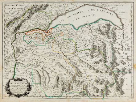
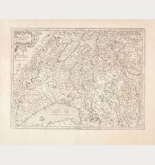
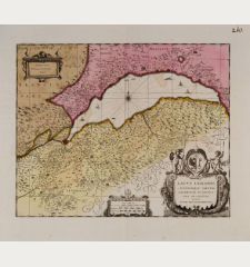
Partie septentrionale des Estats de Savoye... duches de Genevois
Nicolas Sanson (*1600 - †1667)Old coloured map of the Lake Geneve, Haute-Savoie. Printed in Paris by Pierre Mariette in 1663.
Reference 11865
Description
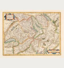
Outline coloured engraving map of Lake Geneva with Savoy by Nicolas Sanson. Shows the area between Jura and Valais. With Geneva, Annecy, Bonneville and Cluses, in the east to St. Moritz. Bottom left a title cartouche.
Details
| Cartographer | Nicolas Sanson |
| Title | Partie septentrionale des Estats de Savoye... duches de Genevois |
| Publisher, Year | Pierre Mariette, Paris, 1663 |
| Plate Size | 42.0 x 57.2 cm (16.5 x 22.5 inches) |
| Sheet Size | 45.2 x 60.2 cm (17.8 x 23.7 inches) |
Condition
Minor browning in margins. Very good condition.
Cartographer
Nicolas Sanson, born 1600 in Abbeville, was a French historian and cartographer. Louis XIII appointed him Géographe Ordinaire du Roi. His main work, the Atlas Cartes Générales de Toutes les Parties du Monde, was issued first in 1654 until 1676. After his death in 1667, the business was continued by his sons Guillaume and Adrien in partnership with A. H. Jaillot.
Images to Download
If you like to download the image of this map with a resolution of 1200 pixels, please follow the link below.
You can use this image for publication on your personal or commercial websites for free if you set a link to this website. If you need photographs with a higher resolution, please contact us.
Nicolas Sanson: Partie septentrionale des Estats de Savoye... duches de Genevois.
Old coloured map of the Lake Geneve, Haute-Savoie. Printed in Paris by Pierre Mariette in 1663.
Switzerland - Sanson, Nicolas - Partie septentrionale des Estats de...


![[Nova Helvetiae tabula geographica] [Nova Helvetiae tabula geographica]](https://www.vintage-maps.com/3425-home_default/scheuchzer-switzerland-lake-geneva-1720.jpg)

![[ohne Titel] [ohne Titel]](https://www.vintage-maps.com/1915-home_default/muenster-switzerland-fribourg-freiburg-im-ueechtland-1574.jpg)
