Product successfully added to your shopping cart
There are 0 items in your cart. There is 1 item in your cart.
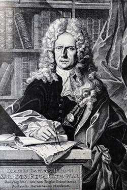
Antique Maps by Johann Baptist Homann (*1664 - †1724)

Accuratissima Totius Africae Tabula in Lucem producta
Jacob von Sandrart, Nuremberg, circa 1697
One of the first maps by Johann Baptist HomannThis rare map of Africa by Jacob von Sandrart is one of only two maps that Johann Baptist Homann engraved before 1700. Parts of the geographical...
Accuratissima Totius Africae Tabula in Lucem producta
1697 - Johann Baptist Homann
12183Old coloured map of the African continent. Printed in Nuremberg by Jacob von Sandrart circa 1697.
900,00 €
Lotharingiae Tabula Generalis in qua Ducatus Lotharingiae et Barri nec non Metensis, Tullensis et...
J.B. Homann, Nuremberg, circa 1720
Original old copper engraved map of Lorraine in north-east France by J. B. Homann. Covering the area around Metz, Nancy and Sarrebruck with Luxembourg in the North and Mulhouse in Southeast. With a...
Lotharingiae Tabula Generalis in qua Ducatus Lotharingiae et Barri nec...
1720 - Johann Baptist Homann
10492Old coloured map of the Lorraine. Printed in Nuremberg by J.B. Homann circa 1720.
130,00 €
Tabula Geographica qua pars Russiae Magnae Pontus Euxinus seu Mare Nigrum et Tartaria Minor ...
J. B. Homann, Nuremberg, circa 1720
Unusual map of South Russia with the Black Sea region and the Ukraine in original old colours. Extends from Moscow to Constantinople. The waters of the Dnieper and Danube are shown as currents in...
Tabula Geographica qua pars Russiae Magnae Pontus Euxinus seu Mare...
1720 - Johann Baptist Homann
11204Old coloured map of the Black Sea. Printed in Nuremberg by J. B. Homann circa 1720.
650,00 €
Amplissimae Regionis Mississipi seu Provinciae Ludovicianae a R.P. Ludovico Hennepin Francisc...
J.B. Homann, Nuremberg, circa 1720
The famous Buffalo Map of the Southeast by J.B. Homann. Showing the most part of today United States from the Great Lakes to Florida, the Mississippi River Valley with Louisiana and Texas, as...
Amplissimae Regionis Mississipi seu Provinciae Ludovicianae a R.P....
1720 - Johann Baptist Homann
11485The Buffalo Map of the Mississippi River Valley.
2 500,00 €
Geographische Universal-Zeig und Schlag-Uhr
J.B. Homann, Nuremberg, circa 1720
Curious Depiction of California as an Island.Illustration of a geographical clock by Zacharias Landteck, who manufactured it in the early 1700's in Nuremberg. The engraving was created by J....
Geographische Universal-Zeig und Schlag-Uhr
1720 - Johann Baptist Homann
11496Old coloured map of California as an Island. Printed in Nuremberg by J.B. Homann circa 1720.
980,00 €
Iudaea seu Palaestina ob Sacratissima Redemtoris Vestigia Hodie dicta Terra Sancta Prout olim in...
J. B. Homann, Nuremberg, circa 1720
Beautiful old coloured map of the Holy Land by Johann Baptist Homann. Divided into the twelve tribes of Israel. At the lower right, a small detailed map shows the Exodus of the Israelites from...
Iudaea seu Palaestina ob Sacratissima Redemtoris Vestigia Hodie dicta...
1720 - Johann Baptist Homann
11710Old coloured map of Israel, Judea. Printed in Nuremberg by J. B. Homann circa 1720.
490,00 € Pars Infima in qua Transylvania, Walachia, Moldavia, Bulgaria, Servia, Romania...")
Danubii Fluminis (hic ab Urbe Belgrado ...) Pars Infima in qua Transylvania, Walachia, Moldavia,...
J. B. Homann, Nuremberg, circa 1720
Old coloured engraved map of the course of the river Danube by Johann Baptist Homann. Shows the Danube river from Belgrade in Serbia, along the border between Romania and Bulgaria up to the mouth...
Danubii Fluminis (hic ab Urbe Belgrado ...) Pars Infima in qua...
1720 - Johann Baptist Homann
11716Old coloured map of the Danube. Printed in Nuremberg by J. B. Homann circa 1720.
280,00 €
Superioris et Inferioris Ducatus Silesiae in suos XVII Minores Principatus et Dominia Divisi Nova...
Johann Baptist Homann, Nuremberg, circa 1720
Old coloured map of Silesia by Johann Baptist Homann. Shows the southwestern part of Poland between Frankfurt Oder in the northwest, over Krosno Odrzańskie, Głogów, Freiberg, Brzeg, Racibórz and...
Superioris et Inferioris Ducatus Silesiae in suos XVII Minores...
1720 - Johann Baptist Homann
11728Old coloured map of Wroclaw, Breslau, Silesia. Printed in Nuremberg by Johann Baptist Homann circa 1720.
430,00 €
Regiae Celsitudinis Sabaudicae Status in quo Ducatus Sabaudiae, Principatus Pedemontium et...
Johann Baptist Homann, Nuremberg, circa 1720
Old coloured map of Liguria and Piedmont (Piemonte) by Johann Baptist Homann. Shows the northwestern regions of Italy between Geneva in the northwest, via Turin to Genoa in the southeast. In the...
Regiae Celsitudinis Sabaudicae Status in quo Ducatus Sabaudiae,...
1720 - Johann Baptist Homann
11733Old coloured map of Piemonte, Piedmont, Liguria. Printed in Nuremberg by Johann Baptist Homann circa 1720.
250,00 €
Belli Typus In Italia vicricis Aquilae progressus In Statu Mediolanensi Et Ducatu Mantuae ......
Johann Baptist Homann, Nuremberg, circa 1720
Old coloured map of the Lombardy (Lombardia) by Johann Baptist Homann. Shows the northwestern regions of Italy between Lago di Como, Lago Maggiore and Lago di Lugano in the northwest, Milan...
Belli Typus In Italia vicricis Aquilae progressus In Statu Mediolanensi...
1720 - Johann Baptist Homann
11734Old coloured map of Lombardia, Lombardy. Printed in Nuremberg by Johann Baptist Homann circa 1720.
Out of stock250,00 €
Lotharingiae Tabula Generalis in qua Ducatus Lotharingiae et Barri nec non Metensis, Tullensis et...
Johann Baptist Homann, Nuremberg, circa 1720
Old coloured map of Lorraine by Johann Baptist Homann. Covering the area around Metz, Nancy and Sarrebruck with Luxembourg in the North and Mulhouse in Southeast. Beautiful title cartouche to the...
Lotharingiae Tabula Generalis in qua Ducatus Lotharingiae et Barri nec...
1720 - Johann Baptist Homann
11754Old coloured map of the Lorraine. Printed in Nuremberg by Johann Baptist Homann circa 1720.
150,00 €
Magnae Britanniae Pars Meridionalis in qua Regnum Angliae tam in Septem Antiqua Anglo-Saxonum...
J. B. Homann, Nuremberg, circa 1720
Old coloured engraved map of England by Johann Baptist Homann. The beautiful title cartouche shows the coat of arms of the United Kingdom, in the lower left the coat of arms of England surrounded...
Magnae Britanniae Pars Meridionalis in qua Regnum Angliae tam in Septem...
1720 - Johann Baptist Homann
11761Old coloured map of England. Printed in Nuremberg by J. B. Homann circa 1720.
450,00 €
Tabula Aquitaniae complectens Gubernationem Guiennae et Vasconiae
J. B. Homann, Nuremberg, circa 1720
Beautiful antique map of southwest France. Shows the former Roman province of Gallia Aquitania from Royan with the Gironde, via Bordeaux to the Pyrenees in the south and the Mediterranean in the...
Tabula Aquitaniae complectens Gubernationem Guiennae et Vasconiae
1720 - Johann Baptist Homann
11792Old coloured map of Bordeaux. Printed in Nuremberg by J. B. Homann circa 1720.
380,00 €
Landgraviatus Alsatiae tam Superioris quam Infericum utroque Marchionatu Badensis ...
J. B. Homann, Nuremberg, circa 1720
Old coloured, very detailed map of the Alsace by J. B. Homann. Covering the Black Forest, Breisgau with the area between Kaiserstuhl via Basel up to Rastatt. With a beautiful title cartouche to the...
Landgraviatus Alsatiae tam Superioris quam Infericum utroque Marchionatu...
1720 - Johann Baptist Homann
11803Old coloured map of Baden-Württemberg. Printed in Nuremberg by J. B. Homann circa 1720.
190,00 €
Atlas novus terrarum orbis imperia regna et status exactis tabulis geographice demonstrans
J. B. Homann, Nuremberg, circa 1720
Old coloured title page of Johann Baptist Homann's atlas Atlas novus terrarum orbis imperia regna et status exactis tabulis geographice demonstrans published around 1720 in Nuremberg.Shows...
Atlas novus terrarum orbis imperia regna et status exactis tabulis...
1720 - Johann Baptist Homann
11808Copper engraving of a title page. Printed in Nuremberg by J. B. Homann circa 1720.
490,00 €
Regni Sueciae in Omnes suas Subjacentes Provincias Accurate Divisi Tabula Generalis ...
J. B. Homann, Nuremberg, circa 1720
Old coloured antique map of Sweden and Finland by Johann Baptist Homann. With parts of Norway, Estonia, Latvia and Russia. Below right a magnificent title cartouche.
Regni Sueciae in Omnes suas Subjacentes Provincias Accurate Divisi...
1720 - Johann Baptist Homann
11816Old coloured map of Sweden. Printed in Nuremberg by J. B. Homann circa 1720.
390,00 €
Novissima & Exactissima Totius Regni Neapolis Tabula ...
Johann Baptist Homann, Nuremberg, circa 1720
Old coloured map of Southern Italy (Italia meridionale) by Johann Baptist Homann. Shows the southern regions of Italy between L'Aquila and Gaeta in the northwest, Naples (Napoli) and the southern...
Novissima & Exactissima Totius Regni Neapolis Tabula ...
1720 - Johann Baptist Homann
12155Old coloured map of Molise, Campania, Basilicata, Puglia, Calabria. Printed in Nuremberg by Johann Baptist Homann circa 1720.
290,00 €
Dominii Veneti cum Vicinis Parmae Mutinae Mantuae et Mirandoli ...
Johann Baptist Homann, Nuremberg, circa 1720
Old coloured antique map of the northeastern part of Italy by Johann Baptist Homann. Shows Veneto, the province of Mantua, Emilia-Romagna, with the northern part of the Adriatic Sea the Gulf of...
Dominii Veneti cum Vicinis Parmae Mutinae Mantuae et Mirandoli ...
1720 - Johann Baptist Homann
12156Old coloured map of Regione del Veneto. Printed in Nuremberg by Johann Baptist Homann circa 1720.
350,00 €
Ducatus Mediolani una cum Confinys Accurata Tabula ...
Johann Baptist Homann, Nuremberg, circa 1720
Old coloured map of the Lombardy (Lombardia) by Johann Baptist Homann. Shows the northwestern regions of Italy between Lago di Como, Lago Maggiore and Lago di Lugano in the northwest, Milan...
Ducatus Mediolani una cum Confinys Accurata Tabula ...
1720 - Johann Baptist Homann
12157Old coloured map of Lombardia, Lombardy. Printed in Nuremberg by Johann Baptist Homann circa 1720.
250,00 €
Tabula Geographica Campaniae
J.B. Homann, Nuremberg, circa 1720
Original old coloured antique map of the Champagne in France by J. B. Homann. Covering the region Champagne-Ardenne with Reims, Troyes and Épernay. With one decorative figurative and allegoric...
Tabula Geographica Campaniae
1720 - Johann Baptist Homann
12159Old coloured map of the Champagne-Ardenne. Printed in Nuremberg by J.B. Homann circa 1720.
250,00 €
Ducatus Brabantiae Nova Tabula
J. B. Homann, Nuremberg, circa 1720
Old coloured antique map of the duchy of Brabant by Johann Baptist Homann. Showing the northern part of Belgium and the southern part of the Netherlands. With Antwerp, Breda, Bruxelles, Eindhoven,...
Ducatus Brabantiae Nova Tabula
1720 - Johann Baptist Homann
12163Old coloured map of Brabant. Printed in Nuremberg by J. B. Homann circa 1720.
200,00 €
Tabula Ducatus Britanniae Gallis Le Gouvernemt. General De Bretagne ...
J.B. Homann, Nuremberg, circa 1720
Old coloured antique map of the Bretagne (Brittany) in northwestern France by J. B. Homann. With Rennes, Brest, Quimper, Lorient, Vannes, Saint-Brieuc, Saint-Malo, Lanester, Fougères and Lannion....
Tabula Ducatus Britanniae Gallis Le Gouvernemt. General De Bretagne ...
1720 - Johann Baptist Homann
12165Old coloured map of Bretagne, Brittany. Printed in Nuremberg by J.B. Homann circa 1720.
390,00 €
Comitatus Burgundiae tam in primarias ejus praefecturas ...
J. B. Homann, Nuremberg, circa 1720
Old coloured antique map of the county of Burgundy by J. B. Homann. Showing Besancon in the centre, in the south to Geneva with Lake Geneva, in the north to the Champagne. Beautiful title cartouche...
Comitatus Burgundiae tam in primarias ejus praefecturas ...
1720 - Johann Baptist Homann
12172Old coloured map of the Burgundy. Printed in Nuremberg by J. B. Homann circa 1720.
190,00 €
Tabula Generalis Marchionatus Moraviae in Sex Circulos Divisae ...
Johann Baptist Homann, Nuremberg, circa 1720
Old coloured antique map of Moravia (Morava) by Johann Baptist Homann. Shows the southeastern part of the Czech Republic between Pelhřimov (Pilgrams) in the northwest, Racibórz (Ratibor) in the...
Tabula Generalis Marchionatus Moraviae in Sex Circulos Divisae ...
1720 - Johann Baptist Homann
12179Old coloured map of Moravia. Printed in Nuremberg by Johann Baptist Homann circa 1720.
350,00 €


 Pars Infima in qua Transylvania, Walachia, Moldavia, Bulgaria, Servia, Romania...")


