Product successfully added to your shopping cart
There are 0 items in your cart. There is 1 item in your cart.
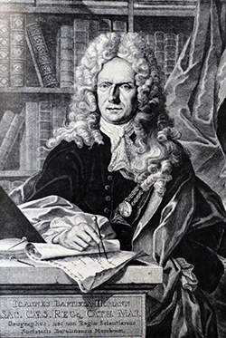
Antique Maps by Johann Baptist Homann (*1664 - †1724)

Ducatus Franciae Orientalis seu Sac. Rom. Imperii Principatus et Episcopatus Herbipolensis.
J. B. Homann, Nuremberg, circa 1720
Old colored, very detailed antique map of Franconia by J. B. Homann. From Tann (Rhön) in the north to Rothenburg in the south, in the east from Lichtenfels to Aschaffenburg in the west. With...
Ducatus Franciae Orientalis seu Sac. Rom. Imperii Principatus et...
1720 - Johann Baptist Homann
12978Old coloured map of Franconia. Printed in Nuremberg by J. B. Homann circa 1720.
280,00 €
Prospect, Grundris und Gegend der Polnischen vesten Reichs und Handels-Stadt Dantzig und ihrem...
J. B. Homann, Nuremberg, circa 1730
Old coloured map of the surroundings of Gdańsk (Danzig) by Johann Baptist Homann. Above left, the Baltic Sea with Gdansk Bay (Zatoka Gdańska) and the mouth of the Vistula, extending south to Tczew...
Prospect, Grundris und Gegend der Polnischen vesten Reichs und...
1730 - Johann Baptist Homann
12676Old coloured city plan of Gdansk, Danzig. Printed in Nuremberg by J. B. Homann circa 1730.
950,00 €
Charte von Russisch Litauen, welche die von Polen an Russland Abgetretene Woiewodschaften,...
Homann Erben, Nuremberg, 1775
A rare map of Belarus, with parts of the Ukraine and Lithuania. Marking the Dnieper and Dwiner rivers, with the towns of Polack, Orsha & Mogilev. With many details.
Charte von Russisch Litauen, welche die von Polen an Russland...
1775 - Johann Baptist Homann
11203Old coloured map of the Ukraine, Lithuania, Belarus. Printed in Nuremberg by Homann Erben in 1775.
550,00 €
Accuratissima totius Africae Tabula in Lucem producta
J. v. Sandrart, Nuremberg, 1700
Rare map of Africa engraved by J.B. Homann prior he became his own publisher. The map is printed and published by Jacob von Sandrart and is a close copy of de Wit's map of 1680. Seems to be the...
Accuratissima totius Africae Tabula in Lucem producta
1700 - Johann Baptist Homann
10113Old coloured map of the African continent. Printed in Nuremberg by J. v. Sandrart in 1700.
Sold
Regnorum Siciliae et Sardiniae nova & accurata tabula - Sardiniae Insula & regnum
J. B. Homann, Nuremberg, 1700-02
Rare antique map of Sicily and Sardinia in the Mediterranean by J. B. Homann. One of the early maps by Homann when he was still working for David Funck. Maps engraved by Homann before and around...
Regnorum Siciliae et Sardiniae nova & accurata tabula - Sardiniae Insula...
1700 - Johann Baptist Homann
12745Old coloured map of Sicily, Sardinia. Printed in Nuremberg by J. B. Homann in 1700.
Sold
Postarum seu Veredariorum Stationes per Germaniam et Provincias Adiacentes
J. B. Homann, Nuremberg, 1709
Postal route map of Germany and the adjacent countries from J. B. Homann. With two beautiful cartouches.
Postarum seu Veredariorum Stationes per Germaniam et Provincias Adiacentes
1709 - Johann Baptist Homann
10627Coloured map of the postal routes. Printed in Nuremberg by J. B. Homann in 1709.
Sold
Totius Americae Septentrionalis et Meridionalis Novisima Representatio
J. B. Homann, Nuremberg, circa 1710
First state of this early edition of J. B. Homann's America map with California as an Island and without printers privilege. The Mississippi River is based on the early French Jesuit explorations,...
Totius Americae Septentrionalis et Meridionalis Novisima Representatio
1710 - Johann Baptist Homann
10328Old coloured map of California as an Island. Printed in Nuremberg by J. B. Homann circa 1710.
Sold
Hydrographia Germaniae qua Geographiae Naturalis ...
J. B. Homann, Nuremberg, circa 1710
Coloured map of the river system of Germany from J. B. Homann. With two beautiful cartouches. From "Grosser Atlas".
Hydrographia Germaniae qua Geographiae Naturalis ...
1710 - Johann Baptist Homann
10646Coloured map of the river sytem of Germany. Printed by J. B. Homann in Nürnberg during the year 1710.
Sold
Belgii Pars Septentrionalis Communi Nomine vulgo Hollandia ... / Batavorum Coloniae Occidential...
J. B. Homann, Nuremberg, circa 1710
Original old coloured map of the Low Countries by JB Homann. With large inset maps of the Northeastern US from the Chesapeake to Massachusetts and Southeast Asia and additional vignette views of...
Belgii Pars Septentrionalis Communi Nomine vulgo Hollandia ... /...
1710 - Johann Baptist Homann
11145Old coloured map of Jakarta, New York. Printed in Nuremberg by J. B. Homann circa 1710.
Sold
Belgii Pars Septentrionalis Communi Nomine vulgo Hollandia ... / Batavorum Coloniae Occidential...
J. B. Homann, Nuremberg, circa 1710
Original old coloured map of the Low Countries by JB Homann. With large inset maps of the Northeastern US from the Chesapeake to Massachusetts and Southeast Asia and additional vignette views of...
Belgii Pars Septentrionalis Communi Nomine vulgo Hollandia ... /...
1710 - Johann Baptist Homann
11146Old coloured map of Jakarta, New York. Printed in Nuremberg by J. B. Homann circa 1710.
Sold
Belgii Pars Septentrionalis Communi Nomine vulgo Hollandia ... / Batavorum Coloniae Occidential...
J. B. Homann, Nuremberg, circa 1710
Original old coloured map of the Low Countries by JB Homann. With large inset maps of the Northeastern US from the Chesapeake to Massachusetts and Southeast Asia and additional vignette views of...
Belgii Pars Septentrionalis Communi Nomine vulgo Hollandia ... /...
1710 - Johann Baptist Homann
11148Old coloured map of Jakarta, New York. Printed in Nuremberg by J. B. Homann circa 1710.
Sold
Planiglobii Terrestris cum utroq Hemisphaerio Caelesti Generalis Repraesentatio
Homann, Nuremberg, circa 1710
Hand coloured double hemisphere world map by J.B. Homann. With double hemisphere celestial charts. Very decorative and nicely coloured map, showing in background decoration windheads and several...
Planiglobii Terrestris cum utroq Hemisphaerio Caelesti Generalis...
1710 - Johann Baptist Homann
11442Old coloured map of the world. Printed in Nuremberg by Homann circa 1710.
Sold
Lotharingiae Tabula Generalis in qua Ducatus Lotharingiae et Barri nec non Metensis, Tullensis et...
J.B. Homann, Nuremberg, 1712
Original old copper engraved map of Lorraine in north-east France by J. B. Homann. Covering the area around Metz, Nancy and Sarrebruck with Luxembourg in the North and Mulhouse in Southeast. With a...
Lotharingiae Tabula Generalis in qua Ducatus Lotharingiae et Barri nec...
1712 - Johann Baptist Homann
10493Old coloured map of the Lorraine. Printed in Nuremberg by J.B. Homann in 1712.
Sold
Asiae Recentissima Delineatio, qua Status et Imperia Totius Orientis Unacum Orientalibus Indiis...
J.B. Homann, Nuremberg, 1712
First edition of J.B. Homann's map of Asia. Still without Kamchatka, but with the big island of Terra Yedso above Japan. Compagnie Land to the upper right could be an early representation of...
Asiae Recentissima Delineatio, qua Status et Imperia Totius Orientis...
1712 - Johann Baptist Homann
11494Old coloured map of the Asian continent. Printed in Nuremberg by J.B. Homann in 1712.
Sold
Neu vermehrte Post Charte durch gantz Teutschland nach Italien, Franckreich. Niederland, Preußen,...
J.B. Homann, Nuremberg, 1714
Copper engraved map with the postal routes of Central Europe after J.P. Nell by J.B. Homann. Covering the area from Paris and Brussels via Germany in the centre to Warsaw in the East. With two...
Neu vermehrte Post Charte durch gantz Teutschland nach Italien,...
1714 - Johann Baptist Homann
10467Old coloured postal map. Printed in Nuremberg by J.B. Homann in 1714.
Sold
Generalis Totius Imperii Russorum Novissim Tabula
J. B. Homann, Nuremberg, 1716
Map of the Russian Empire. With beautiful cartouche, ships and seamonsters. Original publisher colours.
Generalis Totius Imperii Russorum Novissim Tabula
1716 - Johann Baptist Homann
10299Old coloured map of Russia. Printed in Nuremberg by J. B. Homann in 1716.
Sold
Imperii Persici In Omnes Suas Provincias
Homann, Nuremberg, circa 1720
Hand coloured copper engraving by J.B. Homann, showing Persia between Astrakhan, Kabul, Arabic Sea and Cyprus.
Imperii Persici In Omnes Suas Provincias
1720 - Johann Baptist Homann
10011Old coloured map of Persia. Printed in Nuremberg by Homann circa 1720.
Sold
Planiglobii Terrestris cum utroq Hemisphaerio Caelesti Generalis Exhibitio
Homann, Nuremberg, circa 1720
Hand coloured double hemisphere world map by J.B. Homann, showing also double hermisphere celestical charts. It's known as one of Homann's best works.
Planiglobii Terrestris cum utroq Hemisphaerio Caelesti Generalis Exhibitio
1720 - Johann Baptist Homann
10065Old coloured map of the world. Printed in Nuremberg by Homann circa 1720.
Sold
Ducatus Luxemburgi tam in Maiores quam Minores ejusdem Ditiones accurate distinctus et exhibitus...
J. B. Homann, Nuremberg, circa 1720
Old coloured map of Luxembourg by J. B. Homann. With one decorative cartouche.
Ducatus Luxemburgi tam in Maiores quam Minores ejusdem Ditiones accurate...
1720 - Johann Baptist Homann
10408Coloured map of Luxembourg. Printed in Nuremberg by J. B. Homann circa 1720.
Sold
Regni Bohemiae, Ducatus Silesiae, Marchionatus Moraviae et Lusatiae. Tabula Generalis
J. B. Homann, Nuremberg, circa 1720
Original coloured cooper engraved map of Silesia, Bohemia and Moravia by J. B. Homann. Showing a lot of details like forests, rivers and small villages. With one beautiful cartouche.
Regni Bohemiae, Ducatus Silesiae, Marchionatus Moraviae et Lusatiae....
1720 - Johann Baptist Homann
10422Coloured map of Silesia, Moravia. Printed in Nuremberg by J. B. Homann circa 1720.
Sold
Ducatus Luneburgici et Comitatus Dannebergensis accurata Descriptio
J. B. Homann, Nuremberg, circa 1720
Detailed copper engraved map of Lower Saxony of J. B. Homann. Covering the area between Hamburg, Hannover, Braunschweig and Salzwedel with one figurative cartouche.
Ducatus Luneburgici et Comitatus Dannebergensis accurata Descriptio
1720 - Johann Baptist Homann
10460Old coloured map of Lower Saxony. Printed in Nuremberg by J. B. Homann circa 1720.
Sold
Totius Regni Galliae Sive Franciae et Navarrae novißima Tabula edita à Io. Bapt. Homann Norimbergae.
J. B. Homann, Nuremberg, circa 1720
Copper engraved map of France by J. B. Homann. Covering complete France and southern part of the British Isles with many detail and one beautiful dramatic cartouche.
Totius Regni Galliae Sive Franciae et Navarrae novißima Tabula edita à...
1720 - Johann Baptist Homann
10462Old coloured map of France. Printed in Nuremberg by J. B. Homann circa 1720.
Sold
Landgraviatus Alsatiae tam Superioris quam Infericum utroque Marchionatu Badensis
J.B. Homann, Nuremberg, circa 1720
Attractive coloured map of the Alsace from J. B. Homann. Covering the Black Forest, Breisgau with the area between Kaiserstuhl via Basel up to Rastatt.
Landgraviatus Alsatiae tam Superioris quam Infericum utroque Marchionatu...
1720 - Johann Baptist Homann
10487Coloured map of the Rhine, Breisgau, Alsace. Printed in Nuremberg by J.B. Homann circa 1720.
Sold
Landgraviatus Alsatiae tam Superioris quam Infericum utroque Marchionatu Badensis
J.B. Homann, Nuremberg, circa 1720
Attractive coloured map of the Alsace from J. B. Homann. Covering the Black Forest, Breisgau with the area between Kaiserstuhl via Basel up to Rastatt.
Landgraviatus Alsatiae tam Superioris quam Infericum utroque Marchionatu...
1720 - Johann Baptist Homann
10489Coloured map of the Rhine, Breisgau, Alsace. Printed in Nuremberg by J.B. Homann circa 1720.
Sold


