Product successfully added to your shopping cart
There are 0 items in your cart. There is 1 item in your cart.
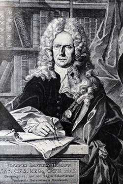
Antique Maps by Johann Baptist Homann (*1664 - †1724)

Regni Norvegiae Accurata Tabula in qua Praefecturae Quinque Generales Aggerhusiensis, Bergensis...
J. B. Homann, Nuremberg, circa 1720
Old coloured engraved map of Norway by Johann Baptist Homann. Top left an inset with the Lofoten to the North Cape. The beautiful title cartouche shows the Norwegian coat of arms.
Regni Norvegiae Accurata Tabula in qua Praefecturae Quinque Generales...
1720 - Johann Baptist Homann
11807Old coloured map of Norway. Printed in Nuremberg by J. B. Homann circa 1720.
Sold
Neue Tafel vor alle Liebhabers und See-fahrende Personen Stellet vor ein Orlog oder Kriegs-Schiff...
J. B. Homann, Nuremberg, circa 1720
Large, old coloured engraving of a warship by Johann Baptist Homann. Published around 1720 in Nuremberg. Shows a three-master battleship with dinghies in the centre, below the cross section of the...
Neue Tafel vor alle Liebhabers und See-fahrende Personen Stellet vor ein...
1720 - Johann Baptist Homann
11809Copper engraving of a maritim scenery. Warship. Printed in Nuremberg by J. B. Homann circa 1720.
Sold
Tafel in welcher alle gehörige Werck-zeuge zur Kriegs-Kunst, Vestungs-bau und Artillerie, zu...
J. B. Homann, Nuremberg, circa 1720
Large, old coloured engraving with numerous illustrations of siege and war technology by Johann Baptist Homann. Including different military equipment such as cannons, mortars, battle axes, various...
Tafel in welcher alle gehörige Werck-zeuge zur Kriegs-Kunst,...
1720 - Johann Baptist Homann
11810Copper engraving of a military scene. Printed in Nuremberg by J. B. Homann circa 1720.
Sold![Homann, World and Continents, 1720: Planiglobii Terrestris cum utroq Hemisphaerio Caelesti [and] Totius Africae [and] Totius Americae Septentrionalis et...]( "Johann Baptist Homann: Planiglobii Terrestris cum utroq Hemisphaerio Caelesti [and] Totius Africae [and] Totius Americae Septentrionalis et...")
Planiglobii Terrestris cum utroq Hemisphaerio Caelesti [and] Totius Africae [and] Totius Americae...
J. B. Homann, Nuremberg, circa 1720
A matching set of the World and the Continents by J. B. HomannWorld Planiglobii Terrestris cum utroq Hemisphaerio Caelesti : Old coloured antique world map by J. B. Homann. With southern...
Planiglobii Terrestris cum utroq Hemisphaerio Caelesti [and] Totius...
1720 - Johann Baptist Homann
11811Old coloured world map and continent maps by Johann Baptist Homann. Published around 1720 in Nuremberg.
Sold
Bavariae Circulus et Electorat ...
J. B. Homann, Nuremberg, circa 1720
Old coloured, very detailed map of Bavaria by J. B. Homann. From Donauwörth to Passau and Bamberg to Kitzbühl. With Nuremberg, Munich, Landshut and Regensburg. With a beautiful title cartouche to...
Bavariae Circulus et Electorat ...
1720 - Johann Baptist Homann
11813Old coloured map of Bavaria. Printed in Nuremberg by J. B. Homann circa 1720.
Sold
Dominii Veneti cum Vicinis Parmae Mutinae Mantuae et Mirandoli ...
Johann Baptist Homann, Nuremberg, circa 1720
Old coloured antique map of the northeastern part of Italy by Johann Baptist Homann. Shows Veneto, the province of Mantua, Emilia-Romagna, with the northern part of the Adriatic Sea the Gulf of...
Dominii Veneti cum Vicinis Parmae Mutinae Mantuae et Mirandoli ...
1720 - Johann Baptist Homann
11814Old coloured map of Regione del Veneto. Printed in Nuremberg by Johann Baptist Homann circa 1720.
Sold
Ukrania quae et Terra Cosaccorum cum vicinis Walachiae, Moldaviae, Minorisq., Tartariae...
J. B. Homann, Nuremberg, circa 1720
Old coloured antique map of the Ukraine with the Black Sea and the Crimea. Extends from Moscow to Constantinople. With a beautiful figural cartouche composed of native figures. Published 1720 by J....
Ukrania quae et Terra Cosaccorum cum vicinis Walachiae, Moldaviae,...
1720 - Johann Baptist Homann
11815Old coloured map of the Black Sea. Printed in Nuremberg by J. B. Homann circa 1720.
Sold
Regnum Borussiae gloriosis auspicijs Seerenissimi et Potentissimi Princip Friderici III. Primi...
J. B. Homann, Nuremberg, circa 1720
Old coloured antique map of East Prussia by Johann Baptist Homann. Shows the coast of the Baltic Sea from Danzig over Königsberg to Memel. With an impressive title cartouche with Frederick I, the...
Regnum Borussiae gloriosis auspicijs Seerenissimi et Potentissimi...
1720 - Johann Baptist Homann
11817Old coloured map of Gdansk, Kaliningrad, Konigsberg, Prussia. Printed in Nuremberg by J. B. Homann circa 1720.
Sold
Regni Poloniae Magnique Ducatus Lithuaniae Nova et Exacta Tabula
Johann Baptist Homann, Nuremberg, circa 1720
Old coloured antique map of Poland by Johann Baptist Homann. Shows the area between Szczecin (Stettin) in the west to the Black Sea in the southeast. In the north with Estonia, Latvia and...
Regni Poloniae Magnique Ducatus Lithuaniae Nova et Exacta Tabula
1720 - Johann Baptist Homann
11818Old coloured map of Poland. Printed in Nuremberg by Johann Baptist Homann circa 1720.
Sold
Palatinatus Bavariae vulgo die Obere Pfaltz
J. B. Homann, Nuremberg, circa 1720
Old coloured, very detailed map of the Upper Palatinate in northeastern Bavaria by J. B. Homann. In the northeast to Bamberg, in the southeast to Weissenburg. With Amberg in the center. With...
Palatinatus Bavariae vulgo die Obere Pfaltz
1720 - Johann Baptist Homann
11830Old coloured map of Bavaria. Printed in Nuremberg by J. B. Homann circa 1720.
Sold
Ducatus Pomeraniae Novissima Tabula in Anteriorem et Interiorem Divisa, quatenus susunt Coronis...
J. B. Homann, Nuremberg, circa 1720
Antique map of Pomerania by Johann Baptist Homann. Showing the Baltic coast from Stralsund with Rügen and Usedom to Gdansk. With Berlin, Szczecin, Toruń. Decorated with beautiful title cartouche.
Ducatus Pomeraniae Novissima Tabula in Anteriorem et Interiorem Divisa,...
1720 - Johann Baptist Homann
12038Old coloured map of Pomerania, Mecklenburg-Vorpommern. Printed in Nuremberg by J. B. Homann circa 1720.
Sold
Planiglobii Terrestris cum utroq Hemisphaerio Caelesti Generalis Repraesentatio
J. B. Homann, Nuremberg, circa 1720
Old coloured antique world map by Johann Baptist Homann. With a southern and northern celestial chart and two diagrams about the movement of the sun. In the background windheads and natural...
Planiglobii Terrestris cum utroq Hemisphaerio Caelesti Generalis...
1720 - Johann Baptist Homann
12150Old coloured map of the world. Printed in Nuremberg by J. B. Homann circa 1720.
Sold
Planiglobii Terrestris cum utroq Hemisphaerio Caelesti Generalis Repraesentatio
J. B. Homann, Nuremberg, circa 1720
Old coloured antique world map by Johann Baptist Homann. With a southern and northern celestial chart and two diagrams about the movement of the sun. In the background windheads and natural...
Planiglobii Terrestris cum utroq Hemisphaerio Caelesti Generalis...
1720 - Johann Baptist Homann
12151Old coloured map of the world. Printed in Nuremberg by J. B. Homann circa 1720.
Sold
Tabula Delphinatus Vulgo le Gouvernement general du Dauphine
J. B. Homann, Nuremberg, circa 1720
Old coloured antique map of the Dauphiné in southeastern France by J. B. Homann. On the left the Rhône from Lyon, Vienne, Tournon-sur-Rhône, Valence to Montélimar. In the east Briançon to Pinerolo...
Tabula Delphinatus Vulgo le Gouvernement general du Dauphine
1720 - Johann Baptist Homann
12174Old coloured map of the Dauphine, Rhone-Alpes. Printed in Nuremberg by J. B. Homann circa 1720.
Sold
Regni Poloniae Magnique Ducatus Lithuaniae Nova et Exacta Tabula
Johann Baptist Homann, Nuremberg, circa 1720
Old coloured antique map of Poland by Johann Baptist Homann. Shows the area between Szczecin (Stettin) in the west to the Black Sea in the southeast. In the north with Estonia, Latvia and...
Regni Poloniae Magnique Ducatus Lithuaniae Nova et Exacta Tabula
1720 - Johann Baptist Homann
12176Old coloured map of Poland. Printed in Nuremberg by Johann Baptist Homann circa 1720.
Sold
Potentissimae Helvetiorum Reipublicae Cantones Tredecim cum Foederatis et Subjectis Provinciis
Homann, Nuremberg, circa 1720
Old coloured antique map of Switzerland by Johann Baptist Homann. The large title cartouche shows 13 coat of arms of the cantons and 20 coat of arms of large cities. Bottom left a scene of a local...
Potentissimae Helvetiorum Reipublicae Cantones Tredecim cum Foederatis...
1720 - Johann Baptist Homann
12178Old coloured map of Switzerland. Printed in Nuremberg by Homann circa 1720.
Sold
Regnorum Hispaniae et Portugalliae tabula generalis de l'Isliana / El Reyno de Espanna ...
J. B. Homann, Nuremberg, circa 1720
Old coloured antique map of the Iberian Peninsula with Spain and Portugal by Johann Baptist Homann. In the east the Balearic Islands with Mallorca, Menorca and Ibiza. Decorated with a beautiful...
Regnorum Hispaniae et Portugalliae tabula generalis de l'Isliana / El...
1720 - Johann Baptist Homann
12181Old coloured map of Spain - Portugal. Printed in Nuremberg by J. B. Homann circa 1720.
Sold
Asiae Recentissima Delineatio, qua Status et Imperia Totius Orientis Unacum Orientalibus Indiis...
J. B. Homann, Nuremberg, circa 1720
Early antique map of Asia by Johann Baptist Homann. With Kamchatka already drawn as a peninsular. Compagnie Land to the upper right could be an early representation of Alaska or a...
Asiae Recentissima Delineatio, qua Status et Imperia Totius Orientis...
1720 - Johann Baptist Homann
12182Old coloured map of the Asian continent. Printed in Nuremberg by J. B. Homann circa 1720.
Sold
Totius Americae Septentrionalis et Meridionalis Novissima Repraesentatio
J. B. Homann, Nuremberg, circa 1720
Early antique map of America by Johann Baptist Homann. The first of two America maps by Homann. This example is in the third state with California already correctly represented as a peninsula. For...
Totius Americae Septentrionalis et Meridionalis Novissima Repraesentatio
1720 - Johann Baptist Homann
12184Old coloured map of the American continent. Printed in Nuremberg by J. B. Homann circa 1720.
Sold
Neue Tafel vor alle Liebhabers und See-fahrende Personen Stellet vor ein Orlog oder Kriegs-Schiff...
J. B. Homann, Nuremberg, circa 1720
Large, old coloured engraving of a warship by Johann Baptist Homann. Published around 1720 in Nuremberg. Shows a three-master battleship with dinghies in the centre, below the cross section of the...
Neue Tafel vor alle Liebhabers und See-fahrende Personen Stellet vor ein...
1720 - Johann Baptist Homann
12472Copper engraving of a maritim scenery. Warship. Printed in Nuremberg by J. B. Homann circa 1720.
Sold
Tafel in welcher alle gehörige Werck-zeuge zur Kriegs-Kunst, Vestungs-bau und Artillerie, zu...
J. B. Homann, Nuremberg, circa 1720
Large, old coloured engraving with numerous illustrations of siege and war technology by Johann Baptist Homann. Including different military equipment such as cannons, mortars, battle axes, various...
Tafel in welcher alle gehörige Werck-zeuge zur Kriegs-Kunst,...
1720 - Johann Baptist Homann
12591Copper engraving of a military scene. Printed in Nuremberg by J. B. Homann circa 1720.
Sold
Neue Tafel vor alle Liebhabers und See-fahrende Personen Stellet vor ein Orlog oder Kriegs-Schiff...
J. B. Homann, Nuremberg, circa 1720
Large, old coloured engraving of a warship by Johann Baptist Homann. Published around 1720 in Nuremberg. Shows a three-master battleship with dinghies in the centre, below the cross section of the...
Neue Tafel vor alle Liebhabers und See-fahrende Personen Stellet vor ein...
1720 - Johann Baptist Homann
12675Copper engraving of a maritim scenery. Warship. Printed in Nuremberg by J. B. Homann circa 1720.
Sold
Planiglobii Terrestris cum utroq Hemisphaerio Caelesti Generalis Repraesentatio
J. B. Homann, Nuremberg, circa 1720
Old coloured antique world map by Johann Baptist Homann. With a southern and northern celestial chart and two diagrams about the movement of the sun. In the background windheads and natural...
Planiglobii Terrestris cum utroq Hemisphaerio Caelesti Generalis...
1720 - Johann Baptist Homann
12694Old coloured map of the world. Printed in Nuremberg by J. B. Homann circa 1720.
Sold
Tafel in welcher alle gehörige Werck-zeuge zur Kriegs-Kunst, Vestungs-bau und Artillerie, zu...
J. B. Homann, Nuremberg, circa 1720
Large, old coloured engraving with numerous illustrations of siege and war technology by Johann Baptist Homann. Including different military equipment such as cannons, mortars, battle axes, various...
Tafel in welcher alle gehörige Werck-zeuge zur Kriegs-Kunst,...
1720 - Johann Baptist Homann
12751Copper engraving of a military scene. Printed in Nuremberg by J. B. Homann circa 1720.
Sold


![Homann, World and Continents, 1720: Planiglobii Terrestris cum utroq Hemisphaerio Caelesti [and] Totius Africae [and] Totius Americae Septentrionalis et...](https://www.vintage-maps.com/2272-home_default/homann-world-and-continents-1720.jpg "Johann Baptist Homann: Planiglobii Terrestris cum utroq Hemisphaerio Caelesti [and] Totius Africae [and] Totius Americae Septentrionalis et...")


