Product successfully added to your shopping cart
There are 0 items in your cart. There is 1 item in your cart.
Planiglobii Terrestris cum utroq Hemisphaerio Caelesti [and] Totius Africae [and]...
Johann Baptist Homann (*1664 - †1724)Reference 11811
Description
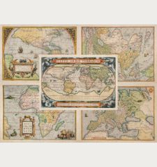
A matching set of the World and the Continents by J. B. Homann
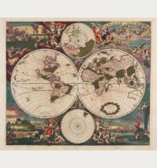
World Planiglobii Terrestris cum utroq Hemisphaerio Caelesti: Old coloured antique world map by J. B. Homann. With southern and northern star maps. California is properly drawn as a peninsula, Australia is still very incomplete, the east coast of New Zealand already exists. Also marked are the routes of the explorers and seafarers Dampier, Magellan, Tasman, Charmont and Gaetani. In the background, windheads and natural phenomena such as the volcano (Etna), earthquakes, the tides, geysers in Norway and a rainbow. At the top a title band holded by Putti. Below a detailed description in Latin. One of the most beautiful and interesting world map of the 18th century.
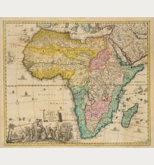
Africa Totius Africae Nova Repraesentatio qua Practer Diversos in ea Status et Regiones: The first map of Africa by J. B. Homann. Parts of the geographic information are already shown accurately, others are still based on the Ptolemaic maps, such as the source of the Nile in the Lakes Zaire and Zaflan. On the left a detailed description of the Nile. Very detailed inland. Beautiful title cartouche with the inhabitants and animals of Africa, ivory to the left below.
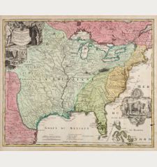
America Totius Americae Septentrionalis et Meridionalis Novissima Repraesentatio: The first of two America maps of Homann. This copy is in the third state with California already correctly represented as a peninsula. For the early 18th century a very detailed map, the Southwest and the Great Lakes have been supplemented over earlier maps by records and reports of the Hudson's Bay Company and French traders.
Asia Asiae Recentissima Delineatio, qua Status et Imperia Totius Orientis Unacum Orientalibus Indiis Exhibentur: An early map of Asia by J.B. Homann. With Kamchatka already drawn as a peninsular. Compagnie Land to the upper right could be an early representation of Alaska or a misrepresentation of Hokkaido. With an outline of Nova Hollandia and Carpentaria, both parts of Australia. Also mentioned the Dampier Strait, named Dampieri, separates New Guinea and New Britain. Decorated with a beautiful title cartouche showing a Sultan on his throne.
Europe Europa Christiani Orbis Domina: Beautiful, very detailed antique map of Europe by J. B. Homann. The colour corresponds to the national borders at the beginning of the 18th century. Top left a magnificent title cartouche surrounded by putti.
Details
| Cartographer | Johann Baptist Homann |
| Title | Planiglobii Terrestris cum utroq Hemisphaerio Caelesti [and] Totius Africae [and] Totius Americae Septentrionalis et Meridionalis [and] Asiae Recentissima Delineatio [and] Europa Christiani Orbis Domina |
| Publisher, Year | J. B. Homann, Nuremberg, circa 1720 |
| Plate Size | 48.0 x 54.0 cm (18.9 x 21.3 inches) |
| Sheet Size | 53.0 x 62.3 cm (20.9 x 24.5 inches) |
Condition
Cartographer
Images to Download
If you like to download the image of this map with a resolution of 1200 pixels, please follow the link below.
You can use this image for publication on your personal or commercial websites for free if you set a link to this website. If you need photographs with a higher resolution, please contact us.
World Maps - Homann, Johann Baptist - Planiglobii Terrestris cum utroq...

![Johann Baptist Homann: Planiglobii Terrestris cum utroq Hemisphaerio Caelesti [and] Totius Africae [and] Totius Americae Septentrionalis et... Antique Maps, Homann, World and Continents, 1720: Planiglobii Terrestris cum utroq Hemisphaerio Caelesti [and] Totius Africae [and] Totius Americae Septentrionalis et...](https://www.vintage-maps.com/2272-large_default/homann-world-and-continents-1720.jpg)
![Ch'onha Chido [Atlas of all under Heaven] Ch'onha Chido [Atlas of all under Heaven]](https://www.vintage-maps.com/3336-home_default/anonymous-korean-manuscript-atlas-chonha-chido-1820.jpg)
![Ch'onha Chido [Atlas of all under Heaven] Ch'onha Chido [Atlas of all under Heaven]](https://www.vintage-maps.com/4291-home_default/anonymous-korean-manuscript-atlas-chonha-chido-1800.jpg)
