Product successfully added to your shopping cart
There are 0 items in your cart. There is 1 item in your cart.
Antique Maps by Petrus Bertius (*1565 - †1629)
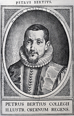
Petrus Bertius (Bert) was a Flemish theologian, historian, geographer and cartographer grown up in Beveren (Flanders). In 1593 he became a librarian and professor of mathematics at the University of Leyden. His main cartographic works are a miniature world atlas of 1600, a pocket atlas dedicated to the architecture, the maps and the views of towns of the German Empire of 1616 (26 engraved maps and 101 town views) and a version of Ptolemy's Geographia containing 28 maps engraved by Mercator for his 1578 edition and 14 maps of Ortelius' Parergon.
1600: Tabularum Geographicarum Contractarum
1616: Commentariorum Rerum Germanicarum libri tres waarin o.a. opgenomen de Tabula Peutingeriana
1618: Theatri Geographiae Veteris

Hispania
W. Blaeu, Amsterdam, 1635
Antique map of Spain and Portugal by Petrus Bertius. Shows the Iberian Peninsula. This map first appeared in the small-format Altas by Bertius, printed in 1616 by Hondius. This example was printed...
Hispania
1635 - Petrus Bertius
12622Antique map of Spain - Portugal. Printed in Amsterdam by W. Blaeu in 1635.
195,00 €
Portugallia
W. Blaeu, Amsterdam, 1635
Antique map of Portugal by Petrus Bertius. This map first appeared in the small-format Altas by Bertius, printed in 1616 by Hondius. This example was printed from the same copper plate by Willem...
Portugallia
1635 - Petrus Bertius
12623Antique map of Spain - Portugal. Printed in Amsterdam by W. Blaeu in 1635.
135,00 €
Majorcae et Minorcae descrip
W. Blaeu, Amsterdam, 1635
Antique map of the Balearic Islands by Petrus Bertius. Shows the Balearic Islands (Islas Baleares) of Mallorca and Menorca. Decorated with two sea monsters and a sailing ship. This map first...
Majorcae et Minorcae descrip
1635 - Petrus Bertius
12624Antique map of Menorca, Mallorca, Balearic Islands. Printed in Amsterdam by W. Blaeu in 1635.
395,00 €
Legio
W. Blaeu, Amsterdam, 1635
Antique map of the province of León by Petrus Bertius. Shows the Atlantic coast from Ribadeo in the west to Santander in the east. In the south to Vallodolid and Zamora, León in the centre. This...
Legio
1635 - Petrus Bertius
12625Antique map of Leon. Printed in Amsterdam by W. Blaeu in 1635.
130,00 €
Valentia
W. Blaeu, Amsterdam, 1635
Antique map of Valencia by Petrus Bertius. Shows the Spanish Mediterranean coast from Torrevieja to Tarragona. With Alicante, Xàbia, Dénia, Gandia, Castellón de la Plana and L'Ampolla. In the...
Valentia
1635 - Petrus Bertius
12626Antique map of Valencia. Printed in Amsterdam by W. Blaeu in 1635.
160,00 €
Galecia
W. Blaeu, Amsterdam, 1635
Antique map of Galicia in north-western Spain by Petrus Bertius. Shows the Atlantic coast from Baiona to Navia. With Santiago de Compostela, A Coruña, Ferrol and Vigo. This map first appeared in...
Galecia
1635 - Petrus Bertius
12628Antique map of Galicia. Printed in Amsterdam by W. Blaeu in 1635.
160,00 €
Guipuscoa et Biscaia
W. Blaeu, Amsterdam, 1635
Antique map of the Basque Country in north-western Spain by Petrus Bertius. Shows the provinces of Biscay and Gipuzkoa on the Atlantic coast from Llanes to Donostia-San Sebastián, with Bilbao in...
Guipuscoa et Biscaia
1635 - Petrus Bertius
12629Antique map of Gipuzkoa, Biscay, Basque Country. Printed in Amsterdam by W. Blaeu in 1635.
135,00 €
Estremadura
W. Blaeu, Amsterdam, 1635
Antique map of Extremadura by Petrus Bertius. Shows the provinces of Cáceres and Badajoz in western Spain. From Badajoz to Caceres, Mérida in the centre. This map first appeared in the small-format...
Estremadura
1635 - Petrus Bertius
12631Antique map of Extremadura. Printed in Amsterdam by W. Blaeu in 1635.
100,00 €
Granada et Murcia
W. Blaeu, Amsterdam, 1635
Antique map of Granada and Murcia by Petrus Bertius. Shows the southern Spanish Mediterranean coast from Gibraltar to Cartagena. With Granada, Murcia, Malaga and Almeria. Decorated with two sailing...
Granada et Murcia
1635 - Petrus Bertius
12632Antique map of Malaga, Murcia, Granada. Printed in Amsterdam by W. Blaeu in 1635.
185,00 €
Castilia Vetus et Nova
W. Blaeu, Amsterdam, 1635
Antique map of Portugal and Spain by Petrus Bertius. Shows the central part of the Iberian Peninsula from the Atlantic coast between Lisbon (Lisboa) and Porto to Andalusia and Aragon with the Ebro...
Castilia Vetus et Nova
1635 - Petrus Bertius
12633Antique map of Castilla. Printed in Amsterdam by W. Blaeu in 1635.
150,00 €
Navarra
W. Blaeu, Amsterdam, 1635
Antique map of Navarre in north-western Spain by Petrus Bertius. Shows the province of Navarre and the Basque Country with the Atlantic coast from Bilbao to Donostia-San Sebastián. This map first...
Navarra
1635 - Petrus Bertius
12634Antique map of Navarre. Printed in Amsterdam by W. Blaeu in 1635.
135,00 €
Andaluzia
W. Blaeu, Amsterdam, 1635
Antique map of Andalusia (Andalucía) by Petrus Bertius. Shows the province of Andalusia with the Atlantic coast from Ayamonte to Cadiz. With Seville and Cordoba. Decorated with a sailing ship. This...
Andaluzia
1635 - Petrus Bertius
12635Antique map of Andalusia - Andalucia. Printed in Amsterdam by W. Blaeu in 1635.
180,00 €
Zurich
J. Janssonius, Amsterdam, 1616
Early cooper engraved view of Zurich in Switzerland from P. Bertius' "Commentariorum Rerum Germanicarum" printed 1616 in Amsterdam. Latin text on verso.
Zurich
1616 - Petrus Bertius
10947Antique town view of Zurich. Printed in Amsterdam by J. Janssonius in 1616.
Sold
Catalonia et Aragonia
W. Blaeu, Amsterdam, 1635
Antique map of Catalonia and Aragon by Petrus Bertius. Shows the Spanish Mediterranean coast from the Spanish-French border to the mouth of the Ebro River. With Girona, Barcelona, Tarragona and...
Catalonia et Aragonia
1635 - Petrus Bertius
12621Antique map of Catalonia and Aragon. Printed in Amsterdam by W. Blaeu in 1635.
Sold![Bertius, Spain - Portugal, Bay of Cadiz, 1635: [Baia de Cadis]]( "Petrus Bertius: [Baia de Cadis]")
[Baia de Cadis]
W. Blaeu, Amsterdam, 1635
Antique map of the Bay of Cádiz by Petrus Bertius. Shows the area around Cádiz with Isla del Trocadero at the Atlantic coast of Portugal. With Puerto Real, San Fernando, Rota and El Puerto de Santa...
[Baia de Cadis]
1635 - Petrus Bertius
12627Antique map of Bay of Cadiz. Printed in Amsterdam by W. Blaeu in 1635.
Sold


![Bertius, Spain - Portugal, Bay of Cadiz, 1635: [Baia de Cadis]](https://www.vintage-maps.com/3753-home_default/bertius-spain-portugal-bay-of-cadiz-1635.jpg "Petrus Bertius: [Baia de Cadis]")