Product successfully added to your shopping cart
There are 0 items in your cart. There is 1 item in your cart.
Antique Maps by George Matthäus Seutter (*1678 - †1757)
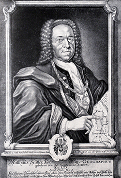
George Matthaus Seutter, a German publisher, cartographer and engraver from Augsburg, was born 1678 as the son of a goldsmith. After an apprenticeship at J. B. Homann in Nuremberg, he returned to his native city of Augsburg and worked in the publishing firm of Jeremiah Wolf. In 1707 he founded his own successful publishing company and produced maps, atlases and globes. Seutter died in 1757. The company went over to his son Albrecht Carl and his stepsons G. B. Probst and T. C. Lotter in after his death in 1757. The latter being regarded as his true successor. According to C. Sandler, following atlases have been published by Seutter:
- Atlas Geographicus oder Accurate Vorstellung der Ganzen Welt, 1725
- Atlas Compendiosus oder die ganze Welt in den nothwendigsten Geographischen Charten
- Atlas Compendiosus Scholasticus
- Atlas Novus Indicubus Instructus, 1728
- Grosser Atlas, 1734
- Atlas Minor, 1744
Beside the atlases, Seutter produced a pair of 20 cm table globes during his early days.

Germaniae Inferioris sive Belgii Pars Meridionalis Exhibens X Provincias Catholic ...
M. Seutter, Augsburg, circa 1720
Old coloured copper engraved map of Belgium by Matthaeus Seutter. Shows the coastline of the North Sea along the Channel from Dieppe in France to Rotterdam, with Brussels in the centre. With a...
Germaniae Inferioris sive Belgii Pars Meridionalis Exhibens X Provincias...
1720 - George Matthäus Seutter
11757Old coloured map of Belgium. Printed in Augsburg by M. Seutter circa 1720.
250,00 €
Nova Mappa Geographica Maris Assoviensis vel de Zabache, et Paludis Maeotidis ...
Augsburg, circa 1730
Old coloured engraved map of the Sea of Azov. Showing parts of the Crimean Peninsula with Feodosiya (Kaffa) and Kerch (Kirtz) in the lower left and parts of Southwest Russia with the city of Azov...
Nova Mappa Geographica Maris Assoviensis vel de Zabache, et Paludis...
1730 - George Matthäus Seutter
11202Old coloured map of the Sea of Azov. Printed in Augsburg circa 1730.
350,00 €
Mappae Imperii Moscovitici Pars Septentrionalis
Augsburg, circa 1730
Beautiful, old-colored engraved map of the western part of Russia by Matthaeus Seutter. Shows the area of Murmansk in the northwest, the White Sea, Lake Onega, Lake Ladoga with St. Petersburg, up...
Mappae Imperii Moscovitici Pars Septentrionalis
1730 - George Matthäus Seutter
11707Old coloured map of Moskwa, Moscow. Printed in Augsburg circa 1730.
550,00 €
Accurata Delineatio Brisgoviae cum Civitatibus Silvestribus Austriae Anterioris, tanquam Limitum...
G. M. Seutter, Augsburg, circa 1730
Old colored antique map of the Breisgau by G. M. Seutter. Shows the Breisgau and Black Forest with the High Rhine from Schaffhausen to Basel and the Upper Rhine to Rhinau. Very detailed, with the...
Accurata Delineatio Brisgoviae cum Civitatibus Silvestribus Austriae...
1730 - George Matthäus Seutter
11797Old coloured map of the Black Forest, Baden-Württemberg. Printed in Augsburg by G. M. Seutter circa 1730.
290,00 €
Nova Designatio Insulae Jamaicae ex Antillanis Americae Septentrion
Augsburg, circa 1730
Beautiful map of the Caribbean Island of Jamaica by M. Seutter. With an extremely decorative cartouche. Top right a description of the island in Latin.
Nova Designatio Insulae Jamaicae ex Antillanis Americae Septentrion
1730 - George Matthäus Seutter
12039Old coloured map of Jamaica. Printed in Augsburg circa 1730.
490,00 €
Marchionatus Lusatiae Inferioris Bohemiae olim Regno ...
M. Seutter, Augsburg, circa 1730
Antique map of Lower Lusatia by Georg Matthäus Seutter. Showing the south of Brandenburg with Spremberg, Senftenberg, Cottbus, Luckau, and Lübben in the Spreewald. Decorated with two beautiful...
Marchionatus Lusatiae Inferioris Bohemiae olim Regno ...
1730 - George Matthäus Seutter
12161Old coloured map of Lower Lusatia, Brandenburg. Printed in Augsburg by M. Seutter circa 1730.
250,00 €
Marchionatus Lusatiae Superioris Felicissimo Poloniae Regis ...
M. Seutter, Augsburg, circa 1730
Antique map of Upper Lusatia by Georg Matthäus Seutter. Showing the east of Saxony with Hoyerswerda, Bautzen, Zittau and Görlitz. Decorated with a beautiful title cartouches.
Marchionatus Lusatiae Superioris Felicissimo Poloniae Regis ...
1730 - George Matthäus Seutter
12162Old coloured map of Upper Lusatia, Saxony. Printed in Augsburg by M. Seutter circa 1730.
290,00 €
Regensburg eine mitten in Bayren an der Donau gelegene / Ratisbona in media Bavaria
M. Seutter, Augsburg, circa 1730
Large, old coloured plan of the city of Regensburg by Matthäus Seutter. With fortification and important buildings. To the left the coat of arms of Regensburg. To the lower third a panoramic view...
Regensburg eine mitten in Bayren an der Donau gelegene / Ratisbona in...
1730 - George Matthäus Seutter
12565Old coloured city plan of Regensburg, Bavaria. Printed in Augsburg by M. Seutter circa 1730.
750,00 €
Cölln am Rhein eine uhralte, sehr grosse, Hochberühmte freye Reichs- und florisante Handel-Statt...
M. Seutter, Augsburg, circa 1730
Large, old coloured plan of the city of Cologne / Köln by Matthäus Seutter. With fortification and important buildings. With the coat of arms of Köln. To the lower third a panoramic view of the...
Cölln am Rhein eine uhralte, sehr grosse, Hochberühmte freye Reichs- und...
1730 - George Matthäus Seutter
12566Old coloured city plan of Köln, Cologne, Nordrhein-Westfalen. Printed in Augsburg by M. Seutter circa 1730.
1 500,00 €
Novissima et Accuratissima Magni Ducatus Lithuaniae
G. M. Seutter, Augsburg, circa 1730
Rare first edition of the map of the Duchy of Lithuania by Georg Matthäus Seutter. Shows the Baltic States with Latvia, Lithuania, Belarus, the northeast of Poland, in the south the northern part...
Novissima et Accuratissima Magni Ducatus Lithuaniae
1730 - George Matthäus Seutter
12569Old coloured map of Latvia, Lithuania. Printed in Augsburg by G. M. Seutter circa 1730.
1 400,00 €
Ichnographia munitissimae Arcis Otzakoff, quae Ao. 1737, die 3. Iulij auspicijs Supremi Campi...
Augsburg, circa 1730
Rare antique map of the fortress Ochakiv (Otschakow, Otschakiw) in the south of Ukraine at the Black Sea northeast of Odessa by M. Seutter. The Baron Münchhausen, known as the Liar Baron, is said...
Ichnographia munitissimae Arcis Otzakoff, quae Ao. 1737, die 3. Iulij...
1730 - George Matthäus Seutter
12755Old coloured map of Ochakov, Ochakiv, Odessa, Baron Munchausen. Printed in Augsburg circa 1730.
980,00 €
Bavariae Pars Superior, designatis Confinibus etiam Provinciis
G. M. Seutter, Augsburg, circa 1730
Antique map of Upper Bavaria by G. M. Seutter. Shows the area from Donauwörth to Hof and Füssen to Bad Reichenhall. With Augsburg, Freising, Ingolstadt, Munich and Traunstein. At upper right an...
Bavariae Pars Superior, designatis Confinibus etiam Provinciis
1730 - George Matthäus Seutter
12972Old coloured map of Oberbayern. Printed in Augsburg by G. M. Seutter circa 1730.
400,00 €
Hamburg eine Weltberühmte Freye Reichs und Hansee, auch reiche u. Volkreiche Handels Statt an der...
M. Seutter, Augsburg, circa 1730
Beautiful, large plan of the city of Hamburg by Matthäus Seutter in excellent condition. Town plan with fortifications and buildings. In the lower third the ornamentally decorated prospect of the...
Hamburg eine Weltberühmte Freye Reichs und Hansee, auch reiche u....
1730 - George Matthäus Seutter
12974Old coloured city plan of Hamburg, Germany. Printed in Augsburg by M. Seutter circa 1730.
1 600,00 €
Manheimium Munitißimum Oppidum. Residentia Electoris Palatini... Matthaeum Seutter
M. Seutter, Augsburg, circa 1730
Beautiful, large plan of the city of Mannheim by Matthäus Seutter in excellent condition. City plan with fortifications surrounded by the Rhine and Neckar. On the opposite bank of the Rhine, the...
Manheimium Munitißimum Oppidum. Residentia Electoris Palatini......
1730 - George Matthäus Seutter
12975Old coloured city plan of Mannheim. Printed in Augsburg by M. Seutter circa 1730.
950,00 €
Accurater Prospect der... Stadt Carls Ruhe - Representation exacte de Charles Ruh...
M. Seutter, Augsburg, circa 1730
Magnificent, large bird's-eye view of Karlsruhe by Matthäus Seutter in excellent condition. With a German-French title bar at the top and ornamental cartouches in the corners, a large coat of arms...
Accurater Prospect der... Stadt Carls Ruhe - Representation exacte de...
1730 - George Matthäus Seutter
12977Old coloured city plan of Karlsruhe. Printed in Augsburg by M. Seutter circa 1730.
1 500,00 €
Wratislavia Antiquissima et Celeberrima Ducat. Silesiaci Metropolis ... / Breslau due Uhralte u...
M. Seutter, Augsburg, circa 1735
Large, old coloured engraved city map of Wroclaw (Breslau) by Matthaus Seutter. The overall perspective plan with determination of individual buildings as well as detailed explanations. In the...
Wratislavia Antiquissima et Celeberrima Ducat. Silesiaci Metropolis ......
1735 - George Matthäus Seutter
12736Old coloured map of Wroclaw, Breslau, Silesia. Printed in Augsburg by M. Seutter circa 1735.
780,00 €
Synopsis Plagae Septentrionalis Sueciae Daniae et Norwegiae Regn.
G. M. Seutter, Augsburg, circa 1744
Old coloured antique map of Scandinavia by Matthaeus Seutter. With Norway, Sweden, Finland and Denmark. Top left a magnificent title cartouche.
Synopsis Plagae Septentrionalis Sueciae Daniae et Norwegiae Regn.
1744 - George Matthäus Seutter
12086Old coloured map of Scandinavia. Printed in Augsburg by G. M. Seutter circa 1744.
480,00 €
Belgradum sive Alba Graece, Serviae Metropolis ubi Savus fluvius Danubio misc... / Belgrad od....
T. Lotter, Augsburg, circa 1760
Large, old coloured plan of Belgrade by Matthaus Seutter. In the lower third a prospect of the city. Title cartouche in the upper left corner, to the left a key with explanation of the letters in...
Belgradum sive Alba Graece, Serviae Metropolis ubi Savus fluvius Danubio...
1760 - George Matthäus Seutter
11486Old coloured city plan of Beograd, Belgrade, Serbia. Printed in Augsburg by T. Lotter circa 1760.
1 100,00 €
Globus Terrestris juxta recentissimas ob.servatio. et navigationes peritissimor Geograph....
Seutter, Georg Matthäus, Augsburg, circa 1710
A rare Pair of South German Baroque Table GlobesA matching pair of fine and rare 20 cm diameter table globes by Matthaeus Seutter, made in Augsburg around 1710. These Seutter globes are...
Globus Terrestris juxta recentissimas ob.servatio. et navigationes...
1710 - George Matthäus Seutter
11167A pair of old coloured table globes by G. M. Seutter. Fabricated in Augsburg during the year 1710.
Sold
Kalendarium Juliano-Romanum Perpetuum
circa 1720
Hand coloured copper engraving of Matthaeus Seutter. Showing large round calendar.
Kalendarium Juliano-Romanum Perpetuum
1720 - George Matthäus Seutter
10004Old coloured engraving of a calendar. Published in 1720.
Sold
Bohemia Regnum juxta XII. Circulos divisum, cum Comitatu Glacensi et ditione Egrana, nec non...
M. Seutter, Augsburg, circa 1720
Large original old coloured map of Bohemia by M. Seutter. With two decorative cartouches and a city view of Carlsbad. Centred around Prague (Praha).
Bohemia Regnum juxta XII. Circulos divisum, cum Comitatu Glacensi et...
1720 - George Matthäus Seutter
10409Coloured map of Carlsbad. Printed in Augsburg by M. Seutter circa 1720.
Sold
Lacus Bodamicus vel Acronius cum regionibus circumjacentibus recens delineatus a Matthaeo...
M. Seutter, Augsburg, circa 1720
Old colored engraved map of the Lake Constance by Matthew Seutter. Probably the most detailed map of the Lake Constance region in the 18th Century. The now rare map shows the administrative...
Lacus Bodamicus vel Acronius cum regionibus circumjacentibus recens...
1720 - George Matthäus Seutter
11142Old coloured map of the Bodensee, Lake of Constance, Baden-Württemberg. Printed in Augsburg by M. Seutter circa 1720.
Sold
Carte de la prevoste et vicomté de Paris, dressée sur un grand nombre de mémoires particuliers...
Augsburg, circa 1720
Old coloured map of the region around Paris, Île-de-Franc by Matthaeus Seutter. Very detailed and accurate engraving, showing hundreds of place names, villages and rivers. With an aesthetic title...
Carte de la prevoste et vicomté de Paris, dressée sur un grand nombre de...
1720 - George Matthäus Seutter
11704Old coloured map of Paris, Ile-de-France. Printed in Augsburg circa 1720.
Sold
Imperium Romano-Germanicum in suos Circulos, Electorat et Status Summa cura et Studio divisum...
M. Seutter, Augsburg, circa 1730
Nice old coloured map of Central Europe by M. seutter. Showing the Low Countries in the West, via Germany centred to Poland in the East. Switzerland and Northern Italy at the bottom. With two large...
Imperium Romano-Germanicum in suos Circulos, Electorat et Status Summa...
1730 - George Matthäus Seutter
10420Old coloured map of Central Europe. Printed in Augsburg by M. Seutter circa 1730.
Sold


