Product successfully added to your shopping cart
There are 0 items in your cart. There is 1 item in your cart.
Antique Maps by Olivier van Noort (*1558 - †1627)
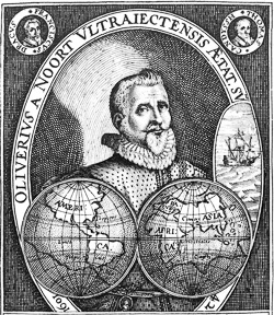
Olivier van Noort was a Dutch pirate and captain who was the first Dutchman to sail around the world.
Born in Utrecht in 1558, Olivier van Noort set sail from Rotterdam on July 2, 1598 with four ships to attack Spanish possessions in the Pacific and trade with China and the Spice Islands during the Eighty Years' War between the Netherlands and Spain. However, his ships were inadequately equipped, especially in terms of armament, and his crews proved unruly. He successfully crossed the treacherous Strait of Magellan and captured several Spanish ships on the Pacific coast of South America. During the passage through the strait, his crew killed around forty indigenous Selknam, making it one of the bloodiest events in the region up to that point.
Despite the challenges, which included the loss of two ships, Van Noort carried on. In November and December 1600, he docked with his two remaining ships near the island of Corregidor in the Bay of Manila in the Philippines. There he undertook activities that were considered piracy by the Spanish. This led to the naval battle of Fortune Island on December 14, 1600, in which the Spanish lost their flagship, the galleon San Diego, and captured the Dutch Eendracht. This forced Van Noort to retreat from the Philippines. Van Noort completed his circumnavigation and returned to Rotterdam on August 26, 1601 with his last ship, the Mauritius, and only 45 of the original 248 crew members via the Dutch East Indies and the Cape of Good Hope. Although the venture was hardly financially profitable, it served as an inspiration for subsequent expeditions. The founding of the united Dutch East India Company followed just a few months later.

La Baye la Baye
Isaac Commelin, Amsterdam, 1602 [1646]
The earliest Western individual depiction of the Gulf of Albay.Very rare map of the Gulf of Albay in the southern Luzon province of the Philippines by Olivier Van Noort. First published in...
La Baye la Baye
1602 - Olivier van Noort
12915Coloured map of the Gulf of Albay, Luzon, Samar, Philippines. Printed in Amsterdam by Isaac Commelin in 1646.
980,00 €
