Antique Maps by Tobias Conrad Lotter (*1717 - †1777)
Planisphaerium Coeleste
circa 1750
A very decorative double hemisphere celestial chart. The smaller circular diagram showing the rotation of the Planets, according to Tycho Brahe, Ptolemy and Copernicus. Further decorated with...
Planisphaerium Coeleste
1750 - Tobias Conrad Lotter
10043Old coloured celestial map. Printed circa 1750.
SoldGermaniae Aliorumque Quorundam Loco-rum Europae Poliometria
circa 1750
Distance table from L.C. Lotter, with nice cartouche and explanation of usage.
Germaniae Aliorumque Quorundam Loco-rum Europae Poliometria
1750 - Tobias Conrad Lotter
10066Old coloured distance chart. Printed circa 1750.
SoldBorussiae Regnum complectens Circulos Sambiensem, Natangiensem et Hockerlandiae nec non Borussia...
T.C. Lotter, Augsburg, 1759
Decorative copper engraved map of Poland by T. C. Lotter. Covering the area around Dantzig (Gdansk), Elbing (Elblag) and Königsberg (Krolewiec). The map has a highly decorative figurative and...
Borussiae Regnum complectens Circulos Sambiensem, Natangiensem et...
1759 - Tobias Conrad Lotter
10458Old coloured map of East Prussia. Printed in Augsburg by T.C. Lotter in 1759.
SoldRegiae Celsitudinis Sabaudicae Status in quo Ducatus Sabaudiae Principat. Pedemontium ut et...
Augsburg, circa 1760
Old coloured map of the Piedmont and Savoy regions by Tobias Lotter. Covering the area between Geneva in the north, Milan and Genoa in the east and Nice in the south. With a beautiful large...
Regiae Celsitudinis Sabaudicae Status in quo Ducatus Sabaudiae...
1760 - Tobias Conrad Lotter
11514Old coloured map of Rhone-Alpes, Savoy, Piemonte. Printed in Augsburg circa 1760.
SoldCarte des Isles de Maiorque Minorque et d' Yvice
T. C. Lotter, Augsburg, circa 1760
Old coloured map of the Balearic Islands with Mallorca, Menorca and Ibiza by Tobias Lotter. To the right a small inset map of the western Mediterranean Sea, below a detailed plan of the port of...
Carte des Isles de Maiorque Minorque et d' Yvice
1760 - Tobias Conrad Lotter
12090Old coloured map of Ibiza, Menorca, Mallorca, Baleares. Printed in Augsburg by T. C. Lotter circa 1760.
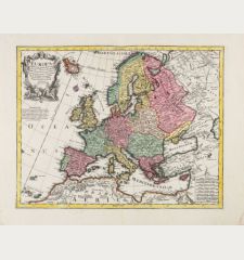
SoldEuropa Delineata juxta Observationes Excellorum Virorum Academia Regalis Scientiarum ... Per G....
T. C. Lotter, Augsburg, circa 1760
Old coloured map of Europe by Guillaume de L'Isle published by Tobias Lotter in Augsburg. A beautiful title cartouche at upper left, a mileage scale at lower right.
Europa Delineata juxta Observationes Excellorum Virorum Academia Regalis...
1760 - Tobias Conrad Lotter
12752Old coloured map of the European continent. Printed in Augsburg by T. C. Lotter circa 1760.
SoldAtlas Geographicus portatilis XXIX mappis orbis habitabilis regna exhibens ... Kurzgefasste...
Augsburg, circa 1762
Pocket atlas of T. Lotter and T. Lobeck. Bound with "Kurzgefasste Geographie" of Lobeck. With 1 World map, 1 Celestial map, 37 european maps including 14 maps of Germany not mentioned in index.
Atlas Geographicus portatilis XXIX mappis orbis habitabilis regna...
1762 - Tobias Conrad Lotter
10296Old coloured pocket atlas by Tobias Lotter. With 43 engraved maps. Published in Augsburg in 1762.
SoldAmerica Meridionalis Concinnata juxta Observationes Dnn Acad
circa 1770
Coloured copper engraving showing South America. After a map of De l'Isle.
America Meridionalis Concinnata juxta Observationes Dnn Acad
1770 - Tobias Conrad Lotter
10005Old coloured map of South America. Printed circa 1770.
SoldGlobus Terrestris ad Sphaeram Obliquam Delineatus / Globus Coelestis cum Astrodictico Artificiali...
1774
Hand colored engraving showing terrestrial and celestial globes.
Globus Terrestris ad Sphaeram Obliquam Delineatus / Globus Coelestis cum...
1774 - Tobias Conrad Lotter
10040Old coloured engraving of a pair of globes. Published in 1774.
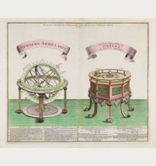
SoldSphaera Armillaris / Instrumentum artificiale Orrery ab inventore appellatum
T. C. Lotter, Augsburg, 1774
Rare and very decorative engraving with two astronomical devices: On the left an armillary sphere to show the movement of the heavenly bodies, on the right a planetarium, as it was constructed in...
Sphaera Armillaris / Instrumentum artificiale Orrery ab inventore...
1774 - Tobias Conrad Lotter
12741Armillary Sphere and Planetarium. Printed in Augsburg by T. C. Lotter in 1774.
Sold


