Product successfully added to your shopping cart
There are 0 items in your cart. There is 1 item in your cart.
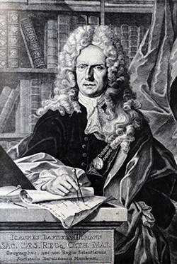
Antique Maps by Johann Baptist Homann (*1664 - †1724)

Tabula Geographica Campaniae
J.B. Homann, Nuremberg, circa 1730
Original old coloured engraved map of the Champagne in France by J. B. Homann. Covering the region Champagne-Ardenne with Reims, Troyes and Épernay. With one decorative figurative and allegoric...
Tabula Geographica Campaniae
1730 - Johann Baptist Homann
10500Old coloured map of the Champagne-Ardenne. Printed in Nuremberg by J.B. Homann circa 1730.
Sold
Geographica Nova.. Mare Caspium altera Kamtzadaliam seu Terram Jedso curiose exhibet... / Das...
J.B. Homann, Nuremberg, circa 1730
Two maps on one sheet in beautiful original old colours. On the right a fascinating mapping of Kamchatka with the Kurils and Hokkaido in the north of Japan. Based a Russian expeditions sent by...
Geographica Nova.. Mare Caspium altera Kamtzadaliam seu Terram Jedso...
1730 - Johann Baptist Homann
11483Old coloured map of the Caspian Sea. Printed in Nuremberg by J.B. Homann circa 1730.
Sold
Principatus Transilvaniae In Suas Quasque Nationes earumque Sedes Et Regiones cum sinitimis...
J.B. Homann, Nuremberg, circa 1730
Old coloured map of Transylvania in Romania around the south Carpathian Mountains by Johann Baptist Homann. Decorated with a beautiful cartouches.
Principatus Transilvaniae In Suas Quasque Nationes earumque Sedes Et...
1730 - Johann Baptist Homann
11489Old coloured map of Transylvania. Printed in Nuremberg by J.B. Homann circa 1730.
Sold
Atlas Novus Terrarum Orbis Imperia, Regna et Status exactis Tabulis Geographice demonstrans /...
Homann Erben, Nuremberg, 1731
Monumental Atlas of the World with 100 Maps by Johann Baptist Homann. All Maps Coloured by an 18th-Century Hand.The magnificent Atlas Novus or Grosser Atlas was first published in 1716 by...
Atlas Novus Terrarum Orbis Imperia, Regna et Status exactis Tabulis...
1731 - Johann Baptist Homann
12698Germany's most famous 18th-century world atlas. Published 1731 by Homann in Nuremberg.
Sold
Potentissimae Helvetiorum Reipublicae Cantones Tredecim cum Foederatis et Subjectis Provinciis
Homann, Nuremberg, 1732
Beautiful detailed map of Switzerland, showing the 13 cantons. The large title cartouche showing 13 coat of arms of the cantons and 20 coat of arms of the large cities. Second cartouche with scene...
Potentissimae Helvetiorum Reipublicae Cantones Tredecim cum Foederatis...
1732 - Johann Baptist Homann
10158Old coloured map of Switzerland, Swiss. Printed in Nuremberg by Homann in 1732.
Sold
Accurata Utopiae tabula. Das ist der Neu-entdeckten Schalck-Welt, oder des so offt benannten, und...
Homann Erben, circa 1740
The Famous Sought After Fantasy Map of Utopia.Schlaraffenland means Land of Cockaigne or Land of milk and honey in German and represents a country of idleness and luxury. This is a...
Accurata Utopiae tabula. Das ist der Neu-entdeckten Schalck-Welt, oder...
1740 - Johann Baptist Homann
12979Old coloured map of Utopia, Land of Cockaigne. Printed by Homann Erben circa 1740.
Sold
Theoria Planetarum Primariorum
Nuremberg, circa 1746
Hand coloured copper engraving from J.G. Doppelmaier by J.B. Homann, showing orbit of the planets.
Theoria Planetarum Primariorum
1746 - Johann Baptist Homann
10001Doppelmaier's map of the orbit of the planets. Published in Nuremberg by J. B. Homann in 1746.
Sold


