Product successfully added to your shopping cart
There are 0 items in your cart. There is 1 item in your cart.

Accurata Utopiae tabula. Das ist der Neu-entdeckten Schalck-Welt, oder des so offt...
Johann Baptist Homann (*1664 - †1724)Reference 12979
Description
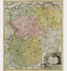
The Famous Sought After Fantasy Map of Utopia.
Schlaraffenland means Land of Cockaigne or Land of milk and honey in German and represents a country of idleness and luxury. This is a totally imaginary map, but constructed in conventional forms. "An extraordinary, fantastic map". (R.V. Tooley)
The map is divided into 19 provinces, each representing a vice or sin. The anonymous author criticizes the eating, drinking, loving and living habits of his time. The actual land of milk and honey is surrounded by the following provinces:
- Senectas regio (doter land)
- Iuventae Regnum (youth land)
- Stultorum regnum (fool land)
- Bibonia Regnum (carouser land)
- Magni Stomachi Imperium (land of large stomach)
- Pigritarium regio (sluggard land)
- Terra Sancta Incognita (wishful thinking land)
- Mammonia (niggard land)
- Schlaraffenland
- Tartaria regnum (empire of hell)
- Res Publica Veneria (land of bawdiness)
- Lusoria (land of gambling)
- Iuronia regnum (curse land)
- Lurconia Regnum (gourmandise land)
- Prodigalia regnum (waste land)
- Insulae Negromanticae
- Insel Tobaco
The map goes back to the 1694 work Das neu entdeckte Schlarraffenland. Johann Andreas Schnebelins Erklärung der Wunder-seltzamen Land-Charten Utopiae and according to Koeman was first published by P. Schenk from 1700/10 in the Atlas Contractus. The first Homann edition published around 1716, is different from Schenk's print only by 3 underlines in the title. The later editions by Homann and Homann Heirs have the slightly different title "durch Autor anonymus Prostat in Officina Homanniana", the following editions by Seutter have a completely different cartouche.
Details
| Cartographer | Johann Baptist Homann |
| Title | Accurata Utopiae tabula. Das ist der Neu-entdeckten Schalck-Welt, oder des so offt benannten, und doch nie erkannten Schlaraffenlandes neu erfundene lächerliche Land-tabelle... durch Author anonymus |
| Publisher, Year | Homann Erben, circa 1740 |
| Plate Size | 48.9 x 57.0 cm (19.3 x 22.4 inches) |
| Sheet Size | 53.1 x 62.5 cm (20.9 x 24.6 inches) |
| Reference | Hill, G.: Cartographic Curiosities, pp. 57-58; Tooley, R.V.: Geographical Oddities, No. 87. |
Condition
Cartographer
Images to Download
If you like to download the image of this map with a resolution of 1200 pixels, please follow the link below.
You can use this image for publication on your personal or commercial websites for free if you set a link to this website. If you need photographs with a higher resolution, please contact us.
Curiosities - Homann, Johann Baptist - Accurata Utopiae tabula. Das ist der...

