Product successfully added to your shopping cart
There are 0 items in your cart. There is 1 item in your cart.
Atlas Novus Terrarum Orbis Imperia, Regna et Status exactis Tabulis Geographice...
Johann Baptist Homann (*1664 - †1724)Reference 12698
Description
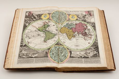
Monumental Atlas of the World with 100 Maps by Johann Baptist Homann. All Maps Coloured by an 18th-Century Hand.
The magnificent Atlas Novus or Grosser Atlas was first published in 1716 by Johann Baptist Homann, the founder of the famous Nuremberg map publishing house. It quickly became the standard gentleman's library atlas around Europe, especially in German-speaking countries. After Johann's death in 1724, his son Johann Christoph continued the business until his death in 1730. Afterwards, the company became Homann Heirs, a combination of family members and other geographers.
The present example is the first new edition of this famous atlas and was published by Homann Heirs in 1731. Now with the Latinised title Novus Atlas and 100 large-format maps, each with contemporary hand colouring. 96 maps still bear the name of Johann Baptist Homann and have been adopted unchanged, three show the name of his son Johann Christoph and one map is already inscribed Homann Heirs.
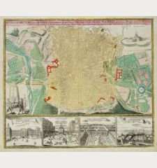
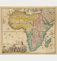
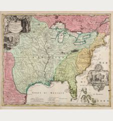
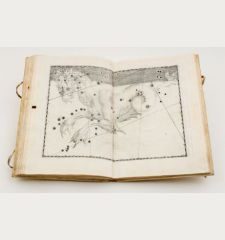
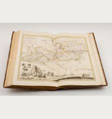
The monumental atlas contains the following maps: Earth and celestial globe and armillary sphere on one sheet, Copernicus' solar system, Tycho Brahes' solar system, the well-known world and cellestial map each in 2 hemispheres, 4 continent maps (Europe, Asia, Africa, America), Spain & Portugal (3), France (8), Great Britain (2), Scotland, Ireland, Benelux (3), Switzerland, Italy (7), Malta, Holy Roman Empire, rivers of central Europe, Bohemia and Moravia (2), Silesia, Germany (22), Austria (4), plan and view of Vienna, Poland (3), Scandinavia (8), Ukraine, Russia (2), Lithuania, Caspian Sea (2), Danube River (3), Hungary, Greece (2), Ottoman Empire, Holy Land, Egypt, Morocco, Persian Empire, North America with Mexico and the Caribbean (Regni Mexicani), Mississippi River (Amplissimae Regionis Mississipi), Carolinas Virginia and Maryland (Virginia Marylandia et Carolina), world clock with a small polar map (Geographische Universal- Zeig und Schlag-Uhr) and a distance table of Germany. The maps in typical publisher's colouring mostly with large uncoloured cartouches with figural depictions, coats of arms, portraits, partly with town plans and insets.
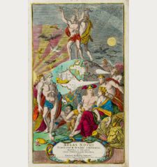
Preceded by a beautiful engraved title by Caspar Luycken, lettre press title page with an engraved title vignette (northern hemisphere in polar projection with California as an island). Followed by the magnificent portrait of Charles VI in mezzotint, 2 leaves dedication with an engraved vignette, 1 leaf content and a 40-page introduction and descriptions by Johann Gabriel Doppelmayr.
All maps of this atlas are shown in high resolution on our Atlas-Gallery website:
Homann: Atlas Novus Terrarum Orbis Imperia
Details
| Cartographer | Johann Baptist Homann |
| Title | Atlas Novus Terrarum Orbis Imperia, Regna et Status exactis Tabulis Geographice demonstrans / Novus Atlas c. tabularum, cosmo-geographicarum Homannianarum. |
| Publisher, Year | Homann Erben, Nuremberg, 1731 |
| Size | 56.5 x 37.0 cm (22.2 x 14.6 inches), Imperial Folio |
| Collation | 6 leaves, 40 pages, 200 leaves (100 double page maps), 2 flyleaves |
| Illustrations | 1 engraved title, 1 engraved title vignette, 1 Mezzotint, 1 engraved head-piece, 100 double page old coloured copper engraved maps |
| Cover | Full leather binding with blind and gilt stamping |
| Reference | Sandler, C.: Johann Baptista Homann, Die Homännischen Erben, Matthäus Seutter und Ihre Landkarten; Shirley, R. W.: Maps in the Atlases of the British Library, T.HOM-1; Phillips, P.L.: A List of Geographical Atlases in the Library of Congress, #586 |
Condition
Contemporary blind-ruled calf, gilt on spine and covers, lable on spine. Somewhat stained, rubbed, leather cover with minor missing parts in the corners and spine extrems.
Some of the maps slightly stained, 4 maps with worm traces in the centrefold. A complete and very well preserved copy with beautiful old colours.
Cartographer
Images to Download
If you like to download the image of this map with a resolution of 1200 pixels, please follow the link below.
You can use this image for publication on your personal or commercial websites for free if you set a link to this website. If you need photographs with a higher resolution, please contact us.
Atlases - Homann, Johann Baptist - Atlas Novus Terrarum Orbis Imperia, Regna...

![Ch'onha Chido [Atlas of all under Heaven] Ch'onha Chido [Atlas of all under Heaven]](https://www.vintage-maps.com/3336-home_default/anonymous-korean-manuscript-atlas-chonha-chido-1820.jpg)
![Ch'onha Chido [Atlas of all under Heaven] Ch'onha Chido [Atlas of all under Heaven]](https://www.vintage-maps.com/4291-home_default/anonymous-korean-manuscript-atlas-chonha-chido-1800.jpg)
![Ch'onha chido [Atlas of all under Heaven] Ch'onha chido [Atlas of all under Heaven]](https://www.vintage-maps.com/3314-home_default/anonymous-korean-woodblock-atlas-chonha-chido-1750.jpg)
