Product successfully added to your shopping cart
There are 0 items in your cart. There is 1 item in your cart.
Ch'onha chido [Atlas of all under Heaven]
AnonymousReference 12080
Description
A Scarce Korean Woodblock Atlas.
Album with 9 woodblock maps from a traditional Korean woodblock atlas, printed mid 18th century. With a map of China with Korea and 8 maps of the provinces of Korea. The map of China prominently depicts the Great Wall and the Yellow river (Huang He) and Yangtze rivers.
The 9 maps are printed on very thin rice paper and were mounted during the 1970s by an experienced bookbinder into an album in a double concertina format made in traditional Korean craftsmanship. Covered with Korean fabric. The size of a single map is about 32 x 32 cm, the album size is 43,5 x 41 cm.
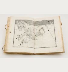
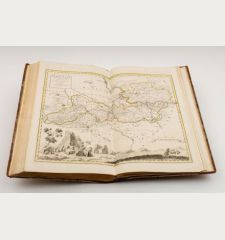
A Ch'onha chido (Atlas of the World) is a traditional Korean atlas made between the mid-18th century and the beginning of the 19th century. Mostly such an atlas contains manuscript maps, more rarely also woodcut maps as seen here. The maps of a Ch'onha chido are based on maps made during the Chinese Ming Dynasty (1368-1644).
All maps of this atlas can be inspected in high resolution on our Atlas-Gallery website: Korean Woodblock Atlas, mid 18th Century
Details
| Cartographer | Anonymous |
| Title | Ch'onha chido [Atlas of all under Heaven] |
| Publisher, Year | circa 1750 |
| Size | 43.5 x 41.0 cm (17.1 x 16.1 inches), Folio |
| Illustrations | 9 woodcut maps |
Condition
Images to Download
If you like to download the image of this map with a resolution of 1200 pixels, please follow the link below.
You can use this image for publication on your personal or commercial websites for free if you set a link to this website. If you need photographs with a higher resolution, please contact us.
Atlases - Anonymous - Ch'onha chido [Atlas of all under Heaven]

![Anonymous: Ch'onha chido [Atlas of all under Heaven] Atlases, Anonymous, Korean Woodblock Atlas, Chonha-Chido, 1750: Ch'onha chido [Atlas of all under Heaven]](https://www.vintage-maps.com/3314-large_default/anonymous-korean-woodblock-atlas-chonha-chido-1750.jpg)
![Ch'onha Chido [Atlas of all under Heaven] Ch'onha Chido [Atlas of all under Heaven]](https://www.vintage-maps.com/3336-home_default/anonymous-korean-manuscript-atlas-chonha-chido-1820.jpg)
![Ch'onha Chido [Atlas of all under Heaven] Ch'onha Chido [Atlas of all under Heaven]](https://www.vintage-maps.com/4291-home_default/anonymous-korean-manuscript-atlas-chonha-chido-1800.jpg)
