Product successfully added to your shopping cart
There are 0 items in your cart. There is 1 item in your cart.
Total products
The item shown below has already been sold. However, we have another example available:
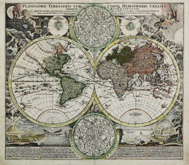
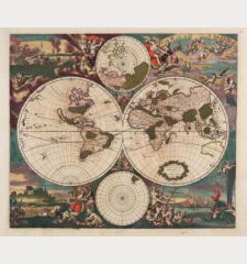
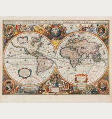
Planiglobii Terrestris cum utroq Hemisphaerio Caelesti Generalis Repraesentatio
Johann Baptist Homann (*1664 - †1724)Old coloured map of the world. Printed in Nuremberg by Homann circa 1710.
Reference 11442
Description
Hand coloured double hemisphere world map by J.B. Homann. With double hemisphere celestial charts. Very decorative and nicely coloured map, showing in background decoration windheads and several natural phenomena such as volcanoes (the Etna), earthquakes, the tides, geysers in Norway and rainbows, all explained in the legend below.
Details
| Cartographer | Johann Baptist Homann |
| Title | Planiglobii Terrestris cum utroq Hemisphaerio Caelesti Generalis Repraesentatio |
| Publisher, Year | Homann, Nuremberg, circa 1710 |
| Plate Size | 48.2 x 55.0 cm (19.0 x 21.7 inches) |
| Sheet Size | 51.2 x 59.0 cm (20.2 x 23.2 inches) |
Condition
Tear in upper right corner backed, a few closed small tears in lower margin, one into image, centrefold backed, closed tear in right hemisphere right of centrefold. Old colour with later additions.
Cartographer
Johann Baptist Homann was born 1664 in Oberkammlach. He founded his business 1702 in Nuremberg, Germany. After a long period of Dutch domination in map publishing, the Homann publishing house became the most important map and atlas producer in Germany. He became a member of the Academy of Science in Berlin just after he published his first atlas in 1707. After his death 1724 in Nuremberg, the company was continued by his son Johann Christoph. The publishing firm was bequeathed to his heirs after his death in 1730 and was traded under the name Homann Heirs until the next century.
Images to Download
If you like to download the image of this map with a resolution of 1200 pixels, please follow the link below.
You can use this image for publication on your personal or commercial websites for free if you set a link to this website. If you need photographs with a higher resolution, please contact us.
Johann Baptist Homann: Planiglobii Terrestris cum utroq Hemisphaerio Caelesti Generalis Repraesentatio.
Old coloured map of the world. Printed in Nuremberg by Homann circa 1710.
World Maps - Homann, Johann Baptist - Planiglobii Terrestris cum utroq...

![Ch'onha Chido [Atlas of all under Heaven] Ch'onha Chido [Atlas of all under Heaven]](https://www.vintage-maps.com/3336-home_default/anonymous-korean-manuscript-atlas-chonha-chido-1820.jpg)
![Ch'onha Chido [Atlas of all under Heaven] Ch'onha Chido [Atlas of all under Heaven]](https://www.vintage-maps.com/4291-home_default/anonymous-korean-manuscript-atlas-chonha-chido-1800.jpg)
