Product successfully added to your shopping cart
There are 0 items in your cart. There is 1 item in your cart.
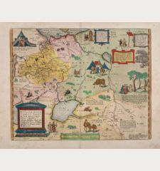
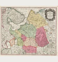
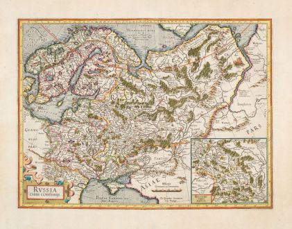
Russia cum Confinijs
Gerard Mercator (*1512 - †1594)Reference 12885
Description
A very fine example of the first map of Russia by Gerard Mercator. First published in 1595 in his famous Atlas. Mercator's attention to detail established a new standard for Russian maps, influencing subsequent cartographers.
In the West from Scandinavia to the Ob River, including Prussia, parts of Denmark, and the eastern regions of Poland and Hungary. To the north, the Sea of Murmansk dominates, while the Black Sea coast lies to the south. The Volga and Don Rivers, marked by mountain ranges just beyond, form the southeast boundary. At the lower right an inset map titled Russiae Pars Amplificata, offers a closer look at the Moscow region, emphasizing its importance for Western European merchants. The map is adorned with informative notes, suggesting new names and providing insights. A Latin text describes the Mari people of the Volga River valley.
This beautiful example comes from the French edition of the Mercator-Hondius Atlas of 1633, printed from the same plate used for the 1595 atlas. French text on verso.
Details
| Cartographer | Gerard Mercator |
| Title | Russia cum Confinijs |
| Publisher, Year | H. Hondius, Amsterdam, 1633 |
| Plate Size | 35.4 x 47.3 cm (13.9 x 18.6 inches) |
| Sheet Size | 46.5 x 57.0 cm (18.3 x 22.4 inches) |
| Reference | Van der Krogt, P.: Koeman's Atlantes Neerlandici, 1800:1A. |
Condition
Cartographer
Images to Download
If you like to download the image of this map with a resolution of 1200 pixels, please follow the link below.
You can use this image for publication on your personal or commercial websites for free if you set a link to this website. If you need photographs with a higher resolution, please contact us.

![Verus Chersonesi Tauricae Seu Crimea Conspectus ... [and] Theatrum Belli Ao MDCCXXXVII ... [and] Explicatio Duarum Tabularum... Verus Chersonesi Tauricae Seu Crimea Conspectus ... [and] Theatrum Belli Ao MDCCXXXVII ... [and] Explicatio Duarum Tabularum...](https://www.vintage-maps.com/2205-home_default/du-chaffat-ukraine-russo-turkish-war-crimea-1740.jpg)
