Product successfully added to your shopping cart
There are 0 items in your cart. There is 1 item in your cart.
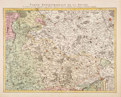
Partie Septentrionale de la Souabe
Guillaume de l'Isle (*1675 - †1726)Reference 12982
Description
Antique map of northern Württemberg and Franken by Guillaume de l'Isle. This is the Covens & Mortier edition of the detailed map by G. de l'Isle. Showing the area Hornberg, Nuremberg, Stuttgart. In the center Schwäbisch-Hall, Ellwangen (Jagst), Crailsheim and Dinkelsbühl, in the east Nuremberg, Würzburg and Donauwörth. In the south Heidenheim, Giengen (Brentz), Dillingen. To the west, the Neckar with Bad Wimpfen, Heilbronn, Besigheim, Bietigheim-Bissingen, Marbach and Esslingen.
Details
| Cartographer | Guillaume de l'Isle |
| Title | Partie Septentrionale de la Souabe |
| Publisher, Year | Covens & Mortier, Amsterdam, circa 1730 |
| Plate Size | 47.0 x 62.5 cm (18.5 x 24.6 inches) |
| Sheet Size | 55.5 x 68.3 cm (21.9 x 26.9 inches) |
Condition
Cartographer
Images to Download
If you like to download the image of this map with a resolution of 1200 pixels, please follow the link below.
You can use this image for publication on your personal or commercial websites for free if you set a link to this website. If you need photographs with a higher resolution, please contact us.
Baden-Württemberg - de l'Isle, Guillaume - Partie Septentrionale de la Souabe

![[Donau Strom von Sigmaringen bis Donauwörth] [Donau Strom von Sigmaringen bis Donauwörth]](https://www.vintage-maps.com/2606-home_default/anonymous-germany-baden-wuerttemberg-danube-1702.jpg)
