Product successfully added to your shopping cart
There are 0 items in your cart. There is 1 item in your cart.
Total products
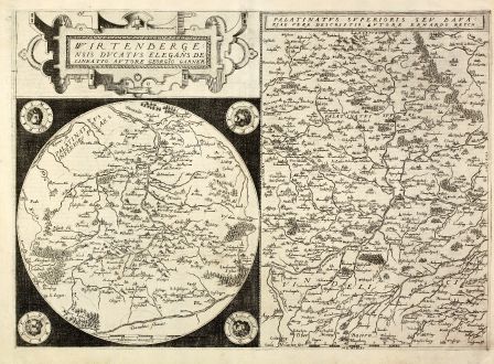
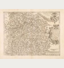
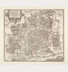
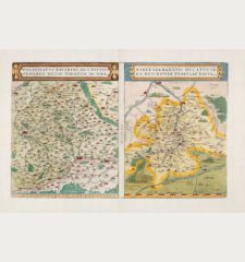
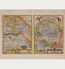
Wirtenbergensis Ducatus Elegans Delineatio / Palatinatus Superioris
Gerard de Jode (*1509 - †1591)Antique map of Bavaria, Wurttemberg. Printed in Antwerp by G. de Jode in 1578.
Reference 10875
Description
Copper engraved map of Wurttemberg and the northern part of Bavaria by Gerard de Jode. Two maps printed from one plate. The round Wurttemberg map is sourrounded by four wind heads and based on the map of G. Gadner [Garner]. On the right side a map of Upper Palatinate with Munich at lower side, after E. Reych. From the first edition of Gerard de Jode's Atlas 'Speculum Orbis Terrarum' 1578. Rare.
Details
| Cartographer | Gerard de Jode |
| Title | Wirtenbergensis Ducatus Elegans Delineatio / Palatinatus Superioris |
| Publisher, Year | G. de Jode, Antwerp, 1578 |
| Plate Size | 37.4 x 52.3 cm (14.7 x 20.6 inches) |
| Sheet Size | 41.2 x 56.3 cm (16.2 x 22.2 inches) |
| Reference | Koeman III 2620+2670:32 |
Condition
Centrefold restored, cleaned and newly glued, good copy.
Cartographer
Gerard de Jode was a printer, publisher, cartographer and engraver in Antwerp, active the same time period as his business rival A. Ortelius. His main work Speculum Orbis Terrarum a major World Atlas, which is extremely rare today, could not be published until 1578, eight years later than the Ortelius Atlas Theatrum Orbis Terrarum in 1570. His son Cornelius de Jode reissued the Altas in 1593. The copper plates have been sold to J.B. Vrients after the death of Cornelius, but no further publication was done. Compared to Ortelius or Mercator maps, only a small number of copies have been printed and makes the maps of G. de Jode vary rare items today.
Images to Download
If you like to download the image of this map with a resolution of 1200 pixels, please follow the link below.
You can use this image for publication on your personal or commercial websites for free if you set a link to this website. If you need photographs with a higher resolution, please contact us.
Gerard de Jode: Wirtenbergensis Ducatus Elegans Delineatio / Palatinatus Superioris.
Antique map of Bavaria, Wurttemberg. Printed in Antwerp by G. de Jode in 1578.
Germany - Jode, Gerard de - Wirtenbergensis Ducatus Elegans Delineatio...

![[Donau Strom von Sigmaringen bis Donauwörth] [Donau Strom von Sigmaringen bis Donauwörth]](https://www.vintage-maps.com/2606-home_default/anonymous-germany-baden-wuerttemberg-danube-1702.jpg)


