Product successfully added to your shopping cart
There are 0 items in your cart. There is 1 item in your cart.
Total products
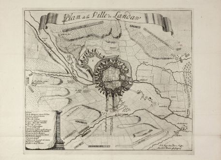
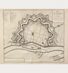
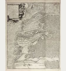
Plan de la Ville de Landaw
Pierre HussonAntique map of Landau, Rhineland-Palatinate. Printed in The Hague circa 1705.
Reference 11092
Description
Very rare, decorative map of Landau by Pierre Husson published in The Hague during the early 1700's. Showing a battle during the War of the Spanish Succession. With a explanation key.
We could not locate one examples of this print in libraries worldwide. The map was published separately, which explains the rarity. Sometime separately issued maps can be found in Composite Atlases.
We could not locate one examples of this print in libraries worldwide. The map was published separately, which explains the rarity. Sometime separately issued maps can be found in Composite Atlases.
Details
| Cartographer | Pierre Husson |
| Title | Plan de la Ville de Landaw |
| Publisher, Year | The Hague, circa 1705 |
| Plate Size | 32.6 x 39.2 cm (12.8 x 15.4 inches) |
| Sheet Size | 38.8 x 53.0 cm (15.3 x 20.9 inches) |
Condition
Evidence of old folds, lower centrefold backed.
Cartographer
Pierre Husson was active as bookseller and geograph in The Hague during the biginning of the 18th century.
Images to Download
If you like to download the image of this map with a resolution of 1200 pixels, please follow the link below.
You can use this image for publication on your personal or commercial websites for free if you set a link to this website. If you need photographs with a higher resolution, please contact us.
Pierre Husson: Plan de la Ville de Landaw.
Antique map of Landau, Rhineland-Palatinate. Printed in The Hague circa 1705.

![[Donau Strom von Sigmaringen bis Donauwörth] [Donau Strom von Sigmaringen bis Donauwörth]](https://www.vintage-maps.com/2606-home_default/anonymous-germany-baden-wuerttemberg-danube-1702.jpg)



![[De Boemia. / Tabula quarta & quinta Europae de nonnullis / Germaniae ...] [De Boemia. / Tabula quarta & quinta Europae de nonnullis / Germaniae ...]](https://www.vintage-maps.com/2304-home_default/fries-germany-1541.jpg)
