Product successfully added to your shopping cart
There are 0 items in your cart. There is 1 item in your cart.
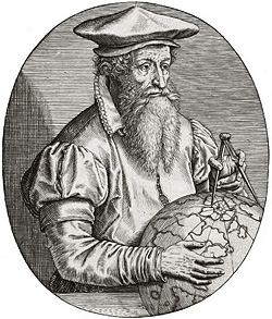
Antique Maps by Gerard Mercator (*1512 - †1594)

Alsatia inferior
Henricus Hondius, Amsterdam, 1633
Early, beautiful coloured map of the Alsace (Basse-Alsace) by G. Mercator. This west-oriented map provides a depiction of the Rhine River's course, extending from Selz to Schoenau, encompassing a...
Alsatia inferior
1633 - Gerard Mercator
12802Coloured map of Strasbourg, Alsace. Printed in Amsterdam by Henricus Hondius in 1633.
290,00 €
Alsatia Superior cu Suntgoia & Brisgoia
Henricus Hondius, Amsterdam, 1633
Early, beautiful coloured map of the Alsace (Haute-Alsace) by G. Mercator. This west-oriented map shows the course of the Rhine between Basel and Strasbourg, Baden with Breisgau, Upper Alsace and...
Alsatia Superior cu Suntgoia & Brisgoia
1633 - Gerard Mercator
12803Coloured map of the Black Forest, Breisgau, Alsace. Printed in Amsterdam by Henricus Hondius in 1633.
320,00 €
Wirtenberg Ducatus
Henricus Hondius, Amsterdam, 1633
Early, beautiful coloured map of Württemberg in South Germany by G. Mercator. Shows the area between Offenburg, Sigmaringen, Ulm and Heidelberg with Esslingen in the center. With Stuttgart,...
Wirtenberg Ducatus
1633 - Gerard Mercator
12804Coloured map of Baden-Württemberg, Germany. Printed in Amsterdam by Henricus Hondius in 1633.
390,00 €
Graecia
H. Hondius, Amsterdam, 1633
Antique map of Greece with the Greek Islands, the Aegean Sea and part of Asia Minor by Gerard Mercator. A beautiful title cartouche to the lower left. From the French edition of the...
Graecia
1633 - Gerard Mercator
12807Coloured map of Greece. Printed in Amsterdam by H. Hondius in 1633.
750,00 €
Candia cum Insulis aliquot circa Graeciam
H. Hondius, Amsterdam, 1633
Early map of the island of Crete by G. Mercator. With six smaller maps in upper panel across the top that provide views of the Greek Islands, including Kerkira (Corfu), Zakynthos (Zante), Milos (a...
Candia cum Insulis aliquot circa Graeciam
1633 - Gerard Mercator
12808Coloured map of Crete, Candia. Printed in Amsterdam by H. Hondius in 1633.
550,00 €
Iutia Septentrionalis
H. Hondius, Amsterdam, 1633
Antique Map of Jutland (Jylland) in Denmark by Gerard Mercator. Shows Midtjylland (Central Jutland) between the North Sea and Kattegat with Thisted, Aalborg, Randers, Aarhus, Horsens, Grenaa and...
Iutia Septentrionalis
1633 - Gerard Mercator
12809Coloured map of Jutland, Jylland. Printed in Amsterdam by H. Hondius in 1633.
390,00 €
Fionia
H. Hondius, Amsterdam, 1633
Old coloured antique map of the eastern part of South Denmark by Gerard Mercator. With Funen (Fyn) and the offshore islands Langeland and Ærø. Below a title cartouche. From the early French edition...
Fionia
1633 - Gerard Mercator
12810Old coloured map of Fyn. Printed in Amsterdam by H. Hondius in 1633.
350,00 €
Barbaria
H. Hondius, Amsterdam, 1633
Beautiful hand colored map of North Africa by G. Mercator. Shows the north of Africa with Morocco, Algeria, Tunisia, Libya, Egypt and the southern part of the Mediterranean. Below two smaller maps...
Barbaria
1633 - Gerard Mercator
12811Coloured map of North Africa. Printed in Amsterdam by H. Hondius in 1633.
530,00 €
Ultoniae Orientalis Pars
H. Hondius, Amsterdam, 1633
Beautiful hand colored map of the eastern part of Ulster in Ireland by G. Mercator. Shows the Down and Antrim Counties in Northern Ireland. This is the first edition of the map, still with...
Ultoniae Orientalis Pars
1633 - Gerard Mercator
12812Coloured map of Ulster. Printed in Amsterdam by H. Hondius in 1633.
450,00 €
Frisia occidentalis
H. Hondius, Amsterdam, 1633
Early map of West Frisia and Groningen by G. Mercator. The map extends from the islands of Schellinck to Borkum in the north, the province of Groningen in the east, the IJsselmeer and part of North...
Frisia occidentalis
1633 - Gerard Mercator
12818Coloured map of Frisia, West-Friesland, Groningen. Printed in Amsterdam by H. Hondius in 1633.
350,00 €![Mercator, Germany, Lower Saxony, 1633: Westfalia cum Dioecesi Bremensi [2 Karten]]( "Gerard Mercator: Westfalia cum Dioecesi Bremensi [2 Karten]")
Westfalia cum Dioecesi Bremensi [2 Karten]
Henricus Hondius, Amsterdam, 1633
Large, two-part map of Lower Saxony and North Rhine-Westphalia by G. Mercator on two sheets. The northern map shows East Frisia, Oldenburg and Bremen with the North Sea coast between Emden and the...
Westfalia cum Dioecesi Bremensi [2 Karten]
1633 - Gerard Mercator
12820Coloured map of Lower Saxony, Germany. Printed in Amsterdam by Henricus Hondius in 1633.
850,00 €![Mercator, British Isles, Scotland, 1633: Scotiae Regnum [2 Maps, North and South Scotland]]( "Gerard Mercator: Scotiae Regnum [2 Maps, North and South Scotland]")
Scotiae Regnum [2 Maps, North and South Scotland]
Henricus Hondius, Amsterdam, 1633
Large, two-sheet map of Scotland by G. Mercator. Consists of two double-page engraved maps that, when combined, form a large and comprehensive map of Scotland. The two sheets are not joined...
Scotiae Regnum [2 Maps, North and South Scotland]
1633 - Gerard Mercator
12830Coloured map of Scotland, British Isles. Printed in Amsterdam by Henricus Hondius in 1633.
1 400,00 €
Scotia Regnum
H. Hondius, Amsterdam, 1633
First state of Gerard Mercator's map of Scotland. It holds the distinction of being the second printed map exclusively dedicated to Scotland in an atlas, with the first being Abraham Ortelius'...
Scotia Regnum
1633 - Gerard Mercator
12832Coloured map of Scotland, British Isles. Printed in Amsterdam by H. Hondius in 1633.
950,00 €
Islandia
H. Hondius, Amsterdam, 1633
The second map based on local Icelandic data.This impressive map showcases Iceland and is attributed to the famous cartographer Gerhard Mercator. It was featured in the Atlas sive...
Islandia
1633 - Gerard Mercator
12845Coloured map of Iceland. Printed in Amsterdam by H. Hondius in 1633.
1 500,00 €
Helvetia cum Finitimis Regionibus Confoederatis
H. Hondius, Amsterdam, 1633
Beautiful coloured detailed antique map of Switzerland by G. Mercator. With one cartouche and a mileage scale. Covering complete Switzerland with the Lake Constance and Lake Geneva. From a French...
Helvetia cum Finitimis Regionibus Confoederatis
1633 - Gerard Mercator
12850Coloured map of Switzerland. Printed in Amsterdam by H. Hondius in 1633.
600,00 €
Irlandiae Regnum
H. Hondius, Amsterdam, 1633
Large, two-sheet map of Ireland by G. Mercator. Consists of two double-page engraved maps that, when combined, form a large and comprehensive map of Ireland. The two sheets are not joined together....
Irlandiae Regnum
1633 - Gerard Mercator
12870Coloured map of Ireland. Printed in Amsterdam by H. Hondius in 1633.
2 300,00 €
Taurica Chersonesus nostra Aetate Przecopsca et Gazara Dicitur
H. Hondius, Amsterdam, 1633
This is the first state of Mercator's depiction of Crimea, known in ancient times as Taurica Chersonesus.Notable places like Moscow, Smolensk, Kiev, and Chernobyl are easily identifiable on...
Taurica Chersonesus nostra Aetate Przecopsca et Gazara Dicitur
1633 - Gerard Mercator
12871Coloured map of the Ukraine. Printed in Amsterdam by H. Hondius in 1633.
650,00 €
Cyprus Ins.
H. Hondius, Amsterdam, 1633
Beautifully coloured antique map of Cyprus from the Mercator-Hondius Atlas. Below six inset maps of Greek islands: Stalimini, Chios, Mitilene, Negroponte, Cerigo, and Rhodes. The map includes a...
Cyprus Ins.
1633 - Gerard Mercator
12875Coloured map of Cyprus. Printed in Amsterdam by H. Hondius in 1633.
1 200,00 €
Lithuania
H. Hondius, Amsterdam, 1633
Beautiful coloured antique map of Lithuania by Gerard Mercator. This is the first large format map exclusively dedicated to Lithuania, created by Mercator and published by Jodocus Hondius. It...
Lithuania
1633 - Gerard Mercator
12877Coloured map of Lithuania. Printed in Amsterdam by H. Hondius in 1633.
850,00 €
Russia cum Confinijs
H. Hondius, Amsterdam, 1633
A very fine example of the first map of Russia by Gerard Mercator. First published in 1595 in his famous Atlas. Mercator's attention to detail established a new standard for Russian maps,...
Russia cum Confinijs
1633 - Gerard Mercator
12885Coloured map of Russia. Printed in Amsterdam by H. Hondius in 1633.
1 200,00 €
Walachia, Servia, Bulgaria, Romania
Jodocus Hondius, Amsterdam, 1633
Coloured map of the Eastern Balkans by Jodocus Hondius. Shows the Wallachia, Serbia, Bulgaria and Romania, in the south Macedonia, in the east the west coast of the Black Sea. First published in...
Walachia, Servia, Bulgaria, Romania
1633 - Gerard Mercator
12889Antique map of the Eastern Balkans with Romania, Bulgaria and Serbia. Printed in Amsterdam by Jodocus Hondius in 1607.
450,00 €
Burgundia Comitatus - Burgundia superior sive liber comitatus
H. Hondius, Amsterdam, 1633
Beautiful antique map of the County of Burgundy (Franche-Comté) by G. Mercator. Showing the historical province in the east of France with Lake Geneva (Lac Léman) and Lake de Neuchâtel. A cartouche...
Burgundia Comitatus - Burgundia superior sive liber comitatus
1633 - Gerard Mercator
12952Antique map of Bourgogne, Franche-Comte. Printed in Amsterdam by H. Hondius in 1633.
390,00 €
Das Wiflispurgergou
H. Hondius, Amsterdam, 1633
Beautiful antique map of Southwestern Switzerland by G. Mercator. Shows the area around Lake Neuchâtel (Lac de Neuchâtel), Lake Geneva (Lac Léman) and Lake Thun. With Geneva, Lausanne, Thun, Bern,...
Das Wiflispurgergou
1633 - Gerard Mercator
12953Antique map of the Lake Thun, Lake Geneva, Lake Neuchatel. Printed in Amsterdam by H. Hondius in 1633.
390,00 €
Zurichgow
H. Hondius, Amsterdam, 1633
Beautiful antique map of northern Switzerland by G. Mercator. Shows the area between Basel, Lucerne and Constance with Zurich in the centre. In the north-east the southern part of the Black Forest....
Zurichgow
1633 - Gerard Mercator
12954Antique map of Northern Switzerland, Zürich. Printed in Amsterdam by H. Hondius in 1633.
390,00 €


![Mercator, Germany, Lower Saxony, 1633: Westfalia cum Dioecesi Bremensi [2 Karten]](https://www.vintage-maps.com/4256-home_default/mercator-germany-lower-saxony-1633.jpg "Gerard Mercator: Westfalia cum Dioecesi Bremensi [2 Karten]")
![Mercator, British Isles, Scotland, 1633: Scotiae Regnum [2 Maps, North and South Scotland]](https://www.vintage-maps.com/4278-home_default/mercator-british-isles-scotland-1633.jpg "Gerard Mercator: Scotiae Regnum [2 Maps, North and South Scotland]")


