Product successfully added to your shopping cart
There are 0 items in your cart. There is 1 item in your cart.
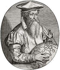
Antique Maps by Gerard Mercator (*1512 - †1594)
![Mercator, Switzerland, Zurich, Basel, 1628: [Zurichgow]]( "Gerard Mercator: [Zurichgow]")
[Zurichgow]
Gerard Mercator, Amsterdam, 1628
Original old coloured detailed engraved map of Northern Switzerland by G. Mercator. Covering the area between Basel, Luzern and Constance, centred around Zurich. From a French edition of...
[Zurichgow]
1628 - Gerard Mercator
10849Old coloured map of Basel, Zurich. Printed in Amsterdam by Gerard Mercator in 1628.
Sold
Persici vel Sophorum Regni typus
Amsterdam, 1628
Hand coloured copper engraved map of Persia by G. Mercator. With two beautiful coloured cartouche. Covering the area of today Iran with the Caspian Sea and the Persian Gulf. From a 1628 edition of...
Persici vel Sophorum Regni typus
1628 - Gerard Mercator
10857Coloured map of the Persian Gulf, Caspian Sea, Iran. Printed in Amsterdam in the year 1628.
Sold
Graecia
Henricus Hondius, Amsterdam, 1628
Antique map of Greece with the Greek Islands, the Aegean Sea and part of Asia Minor by Gerard Mercator. A beautiful title cartouche to the lower left. From the French edition of the...
Graecia
1628 - Gerard Mercator
12570Coloured map of Greece. Printed in Amsterdam by Henricus Hondius in 1628.
Sold
Septentrionalium Terrarum Descriptio
Henricus Hondius, Amsterdam, 1628
The First Separate Printed Map of the North Pole and the Arctic Regions.The first printed map devoted exclusively to the Arctic. First published after Gerard Mercator's death (1594) by his...
Septentrionalium Terrarum Descriptio
1628 - Gerard Mercator
12782Antique map of the North Pole and the Arctic. Printed in Amsterdam by Jodocus Hondius in 1628.
Sold
Asia ex Magna Orbis Terre Descriptione Gerardi Mercatoris Desumpta, Studio et Industria G.M....
1630
This map first appeared in the famous Mercator "Atlas Sive Cosmographicae" of 1595, later puplished until 1633 in Mercator Hondius Atlases.
Asia ex Magna Orbis Terre Descriptione Gerardi Mercatoris Desumpta,...
1630 - Gerard Mercator
10041Old coloured map of the Asian continent. Printed in the year 1630.
Sold
Prussia
1630
Showing coast of Baltic Sea in Prussia, today Poland. First edition of the Prussia map, second state followed 1633. French text on reverse.
Prussia
1630 - Gerard Mercator
10086Old coloured map of Borussia. Printed in the year 1630.
Sold
Alsatia Superior cu Suntgoia & Brisgoia
H. Hondius, Amsterdam, circa 1630
Nice coloured map of the Alsace from G. Mercator by H. Hondius. Covering the area of the Black Forest and Breisgau with the River Rhine between Strasbourg and Basel. From the Mercator-Hondius Atlas...
Alsatia Superior cu Suntgoia & Brisgoia
1630 - Gerard Mercator
10490Coloured map of the Black Forest, Breisgau, Alsace. Printed in Amsterdam by H. Hondius circa 1630.
Sold
Argow
Hondius, Amsterdam, circa 1630
Nice early 17th century copper engraved map of central Switzerland of G. Mercator by Hondius in beautiful colours. With one cartouche. Covering the region around the Lake Lucerne, Lake Zurich and...
Argow
1630 - Gerard Mercator
10616Coloured map of the Lake Thun, Lake Zurich, Lake Lucerne, Argau. Printed in Amsterdam by Hondius circa 1630.
Sold
Saxonia Inferior et Meklenborg Duc.
Janssonius, Amsterdam, circa 1630
Nice mid 17th century copper engraved map of north German region of G. Mercator by J. Janssonius. Showing the area between the estuary of the Elbe river and Rostock. With one cartouche and two...
Saxonia Inferior et Meklenborg Duc.
1630 - Gerard Mercator
10676Antique map of Mecklenburg-Vorpommern, Lower Saxony. Printed in Amsterdam by Janssonius circa 1630.
Sold
Episcopatus Bremensis cum Adiacentibus
Amsterdam, circa 1630
Decorative copper engraved map of Lower Saxony centred around Bremen by G. Mercator. Showing the area between the river Ems and Elbe along the North Sea coast with the East Frisian Islands. With...
Episcopatus Bremensis cum Adiacentibus
1630 - Gerard Mercator
10962Antique map of Bremen, Lower Saxony. Printed in Amsterdam circa 1630.
Sold
Tartaria
Johannes Cloppenburch, Amsterdam, 1630-36
Scarce antique map of the Tartary by G. Mercator. Shows the Tartar Empire with Russia, the Caspian Sea in the west, the north of China with the Great Wall of China, Korea is still shown as an...
Tartaria
1630 - Gerard Mercator
12593Antique map of the Tartary. Printed in Amsterdam by Johannes Cloppenburch in 1630.
Sold
Saltzburg Archiepiscopatus cum Ducatu Carinthiae
H. Hondius, Amsterdam, 1630
Antique map of the province of Salzburg and Carinthia by Gerard Mercator. Shows the area from Vöklabruck in the north to Malborghetto in the south and from Zell am Ziller in the west to Völkermarkt...
Saltzburg Archiepiscopatus cum Ducatu Carinthiae
1630 - Gerard Mercator
12947Coloured map of Salzburg, Carinthia. Printed in Amsterdam by H. Hondius in 1630.
Sold
Sclavonia, Croatia, Bosnia cum Dalmatiae Parte
H. Hondius, Amsterdam, 1633
Beautiful hand colored map of the Western Balkan by G. Mercator. Showing today Slovenia, Croatia, Bosnia-Herzegovina, and Serbia, and extends from the northern banks of the Drava River to the...
Sclavonia, Croatia, Bosnia cum Dalmatiae Parte
1633 - Gerard Mercator
12797Coloured map of Serbia, Bosnia, Croatia, Slovenia. Printed in Amsterdam by H. Hondius in 1633.
Sold
Stiria
H. Hondius, Amsterdam, 1633
Beautiful hand colored map of Styria by G. Mercator. Showing the Duchy of Styria, the eastern part of Carinthia and the northeastern part of Slovenia. With Völkermarkt, Lavamünd, Leibnitz, Gratz,...
Stiria
1633 - Gerard Mercator
12798Coloured map of Styria, Steiermark, Slovenia. Printed in Amsterdam by H. Hondius in 1633.
Sold
Transylvania
H. Hondius, Amsterdam, 1633
Beautiful hand-colored map of Transylvania (Transylvania or Transilvania) by G. Mercator. Shows the historical and geographical area in the southeastern Carpathian region with its eventful history....
Transylvania
1633 - Gerard Mercator
12800Coloured map of Transilvania, Transylvania. Printed in Amsterdam by H. Hondius in 1633.
Sold
Emden & Oldenborch Comit.
H. Hondius, Amsterdam, 1633
Early map of East Frisia, Emden and Oldenburg by G. Mercator. Showing the North Sea coast of Friesland between Dollart and the Jade Bay with Emden, Leer and the East Frisian islands of Borkum,...
Emden & Oldenborch Comit.
1633 - Gerard Mercator
12805Coloured map of East Frisia, Ostfriesland, Oldenburg. Printed in Amsterdam by H. Hondius in 1633.
Sold
Berghe Ducatus Marck comitatus et Coloniensis Dioecesis
Henricus Hondius, Amsterdam, 1633
Beautifully colored map of the triangle of Hesse, North Rhine-Westphalia and Rhineland-Palatinate by G. Mercator. Shows the Duchy of Berg, the County of Mark and the Archbishopric of Cologne,...
Berghe Ducatus Marck comitatus et Coloniensis Dioecesis
1633 - Gerard Mercator
12819Coloured map of Westerwald, Cologne, Mark, Berg. Printed in Amsterdam by Henricus Hondius in 1633.
Sold
Daniae Regnu
H. Hondius, Amsterdam, 1633
Beautiful coloured antique map of Denmark by Gerard Mercator. Shows Denmark with Holstein and Mecklenburg with Rügen in the south and south Sweden in the north. Top right a title cartouche, in the...
Daniae Regnu
1633 - Gerard Mercator
12833Coloured map of Denmark. Printed in Amsterdam by H. Hondius in 1633.
Sold
Islandia
H. Hondius, Amsterdam, 1633
The second map based on local Icelandic data.This impressive map showcases Iceland and is attributed to the famous cartographer Gerhard Mercator. It was featured in the Atlas sive...
Islandia
1633 - Gerard Mercator
12845Coloured map of Iceland. Printed in Amsterdam by H. Hondius in 1633.
Sold
Livonia
H. Hondius, Amsterdam, 1633
Beautiful coloured antique map of the Baltic region by Gerard Mercator. With Estonia, Latvia and Lithuania, the east coast of the Baltic Sea and the Gulf of Finland in the north. Decorated with a...
Livonia
1633 - Gerard Mercator
12878Coloured map of Estonia, Latvia, Lithuania. Printed in Amsterdam by H. Hondius in 1633.
Sold
Irlandiae Regnum
H. Hondius, Amsterdam, 1633
Beautiful coloured antique map of Ireland by Gerard Mercator. Top right a title cartouche. Oriented to the West. From the French edition of the Mercator-Hondius Atlas of 1633. French text on verso.
Irlandiae Regnum
1633 - Gerard Mercator
12880Coloured map of Ireland. Printed in Amsterdam by H. Hondius in 1633.
Sold
Alpinae seu Foederatae Rhaetiae Subditarumque ei Terrarum nova descriptio...
H. Hondius, Amsterdam, 1633
Beautiful antique map of Graubünden by G. Mercator. Showing north-east Switzerland with the Engadine, Bormio, Sargans, Bad Ragaz, Landquart, Chur, St. Moritz, Sils, Lake Como, parts of Vorarlberg...
Alpinae seu Foederatae Rhaetiae Subditarumque ei Terrarum nova...
1633 - Gerard Mercator
12955Antique map of Graubünden. Printed in Amsterdam by H. Hondius in 1633.
Sold
Abissinorum sive Pretiosi Ioannis Imperiu
Amsterdam, 1638
Hand coloured copper engraved map of Central Africa by G. Mercator. With two beautiful coloured cartouche and one inset map of the Congo. Showing the Kingdom of Prester John in central Africa, how...
Abissinorum sive Pretiosi Ioannis Imperiu
1638 - Gerard Mercator
10863Coloured map of Priest Joan, Congo, Central Africa. Printed in Amsterdam in the year 1638.
Sold
Das Wiflispurgergou
Hondius, Amsterdam, 1639
Nice early 17th century copper engraved map of south-western Switzerland of G. Mercator by Hondius in beautiful colours. Second state, with cartouche changed to the shape of a shell. Covering the...
Das Wiflispurgergou
1639 - Gerard Mercator
10617Coloured map of the Lake Thun, Lake Geneva, Lake Neuchatel. Printed in Amsterdam by Hondius in 1639.
Sold
![Mercator, Switzerland, Zurich, Basel, 1628: [Zurichgow]](https://www.vintage-maps.com/958-home_default/mercator-switzerland-zurich-basel-1628.jpg "Gerard Mercator: [Zurichgow]")


