Product successfully added to your shopping cart
There are 0 items in your cart. There is 1 item in your cart.
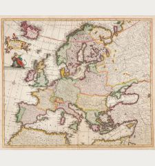
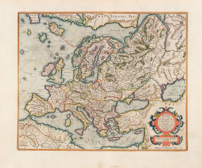
Europa, ad magnae Europae Gerardi Mercatoris
Gerard Mercator (*1512 - †1594)Reference 12766
Description
This map of Europe is from Mercator's Atlas sive Cosmographicae Meditationes de Fabrica Mundi et Fabricati Figura, first published in 1595.
The geography depicted on the map corresponds to Mercator's world wall map of 1569. There are several fictional elements on the map that originated from Nicolo Zeno, a Venetian, in 1558. According to Zeno's map, his noble ancestors Nicolò and Antonio discovered America in the 15th century, predating Columbus. However, they became stranded on an island called Frisland (Frislant), located south of Iceland, which does not actually exist. Mercator included Zeno's information on his maps, and due to his esteemed reputation, these inaccuracies continued to be depicted on maps in subsequent years.
Mercator's maps are renowned for their elegant lettering and engraving. The intricate strapwork cartouche is only present in early editions of this atlas. In 1606, Jodocus Hondius assumed production of the atlas and made numerous alterations.
Details
| Cartographer | Gerard Mercator |
| Title | Europa, ad magnae Europae Gerardi Mercatoris |
| Publisher, Year | Henricus Hondius, Amsterdam, 1628 |
| Plate Size | 38.3 x 46.7 cm (15.1 x 18.4 inches) |
| Sheet Size | 47.7 x 56.7 cm (18.8 x 22.3 inches) |
| Reference | Van der Krogt, P.: Koeman's Atlantes Neerlandici, 1000:1A |
Condition
Cartographer
Images to Download
If you like to download the image of this map with a resolution of 1200 pixels, please follow the link below.
You can use this image for publication on your personal or commercial websites for free if you set a link to this website. If you need photographs with a higher resolution, please contact us.
Europe Continent - Mercator, Gerard - Europa, ad magnae Europae Gerardi Mercatoris


![[Map of Europe] [Map of Europe]](https://www.vintage-maps.com/2931-home_default/bordone-europe-continent-1528-1565.jpg)
