Product successfully added to your shopping cart
There are 0 items in your cart. There is 1 item in your cart.
Total products
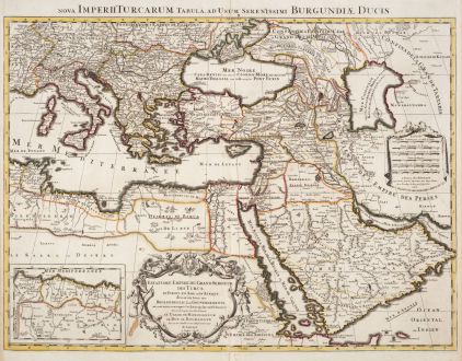
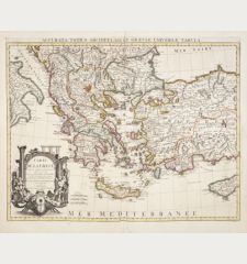
Estats de l'Empire du Grand Seigneur des Turcs en Europe, es Asie, et en Afrique / Nova...
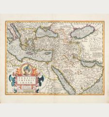
Alexis Hubert Jaillot (*1632 - †1712)Old coloured map of the Ottoman Empire, Turkish Empire. Printed in Paris by H. Jaillot in 1696.
Reference 12480
Description
Old coloured antique map of the Ottoman Empire by Hubert Jaillot. Shows the south-east of Europe, the Middle East and the north-east of Africa. A title cartouche at the bottom centre.
Details
| Cartographer | Alexis Hubert Jaillot |
| Title | Estats de l'Empire du Grand Seigneur des Turcs en Europe, es Asie, et en Afrique / Nova Imperii Turcarum... |
| Publisher, Year | H. Jaillot, Paris, 1696 |
| Plate Size | 48.0 x 61.4 cm (18.9 x 24.2 inches) |
| Sheet Size | 53.0 x 63.0 cm (20.9 x 24.8 inches) |
Condition
Three ink stains, centrefold backed, tear in lower white margin next to centrefold backed. Very good condition with old outline colour. Never framed before.
Cartographer
Hubert Jaillot, one of the most important French cartographers of the 17th century, was born 1632. He had a partnership with Nicolas Sanson's son and re-published and re-engraved many Sanson maps. The Atlases and map mainly have been printed by Pierre Mortier in Amsterdam but also in Paris. He died 1712 in Paris.
Images to Download
If you like to download the image of this map with a resolution of 1200 pixels, please follow the link below.
You can use this image for publication on your personal or commercial websites for free if you set a link to this website. If you need photographs with a higher resolution, please contact us.
Alexis Hubert Jaillot: Estats de l'Empire du Grand Seigneur des Turcs en Europe, es Asie, et en Afrique / Nova Imperii Turcarum....
Old coloured map of the Ottoman Empire, Turkish Empire. Printed in Paris by H. Jaillot in 1696.
Turkey - Jaillot, Alexis Hubert - Estats de l'Empire du Grand Seigneur des...

![Verus Chersonesi Tauricae Seu Crimea Conspectus ... [and] Theatrum Belli Ao MDCCXXXVII ... [and] Explicatio Duarum Tabularum... Verus Chersonesi Tauricae Seu Crimea Conspectus ... [and] Theatrum Belli Ao MDCCXXXVII ... [and] Explicatio Duarum Tabularum...](https://www.vintage-maps.com/2205-home_default/du-chaffat-ukraine-russo-turkish-war-crimea-1740.jpg)

![[Euboea, Negroponte, Bosporus, Istanbul] [Euboea, Negroponte, Bosporus, Istanbul]](https://www.vintage-maps.com/2937-home_default/bordone-greece-negroponte-euboea-1528-1565.jpg)
![[Asia Minor] [Asia Minor]](https://www.vintage-maps.com/3717-home_default/muenster-turkey-asia-minor-1550.jpg)
