Product successfully added to your shopping cart
There are 0 items in your cart. There is 1 item in your cart.
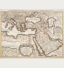
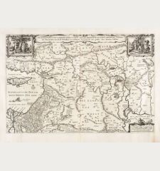
Turcici Imperii Imago
Jodocus Hondius (*1563 - †1612)Reference 12872
Description
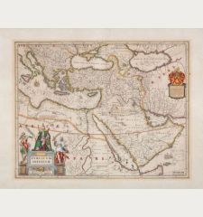
Beautifully coloured antique map of the Ottoman Empire from the 1633 French edition of the Mercator-Hondius Atlas Major, published by Henricus Hondius and Johannes Janssonius. The geographical scope covers modern-day Turkey, the Balkans, Greece, the Levant, the Arabian Peninsula, and North Africa. Ornately adorned in superb hand color, the map showcases principal cities in red and provides labels for kingdoms beyond the empire, accompanied by concise Latin descriptions.
The Black Sea and the Caspian Sea are named through various sources, including Greek, Roman, and Turkish. The map's far right delves into the Ottoman relationship with neighboring kingdoms like Persia and Ormus. Beneath the Ottoman province of Egypt, a note introduces the kingdom of Tigremaon, described as a Christian nation, reflecting contemporary beliefs and accounts of the legendary patriarch Prester John.
In the bottom left corner, an elaborate strapwork cartouche dominates, enclosing the title, information on the map's meridian, a scale in German and Italic miles, and a large portrait roundel featuring Mehmed II, also known as Mehmet the Conqueror. Mehmed II is renowned for capturing Constantinople in AD 1453, a historical event depicted with reverence on this visually rich and informative map.
Details
| Cartographer | Jodocus Hondius |
| Title | Turcici Imperii Imago |
| Publisher, Year | H. Hondius, Amsterdam, 1633 |
| Plate Size | 36.0 x 48.2 cm (14.2 x 19.0 inches) |
| Sheet Size | 47.7 x 55.2 cm (18.8 x 21.7 inches) |
| Reference | Van der Krogt, P.: Koeman's Atlantes Neerlandici, 8100:1A. |
Condition
Cartographer
Images to Download
If you like to download the image of this map with a resolution of 1200 pixels, please follow the link below.
You can use this image for publication on your personal or commercial websites for free if you set a link to this website. If you need photographs with a higher resolution, please contact us.


![Verus Chersonesi Tauricae Seu Crimea Conspectus ... [and] Theatrum Belli Ao MDCCXXXVII ... [and] Explicatio Duarum Tabularum... Verus Chersonesi Tauricae Seu Crimea Conspectus ... [and] Theatrum Belli Ao MDCCXXXVII ... [and] Explicatio Duarum Tabularum...](https://www.vintage-maps.com/2205-home_default/du-chaffat-ukraine-russo-turkish-war-crimea-1740.jpg)

![[Euboea, Negroponte, Bosporus, Istanbul] [Euboea, Negroponte, Bosporus, Istanbul]](https://www.vintage-maps.com/2937-home_default/bordone-greece-negroponte-euboea-1528-1565.jpg)
![[Asia Minor] [Asia Minor]](https://www.vintage-maps.com/3717-home_default/muenster-turkey-asia-minor-1550.jpg)
