Product successfully added to your shopping cart
There are 0 items in your cart. There is 1 item in your cart.
Total products

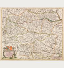
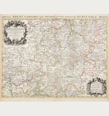
Partie du Cercle d'Austriche, Scavoir l'Archduche d'Austriche / Austriae Circuli...
Alexis Hubert Jaillot (*1632 - †1712)Old coloured map of Austria - Hungary. Printed in Paris by H. J. Jaillot in 1696.
Reference 12495
Description
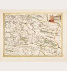
Large antique map of Upper Austria and Lower Austria by Jaillot. Shows the area along the Danube from Braunau and Passau, Linz, Enns, Grein, Ypps, Vienna, up to Bratislava. Below left the Königsee, Wolfgangsee, Attensee, Traunsee and Hallstätter See, in the east the Neusiedler See. To the upper left a title cartouche.
Details
| Cartographer | Alexis Hubert Jaillot |
| Title | Partie du Cercle d'Austriche, Scavoir l'Archduche d'Austriche / Austriae Circuli... |
| Publisher, Year | H. J. Jaillot, Paris, 1696 |
| Plate Size | 46.5 x 61.0 cm (18.3 x 24.0 inches) |
| Sheet Size | 53.0 x 63.0 cm (20.9 x 24.8 inches) |
Condition
A tear at the lower right of the centrefold backed. Very good condition with old outline colour. Never framed before.
Cartographer
Hubert Jaillot, one of the most important French cartographers of the 17th century, was born 1632. He had a partnership with Nicolas Sanson's son and re-published and re-engraved many Sanson maps. The Atlases and map mainly have been printed by Pierre Mortier in Amsterdam but also in Paris. He died 1712 in Paris.
Images to Download
If you like to download the image of this map with a resolution of 1200 pixels, please follow the link below.
You can use this image for publication on your personal or commercial websites for free if you set a link to this website. If you need photographs with a higher resolution, please contact us.
Alexis Hubert Jaillot: Partie du Cercle d'Austriche, Scavoir l'Archduche d'Austriche / Austriae Circuli....
Old coloured map of Austria - Hungary. Printed in Paris by H. J. Jaillot in 1696.
Austria - Hungary - Jaillot, Alexis Hubert - Partie du Cercle d'Austriche, Scavoir...


