Product successfully added to your shopping cart
There are 0 items in your cart. There is 1 item in your cart.
Total products

Isole Canarie
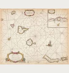
Vincenzo Maria Coronelli (*1650 - †1718)Coloured map of Madeira and the Canary Islands. Printed in Venice in the year 1696.
Reference 12574
Description
Large antique sea chart of the Canary Islands and Madeira by V. M. Coronelli. The detailed map shows the Canary Islands with Fuerteventura, Lanzarote, Tenerife, Gran Canaria, La Gomera and La Palma. To the right a map of Madeira and a large view of Funchal with the harbour. Published by Coronelli in his Isolario, descrittione di tutte l'isole 1696 in Venice.
Details
| Cartographer | Vincenzo Maria Coronelli |
| Title | Isole Canarie |
| Publisher, Year | Venice, 1696 |
| Plate Size | 45.2 x 59.8 cm (17.8 x 23.5 inches) |
| Sheet Size | 48.4 x 64.2 cm (19.1 x 25.3 inches) |
Condition
Small wormholes in the centrefold. Very good condition.
Cartographer
Vincenzo Coronelli, a Franciscan priest lived most of his life in Venice and was born 1650. He was well known because of his mathematician and geographical knowledge and became the greatest Italian cartographer of the late 17th century. He published a large two volume Atlante Veneto and became Cosmographer to the Venetian Republic. He also produced large celestial and terrestrial globes. He died in 1718.
Images to Download
If you like to download the image of this map with a resolution of 1200 pixels, please follow the link below.
You can use this image for publication on your personal or commercial websites for free if you set a link to this website. If you need photographs with a higher resolution, please contact us.
Vincenzo Maria Coronelli: Isole Canarie.
Coloured map of Madeira and the Canary Islands. Printed in Venice in the year 1696.
Spain - Portugal - Coronelli, Vincenzo Maria - Isole Canarie

![Tabula nova Hispaniae [Tabula noua Hispaniae] Tabula nova Hispaniae [Tabula noua Hispaniae]](https://www.vintage-maps.com/3236-home_default/fries-spain-portugal-1541.jpg)
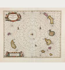

![[Canary Islands] [Canary Islands]](https://www.vintage-maps.com/3021-home_default/bordone-spain-portugal-canaries-tenerife-gran-canaria.jpg)
