Product successfully added to your shopping cart
There are 0 items in your cart. There is 1 item in your cart.
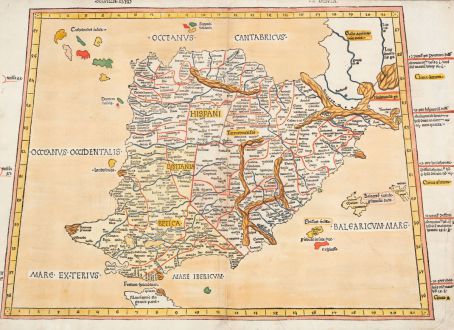
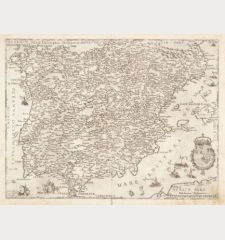
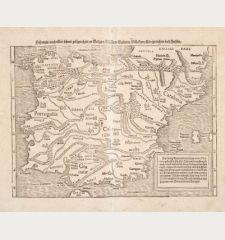
Secunda Europe Tabula
Lienhart HolleReference 12853
Description
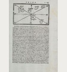
One of the earliest obtainable maps of the Iberian Peninsula and Balearic Islands.
Very rare old colored woodcut map of Spain and Portugal from the 15th century. From the second edition of the first world atlas produced outside Italy. The printing block of this map was first used in July 1482 in Ulm by Lienhard Holle, here the second edition from 1486 by Johann Reger, whose printing workshop was also located in Ulm.
The map of Spain and Portugal Secunda Europe Tabula goes back to the Greek geographer Claudius Ptolemy (100-160 AD), who lived in Alexandria. It shows the Iberian Peninsula, in the east the Balearic Islands with Mallorca, Menorca, Ibiza and Formentera, in the northwest the legendary archipelago of the Cassiterides, in the south the Strait of Gibraltar and the north of Mauritania.
With a large watermark, snake staff with cross and epithet. Latin text on the verso, printed by the largest Antiqua type of the incunabula period as well as a large colored woodcut initial.
The second German Ptolemy edition
Before his time in Ulm, Johann Reger seems to have worked in Nuremberg. At one point, Reger began working for the Venetian bookseller and publisher Justus de Albano. Reger acted as a representative, handling the interests of the active Italian in the emerging printing trade in southern Germany. In 1484, when the book printer Lienhart Holle faced financial difficulties and had to leave Ulm, Justus de Albano stepped in and purchased Holle's printing press along with all the type, printing plates, and other equipment used for the first German printing of Ptolemy's Geography in 1482.
This particular print by Holle was based on an Italian manuscript of Ptolemy's Geography, which had made its way over the Alps in a version edited by the cosmographer Donnus Nicolaus Germanus (1420-1490). The manuscript had come into the possession of the Truchsessen at Wolfegg Castle around 1470. Lienhart Holle used this manuscript as a model for his print in Ulm, marking a significant development in cartography on German soil.
Johann Reger was later tasked by Justus de Albano to create a second German print of Ptolemy's work in Ulm in 1486. This edition, known as "Cosmographia," included a dedication to Pope Paul II by Nicolaus Germanus, along with an alphabetical index and additional content by Johann Reger. The woodcut maps, designed by Nicolaus Germanus, were executed by Johannes from Armsheim.
While the two Ulm editions are almost identical, a notable distinction lies in the coloring of the water areas. Lienhart Holle used dark blue, while Johann Reger opted for a distinctive golden brown. This intentional difference in coloring made it easy to distinguish between the two editions, likely a deliberate choice by Johann Reger. Beside the coloring, the woodcut border on the back side of the maps of the Holle edition is missing on the Reger edition. The first edition has no title above the maps, it was added by Reger in 1486.
Details
| Cartographer | Lienhart Holle |
| Title | Secunda Europe Tabula |
| Publisher, Year | Johann Reger, Ulm, 1486 |
| Plate Size | 39.2 x 54.4 cm (15.4 x 21.4 inches) |
| Sheet Size | 41.9 x 57.2 cm (16.5 x 22.5 inches) |
| Reference | Campbell, T.: The earliest printed maps, 1472-1500, No. 181; Skelton, R. A.: Bibliographical note prefixed to the facsimile of the 1482 Ulm Ptolemy; Destombes, M.: Catalogue des Cartes Gravées au XVe Siècle. No. 44-3; Cortesao, A.: History of Portugese Cartography. pp. 109. |
Condition
Cartographer
Lienhart Holle, also mentioned under the name Leonhart Holl, is considered as the third book printer of the city of Ulm. It is very little known about his life. At least is it verified that he was active in Ulm from 1478 onward.
At the beginning of his activity as a printer he published playing cards. Between 1482 and 1484 several outstanding works of early book printing have been produced in his printing shop. His masterpiece is considered the first atlas printed north of the Alps. The outstanding features of this atlas is extraordinary: The largest Antiqua typeface of the incunabula time, paper of unusual size and strength from Milan and 27 woodcut maps with stunning color. It is the first atlas printed with accompanying text on the verso of the maps and the first atlas with woodcut maps in general.
The blue pigment used by Holle for the colouration of the seas is most probably lapis lazuli, the ultramarine of the Middle Ages and the Renaissance. The price per ounce for the rich blue pigment during the Renaissance correlated with that of gold and was extracted in western Afghanistan.
The exorbitant cost of the production of the atlas led to the bankruptcy of his printing operation. The woodblocks of the maps, the remaining paper and the types passed to Johann Reger, who reissued the atlas in 1486 in a second edition. The colouring of the seas was done with a cheaper brown pigment in the 1486 edition of Reger. Also some of the maps of the second edition can be identified by an additional title on top.
Lienhart Holle died after the year 1492.
Images to Download
If you like to download the image of this map with a resolution of 1200 pixels, please follow the link below.
You can use this image for publication on your personal or commercial websites for free if you set a link to this website. If you need photographs with a higher resolution, please contact us.

![Tabula nova Hispaniae [Tabula noua Hispaniae] Tabula nova Hispaniae [Tabula noua Hispaniae]](https://www.vintage-maps.com/3236-home_default/fries-spain-portugal-1541.jpg)

![[Canary Islands] [Canary Islands]](https://www.vintage-maps.com/3021-home_default/bordone-spain-portugal-canaries-tenerife-gran-canaria.jpg)
