Product successfully added to your shopping cart
There are 0 items in your cart. There is 1 item in your cart.
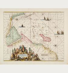
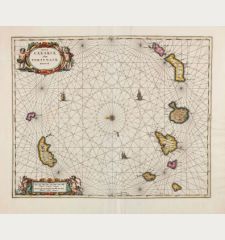
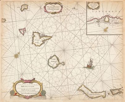
Caarte voor een gedeelte der Canarise Eylanden
Pieter Goos (*1615 - †1675)Reference 12943
Description
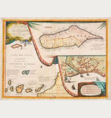
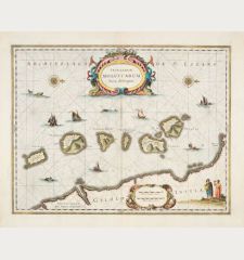
Rare sea chart of the Canary Islands by Pieter Goos. The islands featured from left to right include El Hierro, La Palma, La Gomera, Tenerife, Gran Canaria, Fuerteventura, Isla de Lobos, Lanzarote, La Graciosa, Montaña Clara, and Alegranza.
The chart not only indicates the locations of ports but also includes crucial navigational information such as soundings, sand bars, fishing banks, and potential hazards. Additionally, it features rhumb lines, scales, a ship illustration, and an ornate compass rose. The decorative title cartouche adds an artistic touch to the map.
An inset map specifically focuses on the harbor of Lanzarote, an island that served as an important Dutch trading center in the 17th century. The small cartouche and compass rose in the inset map contribute to the overall aesthetic appeal of this sea chart. The map was originally published in Pieter Goos' De Zee-Atlas Ofte Water-Weereld. Old mounted on paper, as usual for nautical charts by Goos.
Details
| Cartographer | Pieter Goos |
| Title | Caarte voor een gedeelte der Canarise Eylanden |
| Publisher, Year | Amsterdam, circa 1660 |
| Plate Size | 42.5 x 52.3 cm (16.7 x 20.6 inches) |
| Sheet Size | 44.7 x 54.3 cm (17.6 x 21.4 inches) |
Condition
Cartographer
Images to Download
If you like to download the image of this map with a resolution of 1200 pixels, please follow the link below.
You can use this image for publication on your personal or commercial websites for free if you set a link to this website. If you need photographs with a higher resolution, please contact us.
Sea Charts - Goos, Pieter - Caarte voor een gedeelte der Canarise...

![[Manuscript Chart of the South Atlantic Ocean] Tweede stuck wassende Graedkaert van de Kaap Verdische Eilanden tot de Kaap [Manuscript Chart of the South Atlantic Ocean] Tweede stuck wassende Graedkaert van de Kaap Verdische Eilanden tot de Kaap](https://www.vintage-maps.com/3745-home_default/blaeu-manuscript-1690.jpg)
