Product successfully added to your shopping cart
There are 0 items in your cart. There is 1 item in your cart.
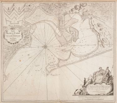
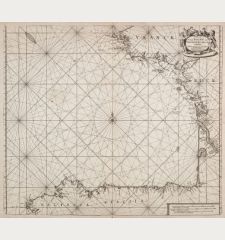
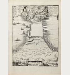
Kaart van de Baay van Cadix met de Plans der Fortificatien. Ten Dienst der Zeevaart...
Johannes van Keulen (*1654 - †1711)Reference 12618
Description
Sea chart of the Bay of Cadiz by Johannes van Keulen. Shows the bay and harbour of Cádiz on the Atlantic coast of Spain after a map by William May. With Rota, El Puerto de Santa Maria and Cádiz. Top left a title cartouche, below right a cartouche with dedication to Gerard Hasselaar. Marked are anchorages and shoals, with a compass rose in the centre.
Old doubled on blue paper. Nautical charts not bound in atlases and intended for navigation at sea were often reinforced with a second sheet, as seen here. This made them easier to handle and a suitable set of different maps could be taken along on the planned voyage.
Details
| Cartographer | Johannes van Keulen |
| Title | Kaart van de Baay van Cadix met de Plans der Fortificatien. Ten Dienst der Zeevaart opgesteld door William May, Luit. ter Zee. |
| Publisher, Year | Johannes van Keulen, Amsterdam, circa 1700 |
| Plate Size | 50.0 x 56.5 cm (19.7 x 22.2 inches) |
| Sheet Size | 52.0 x 59.5 cm (20.5 x 23.4 inches) |
Condition
Cartographer
Images to Download
If you like to download the image of this map with a resolution of 1200 pixels, please follow the link below.
You can use this image for publication on your personal or commercial websites for free if you set a link to this website. If you need photographs with a higher resolution, please contact us.
Spain - Portugal - Keulen, Johannes van - Kaart van de Baay van Cadix met de Plans...

![Tabula nova Hispaniae [Tabula noua Hispaniae] Tabula nova Hispaniae [Tabula noua Hispaniae]](https://www.vintage-maps.com/3236-home_default/fries-spain-portugal-1541.jpg)

![[Canary Islands] [Canary Islands]](https://www.vintage-maps.com/3021-home_default/bordone-spain-portugal-canaries-tenerife-gran-canaria.jpg)


