Product successfully added to your shopping cart
There are 0 items in your cart. There is 1 item in your cart.
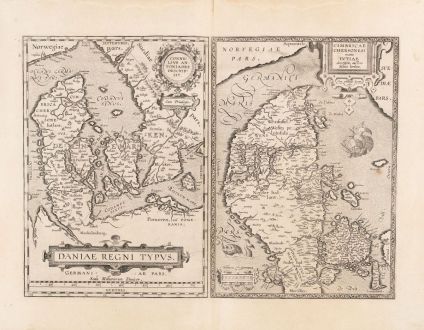
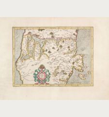
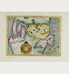
Daniae regni typus / Cimbricae Chersonesi nunc Iutiae
Abraham Ortelius (*1527 - †1598)Reference 12763
Description
Antique map of Denmark by A. Ortelius. Two maps on one sheet. The left map shows the entire Kingdom of Denmark with Schleswig-Holstein and the Baltic coast of Mecklenburg-Vorpommern in the south. In the northwest the southern part of Sweden. The map of Denmark is based on the large map of Scandinavia by Olaus Magnus. On the right the map of Jutland by Mark Jorden with Funen and Northern Schleswig.
Decorated with a total of three cartouches, a sea monster and a sailing ship. From the rare Spanish edition of the Theatrum Orbis Terrarum from 1602. Spanish text on verso.
Details
| Cartographer | Abraham Ortelius |
| Title | Daniae regni typus / Cimbricae Chersonesi nunc Iutiae |
| Publisher, Year | Jan Baptist Vrients, Antwerp, 1602 |
| Plate Size | 34.3 x 48.2 cm (13.5 x 19.0 inches) |
| Sheet Size | 44.7 x 58.0 cm (17.6 x 22.8 inches) |
| Reference | Van den Broecke, M.: Ortelius Atlas Maps, No. 86; Van der Krogt, P.: Koeman's Atlantes Neerlandici, 1500:31C+1550:31C |
Condition
Cartographer
Images to Download
If you like to download the image of this map with a resolution of 1200 pixels, please follow the link below.
You can use this image for publication on your personal or commercial websites for free if you set a link to this website. If you need photographs with a higher resolution, please contact us.
Denmark - Ortelius, Abraham - Daniae regni typus / Cimbricae Chersonesi...

