Product successfully added to your shopping cart
There are 0 items in your cart. There is 1 item in your cart.
Total products
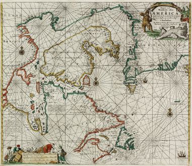
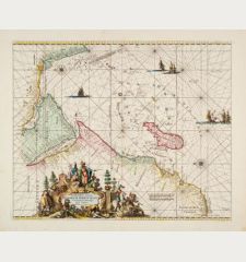
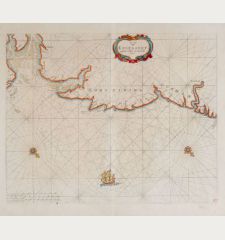
Pascaarte vande Noorder Zee Custen van America, vande West-Hoeck van Ysland doorde...
Johannes van Keulen (*1654 - †1711)Coloured sea chart of Greenland, Northwest Passage, Hudson Bay. Printed in Amsterdam by van Keulen in 1728.
Reference 11308
Description
Fourth and last edition of van Keulen's chart of the Arctic Canada with the Hudson Bay and the supposed Northwest Passage. First published in 1680. The map is based upon Van Loon's map of 1666 and is copied directly from Hendrik Doncker's chart of 1678. Beautified with rhumb lines, three compass rose and two sailing ships. A figural cartouche showing an Arctic Native hunting a polar bear, natives are packing supplies around the mileage scale.
Details
| Cartographer | Johannes van Keulen |
| Title | Pascaarte vande Noorder Zee Custen van America, vande West-Hoeck van Ysland doorde Straet Davis en Hudson, tot aen Terra Neuf |
| Publisher, Year | van Keulen, Amsterdam, 1728-80 |
| Plate Size | 50.5 x 57.6 cm (19.9 x 22.7 inches) |
| Sheet Size | 53.0 x 60.6 cm (20.9 x 23.9 inches) |
| Reference | Burden 515; Kershaw 208; Koeman IV, p. 371/10. |
Condition
Minor creases around cenrefold. Very good conditions.
Cartographer
Johannes van Keulen, born in 1654, was a bookseller in Amsterdam and funded a publishing company in 1678. The family owned company was successful until middle of 19th century, also the sons and grandsons of Johannes had large contribution. The two major atlases have been the Zee Atlas first published 1680 and the Zee-Fakkel first printed 1681 with editions up to 1803. He died in 1711.
Images to Download
If you like to download the image of this map with a resolution of 1200 pixels, please follow the link below.
You can use this image for publication on your personal or commercial websites for free if you set a link to this website. If you need photographs with a higher resolution, please contact us.
Johannes van Keulen: Pascaarte vande Noorder Zee Custen van America, vande West-Hoeck van Ysland doorde Straet Davis en Hudson, tot aen Terra Neuf.
Coloured sea chart of Greenland, Northwest Passage, Hudson Bay. Printed in Amsterdam by van Keulen in 1728.
Sea Charts - Keulen, Johannes van - Pascaarte vande Noorder Zee Custen van...

![[Manuscript Chart of the South Atlantic Ocean] Tweede stuck wassende Graedkaert van de Kaap Verdische Eilanden tot de Kaap [Manuscript Chart of the South Atlantic Ocean] Tweede stuck wassende Graedkaert van de Kaap Verdische Eilanden tot de Kaap](https://www.vintage-maps.com/3745-home_default/blaeu-manuscript-1690.jpg)
