Product successfully added to your shopping cart
There are 0 items in your cart. There is 1 item in your cart.
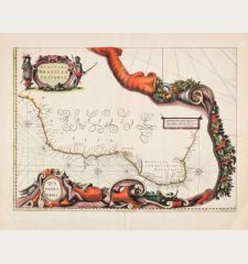
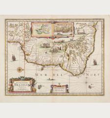
Paraguay, o Prov. de Rio de la Plata cum Regionibus Adiacentibus Tucuman et Sta. Cruz...
Johannes Janssonius (*1588 - †1664)Reference 12891
Description
Beautiful map centered on Paraguay by J. Janssonius. With Uruguay, Bolivia and parts of Argentina, Brazil, Peru and Chile. Including the Paraguay River basin, the Peru-Chilean coast, and Lake Titicaca. The Rio de la Plata is prominently featured, showing numerous large islands in the expansive river. Various towns are named, such as Rio de Janeiro, São Paulo, Buenos Aires, Mendoza, Arica, Potosi, and Cusco. The map closely resembles Blaeu's map of the same title, featuring a decorative title cartouche with distance scales, a smaller cartouche with an armillary sphere, a large compass rose, and a sea monster. Janssonius has additionally included a sailing ship off the coast of Brazil.
From the French edition of the Mercator-Hondius Atlas of 1633. French text on verso.
Details
| Cartographer | Johannes Janssonius |
| Title | Paraguay, o Prov. de Rio de la Plata cum Regionibus Adiacentibus Tucuman et Sta. Cruz de la Sierra |
| Publisher, Year | J. Hondius, Amsterdam, 1633 |
| Plate Size | 37.2 x 47.6 cm (14.6 x 18.7 inches) |
| Sheet Size | 47.2 x 54.5 cm (18.6 x 21.5 inches) |
| Reference | Van der Krogt, P.: Koeman's Atlantes Neerlandici, 9900:1. |
Condition
Cartographer
Images to Download
If you like to download the image of this map with a resolution of 1200 pixels, please follow the link below.
You can use this image for publication on your personal or commercial websites for free if you set a link to this website. If you need photographs with a higher resolution, please contact us.
South America - Janssonius, Johannes - Paraguay, o Prov. de Rio de la Plata cum...


![[West Indies, Jamaica, Hispaniola and South America] [West Indies, Jamaica, Hispaniola and South America]](https://www.vintage-maps.com/3035-home_default/bordone-central-america-caribbean-jamaica-hispaniola.jpg)
