Product successfully added to your shopping cart
There are 0 items in your cart. There is 1 item in your cart.
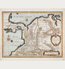
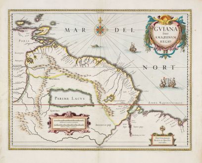
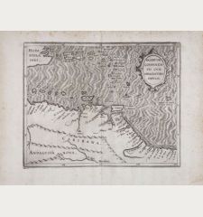
Guiana sive Amazonum Regio
Jodocus Hondius (*1563 - †1612)Reference 12876
Description
Beautiful coloured antique map of Guiana by Jodocus Hondius, showcasing the northeastern parts of South America, Lake Parima (Parime Lacus), and the route to El Dorado. The map's geographical information originates from Dutch cartographer Hessel Gerritz. Gerritz created the map based on his 1628/29 voyage to Brazil and the Caribbean, contributing it to Joannes de Laet’s Beschrijvinghe van West-Indién first published in 1625. The map spans from Isla Margarita and the Orinoco Delta eastward to Tampico and southward to the Amazon River.
From the French edition of the Mercator-Hondius Atlas printed in 1633.
Details
| Cartographer | Jodocus Hondius |
| Title | Guiana sive Amazonum Regio |
| Publisher, Year | Janssonius, Amsterdam, 1633 |
| Plate Size | 37.2 x 48.2 cm (14.6 x 19.0 inches) |
| Sheet Size | 47.8 x 55.2 cm (18.8 x 21.7 inches) |
| Reference | Van der Krogt, P.: Koeman's Atlantes Neerlandici, 9840:1.1. |
Condition
Cartographer
Images to Download
If you like to download the image of this map with a resolution of 1200 pixels, please follow the link below.
You can use this image for publication on your personal or commercial websites for free if you set a link to this website. If you need photographs with a higher resolution, please contact us.
South America - Hondius, Jodocus - Guiana sive Amazonum Regio

![[West Indies, Jamaica, Hispaniola and South America] [West Indies, Jamaica, Hispaniola and South America]](https://www.vintage-maps.com/3035-home_default/bordone-central-america-caribbean-jamaica-hispaniola.jpg)
