Product successfully added to your shopping cart
There are 0 items in your cart. There is 1 item in your cart.
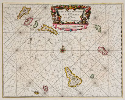
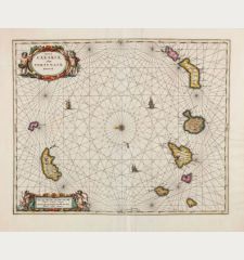
Insulae de Cabo Verde Olim Hesperides sive Gorgades: Belgice De Zoute Eylanden.
Johannes Janssonius (*1588 - †1664)Reference 11916
Description
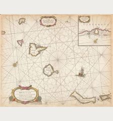
Rare and decorative, old coloured sea chart of the Cape Verde Islands by J. Janssonius. Showing Cape Verde (Cabo Verde) with the islands Santo Antão, São Vicente, Santa Luzia, São Nicolau, Sal, Boa Vista, Maio, Santiago, Fogo and Brava. Decorated with rhumb lines, a compass rose and a beautiful title cartouche.
From the first real sea atlas, known as the Atlas Maritimus. This map comes from the German edition Das Fünffte Theil Des Grossen Atlantis, Welches begreiffet Die Wasser-Welt, Das ist: Eine sehr kunstreiche Abbildung und Beschreibung aller Wasser und Meeren... by Johannes Janssonius (J. Jansson), published as the fifth volume of his Atlas Novus in Amsterdam in 1650.
Details
| Cartographer | Johannes Janssonius |
| Title | Insulae de Cabo Verde Olim Hesperides sive Gorgades: Belgice De Zoute Eylanden. |
| Publisher, Year | Johannes Janssonius, Amsterdam, 1650 |
| Plate Size | 44.0 x 55.3 cm (17.3 x 21.8 inches) |
| Sheet Size | 47.0 x 57.7 cm (18.5 x 22.7 inches) |
| Reference | Van der Krogt, P.: Koeman's Atlantes Neerlandici, 8980:1 |
Condition
Cartographer
Images to Download
If you like to download the image of this map with a resolution of 1200 pixels, please follow the link below.
You can use this image for publication on your personal or commercial websites for free if you set a link to this website. If you need photographs with a higher resolution, please contact us.
Atlantic Ocean - Janssonius, Johannes - Insulae de Cabo Verde Olim Hesperides sive...

![[Manuscript Chart of the South Atlantic Ocean] Tweede stuck wassende Graedkaert van de Kaap Verdische Eilanden tot de Kaap [Manuscript Chart of the South Atlantic Ocean] Tweede stuck wassende Graedkaert van de Kaap Verdische Eilanden tot de Kaap](https://www.vintage-maps.com/3745-home_default/blaeu-manuscript-1690.jpg)

![[Canary Islands] [Canary Islands]](https://www.vintage-maps.com/3021-home_default/bordone-spain-portugal-canaries-tenerife-gran-canaria.jpg)
![[Porto Santo and Madeira] [Porto Santo and Madeira]](https://www.vintage-maps.com/3025-home_default/bordone-spain-portugal-porto-santo-madeira-1528-1565.jpg)
