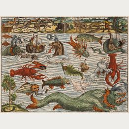
Sea Monsters
America sive Novus Orbis Respectu Europaeorum Inferior Globi Terrestris Pars 1596
Theodor de Bry, Frankfurt, 1596
De Bry's Beautifully Engraved Map of the New World.A very fine full color example of De Bry's scarce map of North and South America. With full-length portraits of the important explorers...
America sive Novus Orbis Respectu Europaeorum Inferior Globi Terrestris...
1596 - Theodor de Bry
12579Coloured map of the American continent. Printed in Frankfurt by Theodor de Bry in 1596.
SoldAfricae tabula nova
Antwerp, 1598
Beautiful original coloured map of the African continent. From the 1598 French edition of Theatrum Orbis Terrarum by Abraham Ortelius. Fifth state of the copperplate, still the date 1570 is present...
Africae tabula nova
1598 - Abraham Ortelius
10112Old coloured map of the African continent. Printed in Antwerp in the year 1598.
SoldGeografia di Claudio Tolomeo Alessandrino Tradotta di Greco nell'Idioma Volgare Italiano da...
M. Sessa Erben, Venice, 1598-99
Sixth edition of Ruscelli's translation of Ptolemy's Geografia edited and extended by Giuseppe Rosaccio published by the Hires of M. Sessa in 1598 and 1599. Illustrated with 69 double page...
Geografia di Claudio Tolomeo Alessandrino Tradotta di Greco nell'Idioma...
1598 - Girolamo Ruscelli
10870A 16th century Ptolemy Atlas, published by the Hires of Sessa in Venice during the years 1598-99.
SoldRegni Hispaniae Post Omnium Editiones Locuplettissima Descriptio
Plantin Press, Antwerp, 1598
Antique map of Spain and Portugal by A. Ortelius. Showing the Iberian Peninsula with Balearic Islands and parts of northern Africa. With one large cartouche, a mileage scale, sailing ships and sea...
Regni Hispaniae Post Omnium Editiones Locuplettissima Descriptio
1598 - Abraham Ortelius
12092Coloured map of Spain - Portugal. Printed in Antwerp by Plantin Press in 1598.
SoldTypus Orbis Terrarum
Plantin Press, Antwerp, 1598
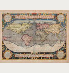
An old coloured and early example of one of the most famous world maps ever published. From the first modern atlas Theatrum Orbis Terrarum by Abraham Ortelius. "As the first world map occurring...
Typus Orbis Terrarum
1598 - Abraham Ortelius
12786Antique map of the world by Abraham Ortelius. Published in 1598 in Antwerp.
SoldThietmarsiae Holsaticae regionis partis typus Auctore Petro Boeckel
J. Bussemacher, Cologne, circa 1600
Antique map of Dithmarschen, Schleswig-Holstein by Matthias Quad. Shows Dithmarschen between the North Sea, Eider and Elbe. From Brunsbüttel to St. Annen, with Heide and Hemmingstedt in the centre....
Thietmarsiae Holsaticae regionis partis typus Auctore Petro Boeckel
1600 - Matthias Quad
12389Old coloured map of Dithmarschen, Schleswig-Holstein. Printed in Cologne by J. Bussemacher circa 1600.
SoldScotiae Tabula
Antwerp, 1602
Original old coloured map of Scotland by A. Ortelius. With one large cartouche, one sailing ship and a sea monster. From the 1602 German edition of "Theatrum Orbis Terrarum". Based on Mercator's...
Scotiae Tabula
1602 - Abraham Ortelius
10879Old coloured map of Scotland. Printed in Antwerp in the year 1602.
SoldAfricae Tabula Nova
Antwerp, 1603
Beautiful hand coloured map of the African continent. From the 1603 Latin edition of Theatrum Orbis Terrarum by Abraham Ortelius. Fifth state of the copperplate, still the date 1570 is present in...
Africae Tabula Nova
1603 - Abraham Ortelius
10656Coloured map of the African continent. Printed in Antwerp in the year 1603.
SoldPresbiteri Iohannis, sive, Abissinorum Imperii Descriptio
Jan Baptist Vrients, Antwerp, 1603
Hand coloured antique map of Africa by Abraham Ortelius. Shows the Kingdom of the mystical Prester John in central Africa. Decorated with two cartouches, four elephants, sea monsters and a sailing...
Presbiteri Iohannis, sive, Abissinorum Imperii Descriptio
1603 - Abraham Ortelius
11900Coloured map of Priest Joan, Ethiopia, Central Africa. Printed in Antwerp by Jan Baptist Vrients in 1603.
SoldCypri Insulae Nova Descript. 1573
Jan Baptist Vrients, Antwerp, 1603
Early and important map of Cyprus by Abraham Ortelius. The geographical details are based on the map of Cyprus by Giacomo Franco from 1570. Below right a inset map of Lemnos, based on notes by...
Cypri Insulae Nova Descript. 1573
1603 - Abraham Ortelius
11921Coloured map of Cyprus. Printed in Antwerp by Jan Baptist Vrients in 1603.
SoldAusszug auss des Abrahami Ortelij Theatro Orbis teutsch beschriben durch Levinum Hulsium,...
Levinus Hulsius, Jan van Keerbergen, Frankfurt, 1604
Very Rare and Only German Edition of the Pocket Atlas by Ortelius. With 128 Maps.Complete and well preserved example of the rare German edition of Ortelius's Epitome. Edited by Levinus...
Ausszug auss des Abrahami Ortelij Theatro Orbis teutsch beschriben durch...
1604 - Abraham Ortelius
12590Pocket atlas by Ortelius with 128 copper engraved maps, publihed by L. Hulsius and J. van Keerbergen 1604 in Frankfurt.
SoldIndia Orientalis
H. Hondius, Amsterdam, circa 1606
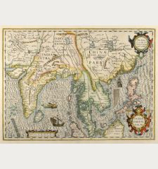
Beautiful coloured map of India, the Malay Peninsula, China and the Philippines, Thailand and Cambodia and parts of Sumatra with Borneo from a French edition of the Mercator-Hondius Atlas. With two...
India Orientalis
1606 - Gerard Mercator
10687Coloured map of the Philippines, Thailand, China, India. Printed in Amsterdam by H. Hondius circa 1606.
SoldNova Africae Tabula Auctore Jodoco Hondio
Amsterdam, 1606
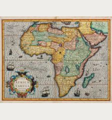
Old coloured map of Africa by Jodocus Hondus. The second map of Africa by Hondius, first published in the Mercator-Hondius Atlas of 1606. The geographical information is based on the Mercator map...
Nova Africae Tabula Auctore Jodoco Hondio
1606 - Jodocus Hondius
12406Old coloured map of the African continent. Printed in Amsterdam in the year 1606.
SoldAtlas minor à I.Hondio plurimis aeneis tabulis auctus atque illustratus.
J. Hondius, C. Claesz, J. Janssonius, Amsterdam, 1607
Rare First Edition of the Atlas Minor by Mercator. With 153 Maps.A complete and well preserved example of the rare first edition of Mercator's Atlas Minor .In 1607, Jodocus Hondius...
Atlas minor à I.Hondio plurimis aeneis tabulis auctus atque illustratus.
1607 - Gerard Mercator
12787Atlas Minor by G. Mercator with 153 copper engraved maps, publihed by J. Hondius and J. Janssonius 1607 in Amsterdam.
SoldIrlandiae Accurata Descriptio, Auctore Baptista Boazio
J. B. Vrients, Antwerp, 1608 or 1612
Rare and incredible decorative map of Ireland with beautiful old colour. This west-oriented map rarely appears on the market, since it was bound in only a few copies of the Ortelius Atlas, while...
Irlandiae Accurata Descriptio, Auctore Baptista Boazio
1608 - Abraham Ortelius
11476One of the most desirable map of Ireland for collectors. Based on the map of Boazio, published by J. B. Vrients in Antwerp between 1608 and 1612.
SoldCataloniae principatus novissima et accurata descriptio
J. B. Vrients, Antwerp, 1608 or 1612
Rare and very decorative map of Catalonia (Catalunya) by J. B. Vrients. Commissioned by Jacob Baptiste Vrients and engraved by Pieter van den Keere, probably the finest engraver of his time....
Cataloniae principatus novissima et accurata descriptio
1608 - Abraham Ortelius
12413Old coloured map of Catalonia, Cataluna, Catalunya. Printed in Antwerp by J. B. Vrients in 1608 or 1612.
SoldNova totius terrarum orbis geographica ac hydrographica tabula
Amsterdam, 1608 [1637-44]
The Rare Kerius-Janssonius World Map After Blaeu.Perhaps the finest world map ever printed. This world map in Mercator projection, surrounded by four decorative borders, was engraved by...
Nova totius terrarum orbis geographica ac hydrographica tabula
1608 - Pieter van den Keere
12659Antique world map with borders by Pieter van den Keere. Published around 1640 in Amsterdam.
SoldScotiae Tabula
Antwerp, 1609
Beautiful original coloured map of Scotland. From the 1609 Latin edition of "Theatrum Orbis Terrarum" by Abraham Ortelius. Second state of the copperplate. The cartographical source of this map...
Scotiae Tabula
1609 - Abraham Ortelius
10143Old coloured map of Scotland. Printed in Antwerp in the year 1609.
SoldLacus Lemani Vicinorumq. Locorum Nova et Accurata Descriptio
J. B. Vrients, Antwerp, 1609 or 1612
Rare and extremely decorative map of Lake Geneva by J. B. Vrients. Vrients used this map only in 3 editions of the Ortelius atlases he published between 1608 and 1612. According to Marcel Van den...
Lacus Lemani Vicinorumq. Locorum Nova et Accurata Descriptio
1609 - Abraham Ortelius
12646Old coloured map of the Lac Leman, Lake Geneva. Printed in Antwerp by J. B. Vrients in 1609 or 1612.
SoldDaniae Regnu
J. Hondius, Amsterdam, 1613-19
Old coloured antique map of Denmark by Gerard Mercator. Shows Denmark with Holstein and Mecklenburg with Rügen in the south and south Sweden in the north. Top right a title cartouche, in the North...
Daniae Regnu
1613 - Gerard Mercator
11863Old coloured map of Denmark. Printed in Amsterdam by J. Hondius in 1613.
SoldAsiae Nova Descriptio Auctore Jodoco Hondio
H. Hondius, Amsterdam, 1613-19
Beautiful antique map of the Asian continent by Jodocus Hondius. Shows Asia from the Mediterranean to the Pacific. With the Arabian Peninsula, India, Thailand, China, Japan, Korea as an island,...
Asiae Nova Descriptio Auctore Jodoco Hondio
1613 - Jodocus Hondius
12560Coloured map of the Asian continent. Printed in Amsterdam by H. Hondius in 1613.
SoldNova Germaniae Descriptio
Johannes Janssonius, Amsterdam, 1616 [1632]
Scarce Janssonius map of the Holy Roman Empire with side panels.Very decorative and rare 'carte-à-figures' map of Germany with the surrounding countries by Johannes Janssonius. First...
Nova Germaniae Descriptio
1616 - Johannes Janssonius
12656Coloured map of Germany. Printed in Amsterdam by Johannes Janssonius in 1632.
SoldNova Famigerabilis Insulae ac Ducatus Rugiae Descripto.
Amsterdam, 1623
Beautiful old coloured map of Rügen with Hiddensee by Eilhard Lübben. Shows the coast of the Baltic Sea from Peenemunde and Stralsund to Barhöft and the island of Rügen with many details. The...
Nova Famigerabilis Insulae ac Ducatus Rugiae Descripto.
1623 - Jodocus Hondius
11520Old coloured map of Rügen, Baltic Sea. Printed in Amsterdam in the year 1623.
SoldAmerica
Henricus Hondius, Amsterdam, 1628
This map, engraved by Jodocus Hondius the Elder, is a finely colored example of a highly sought-after map of America. It was created in 1604 for Hondius' first edition of the Mercator Atlas Sive...
America
1628 - Jodocus Hondius
12765Coloured map of the American continent. Printed in Amsterdam by Henricus Hondius in 1628.
Sold


![Pieter van den Keere: Nova totius terrarum orbis geographica ac hydrographica tabula van den Keere, World Map, 1608 [1637-44]: Nova totius terrarum orbis geographica ac hydrographica tabula](https://www.vintage-maps.com/3842-home_default/van-den-keere-world-map-1608-1637-44.jpg)


![Johannes Janssonius: Nova Germaniae Descriptio Janssonius, Germany, 1616 [1632]: Nova Germaniae Descriptio](https://www.vintage-maps.com/3794-home_default/janssonius-germany-1616-1632.jpg)

