Product successfully added to your shopping cart
There are 0 items in your cart. There is 1 item in your cart.
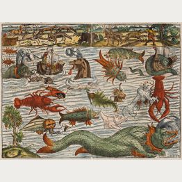
Sea Monsters

Insulae Corsicae Nova & accurata Descriptio
P. Schenk & G. Valk, Amsterdam, circa 1700
Beautiful old coloured engraved map of Corsica. Decorated with several sailing ships, sea monsters, a figurative text cartouche, a coat of arms and a mileage scale surrounded by Aquarius and putti.
Insulae Corsicae Nova & accurata Descriptio
1700 - Valk & Schenk
11439Old coloured map of Corse, Corsica. Printed in Amsterdam by P. Schenk & G. Valk circa 1700.
Sold
Partie Meridionale d'Afrique ou se Trouvent la Basse Guinee, la Cafrerie, le Monomotapa, le...
Paris, circa 1705
A charming map of South Africa with Madagascar. From Nicolas de Fer's Atlas Curieux . With many details in the interior of the country. Decorated with a nice title cartouche with a ship and a sea...
Partie Meridionale d'Afrique ou se Trouvent la Basse Guinee, la...
1705 - Nicolas de Fer
11702Antique map of South Africa. Printed in Paris circa 1705.
Sold
Terra Neuf, en de Custen van Nieu Vranckryck, Nieu Engeland, Nieu Nederland, Nieu Andalusia,...
L. Renard, Amsterdam, 1715
L. Renard's edition of Frederick de Wit's magnificent Atlantic map oriented to the East. From the 1715 edition of "Atlas de la Navigation et du Commerce". A fascinating and very decorative early...
Terra Neuf, en de Custen van Nieu Vranckryck, Nieu Engeland, Nieu...
1715 - Louis Renard
10318Old coloured sea chart of the Azores, Caribbean. Printed in Amsterdam by L. Renard in 1715.
Sold
Generalis Totius Imperii Russorum Novissim Tabula
J. B. Homann, Nuremberg, 1716
Map of the Russian Empire. With beautiful cartouche, ships and seamonsters. Original publisher colours.
Generalis Totius Imperii Russorum Novissim Tabula
1716 - Johann Baptist Homann
10299Old coloured map of Russia. Printed in Nuremberg by J. B. Homann in 1716.
Sold
Uitbeelding der heerlijkheit Friesland, zoo in 't algemeen, als in haare... door Dr. Bern....
Francois Halma, Leeuwarden, 1718
Second and enlarged edition of the first atlas of the Dutch province of Friesland, including 30 detail maps of the entire provinces of Friesland, an overview map of Friesland and 8 historical maps...
Uitbeelding der heerlijkheit Friesland, zoo in 't algemeen, als in...
1718 - B. Schotanus van Sterringa
11466A splendid copy of the famous Friesland Atlas. All maps and views finely coloured by a contemporary hand.
Sold
Nieuwe Pascaert vande Kust van Maroca en Zanhaga Beginnend van C. Cantin tot C. Bajador, waer in...
van Keulen, Amsterdam, circa 1720
Highly decorative sea chart of the North West coast of Africa with Fuerteventura and Lanzarote. Shows the south-western coast of Morocco and western parts of the Sahara, from the Cape Cantin to...
Nieuwe Pascaert vande Kust van Maroca en Zanhaga Beginnend van C. Cantin...
1720 - Johannes van Keulen
11301Coloured sea chart of the Canary Island, Lanzarote, Atlantic, North Africa. Printed in Amsterdam by van Keulen circa 1720.
Sold
Generalis totius Imperii Moscovitici Novissima Tabula. Magnam Orbis Terrarum Partem a Polo...
J. B. Homann, Nuremberg, circa 1720
Decorative map of the Russian Empire with original publishers colour. Showing the Northeast Passage. With beautiful cartouche, ships and sea monsters around Spitsbergen.
Generalis totius Imperii Moscovitici Novissima Tabula. Magnam Orbis...
1720 - Johann Baptist Homann
11484Old coloured map of Russia. Printed in Nuremberg by J. B. Homann circa 1720.
Sold
Statuum Totius Italiae Novissima Repraesentatio Geographica ...
J. B. Homann, Nuremberg, circa 1720
Old coloured map of Italy by Johann Baptist Homann. With Corsica, Sardinia and Sicily. To the lower left a beautiful, skillful finished title cartouche.
Statuum Totius Italiae Novissima Repraesentatio Geographica ...
1720 - Johann Baptist Homann
11732Old coloured map of Italy. Printed in Nuremberg by J. B. Homann circa 1720.
Sold
Novissima & Exactissima Totius Regni Neapolis Tabula ...
Johann Baptist Homann, Nuremberg, circa 1720
Old coloured map of Southern Italy (Italia meridionale) by Johann Baptist Homann. Shows the southern regions of Italy between L'Aquila and Gaeta in the northwest, Naples (Napoli) and the southern...
Novissima & Exactissima Totius Regni Neapolis Tabula ...
1720 - Johann Baptist Homann
11736Old coloured map of Molise, Campania, Basilicata, Puglia, Calabria. Printed in Nuremberg by Johann Baptist Homann circa 1720.
Sold
Mappe-Monde Dresse sur les Observations de Mrs de l'Academie Royale des Sciences
Covens & Mortier, Amsterdam, circa 1730
Very decorative double-hemisphere world map by J. Covens and P. Mortier. The map is based on the 1700 world map by Guillaume De L'Isle. Compared to the map by De L'Isle, this one has four...
Mappe-Monde Dresse sur les Observations de Mrs de l'Academie Royale des...
1730 - Covens and Mortier
12553Old coloured map of the world. Printed in Amsterdam by Covens & Mortier circa 1730.
Sold


