Product successfully added to your shopping cart
There are 0 items in your cart. There is 1 item in your cart.
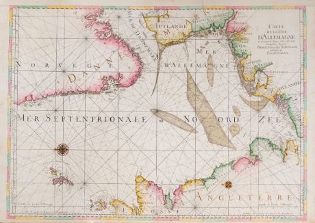
Carte de la Mer d'Allemagne ... depuis Bergen et les Isles Schetland jusques au Pas de...
Covens and MortierReference 12057
Description
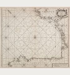
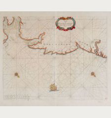
Very large sea chart of the North Sea by J. Covens and P. Mortier. Showing the coast of the North Sea with the Shetland and Orkney Islands, the Scottish and English east coast, Calais and Dover, the North Sea coast of the Netherlands, Germany and Denmark, along the Atlantic coast of Norway with Stavanger and Bergen. Oriented to the east. Decorated with rhumb lines and two compass roses.
Koeman about Le Neptune François:
The Neptune Francois in two parts and its third part Cartes Marines... was the most expensive sea-atlas ever published in Amsterdam in the 17th century. Its charts are larger and more lavishly decorated than those of any preceding book of its kind... In 1700, Mortier brought out a third volume with charts of the outer-European waters... Suite du Neptune François. Apart from the first volume which had a second edition in 1703, none of the atlases was republished. This magnificent work was intended more as a show-piece than something to be used by the pilots at sea.
Details
| Cartographer | Covens and Mortier |
| Title | Carte de la Mer d'Allemagne ... depuis Bergen et les Isles Schetland jusques au Pas de Calais |
| Publisher, Year | Pierre Mortier, Amsterdam, circa 1700 |
| Plate Size | 61.0 x 86.0 cm (24.0 x 33.9 inches) |
| Sheet Size | 64.5 x 92.0 cm (25.4 x 36.2 inches) |
Condition
Cartographer
Images to Download
If you like to download the image of this map with a resolution of 1200 pixels, please follow the link below.
You can use this image for publication on your personal or commercial websites for free if you set a link to this website. If you need photographs with a higher resolution, please contact us.
Atlantic Ocean - Covens and Mortier - Carte de la Mer d'Allemagne ... depuis...

![[Manuscript Chart of the South Atlantic Ocean] Tweede stuck wassende Graedkaert van de Kaap Verdische Eilanden tot de Kaap [Manuscript Chart of the South Atlantic Ocean] Tweede stuck wassende Graedkaert van de Kaap Verdische Eilanden tot de Kaap](https://www.vintage-maps.com/3745-home_default/blaeu-manuscript-1690.jpg)


![[Canary Islands] [Canary Islands]](https://www.vintage-maps.com/3021-home_default/bordone-spain-portugal-canaries-tenerife-gran-canaria.jpg)
![[Porto Santo and Madeira] [Porto Santo and Madeira]](https://www.vintage-maps.com/3025-home_default/bordone-spain-portugal-porto-santo-madeira-1528-1565.jpg)
