Product successfully added to your shopping cart
There are 0 items in your cart. There is 1 item in your cart.
Total products
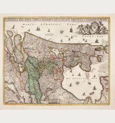
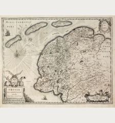
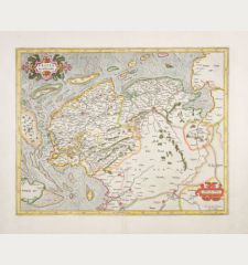
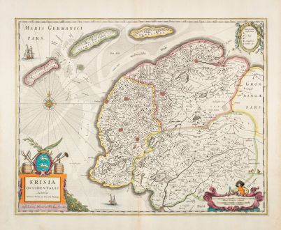
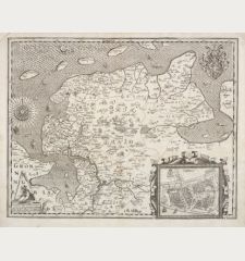
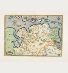
Frisia Occidentalis Auctoribus Adriano Metio et Gerardo Freitag.
Jodocus Hondius (*1563 - †1612)Coloured map of West-Friesland. Printed in Amsterdam by H. Hondius in 1633.
Reference 12829
Description
Beautifully coloured antique map of West Frisia with the islands of Vlieland, Terschelling and Ameland with mileage indicator and figural cartouche, two sailing ships and a compass rose. After Adrian Metius and Gerard Freitag, by H. Hondius. From the French edition of the Mercator-Hondius Atlas printed in 1633.
Details
| Cartographer | Jodocus Hondius |
| Title | Frisia Occidentalis Auctoribus Adriano Metio et Gerardo Freitag. |
| Publisher, Year | H. Hondius, Amsterdam, 1633 |
| Plate Size | 38.7 x 49.5 cm (15.2 x 19.5 inches) |
| Sheet Size | 48.2 x 56.5 cm (19.0 x 22.2 inches) |
| Reference | Van der Krogt, P.: Koeman's Atlantes Neerlandici, 3910:1.1 |
Condition
Very good condition.
Cartographer
Jodocus Hondius was born 1563 in Wakken (West Flanders). He became a globe maker and map engraver. In 1593 he set up his business in Amsterdam after he spent several years in London. He was one of the most important engravers of his time and engraved maps for van den Keere, Waghenaer and Speed. Hondius bought the plates of Mercator in 1604, added around 40 maps and published the expanded Mercator-Atlas first 1606 still under Mercator's name. After his death 1612 in Amsterdam, the business was carried out by his sons Jodocus II and Henricus.
Images to Download
If you like to download the image of this map with a resolution of 1200 pixels, please follow the link below.
You can use this image for publication on your personal or commercial websites for free if you set a link to this website. If you need photographs with a higher resolution, please contact us.
Jodocus Hondius: Frisia Occidentalis Auctoribus Adriano Metio et Gerardo Freitag..
Coloured map of West-Friesland. Printed in Amsterdam by H. Hondius in 1633.
Netherlands - Hondius, Jodocus - Frisia Occidentalis Auctoribus Adriano...

![[Aa-Berlicum-Erp] [Aa-Berlicum-Erp]](https://www.vintage-maps.com/2588-home_default/anonymous-netherlands-river-aa-1780.jpg)
![[Kleve, Duisburg, Emmerich, Gennep] Cliviam, Ducatus Clivensis - Duisburgum - Embrica, Clivensis ditionis - Gennapium... [Kleve, Duisburg, Emmerich, Gennep] Cliviam, Ducatus Clivensis - Duisburgum - Embrica, Clivensis ditionis - Gennapium...](https://www.vintage-maps.com/3818-home_default/braun-hogenberg-north-rhine-westphalia-emmerich-duisburg-kleve.jpg)
