Product successfully added to your shopping cart
There are 0 items in your cart. There is 1 item in your cart.
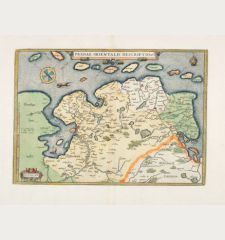
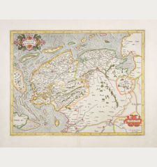
Typus Frisiae Orientalis à Dullarto ...
Pieter van den Keere (*1571 - †1650)Reference 12662
Description
One of the most beautiful maps of East Frisia.
Rare and very decorative map of East Frisia (Ostfriesland) by Ubbo Emmius. Showing the North Sea coast of Friesland between Dollart and the Jade Bay with Emden, Leer and the East Frisian islands of Juist, Norderney, Baltrum, Langeoog, Spiekeroog and Wangerooge. Richly decorated with sea monsters, numerous sailing ships and a large compass rose. At the bottom left a plan of Emden.
The fourth state of the original plate by Ubbo Emmius, which was first taken over by Cornelis Claesz and published unchanged. After his death in 1609, Pieter van den Keere (Kaerius) acquired the plate, revised the name and sold a few separate published prints of it. The plate was too large for inclusion in his famous Atlas Germania inferior, so he cut it at the bottom and left and replaced the two text cartouches with a figural cartouche. Our example comes from the last edition of the atlas with Latin text on the verso, published in 1622.
Details
| Cartographer | Pieter van den Keere |
| Title | Typus Frisiae Orientalis à Dullarto ... |
| Publisher, Year | Pieter van den Keere, Amsterdam, 1622 |
| Plate Size | 39.5 x 50.1 cm (15.6 x 19.7 inches) |
| Sheet Size | 44.1 x 54.3 cm (17.4 x 21.4 inches) |
| Reference | Schilder, G.: Monumenta Cartographica Neerlandica VIII, 37.2; Van der Krogt, P.: Koeman's Atlantes Neerlandici, 2310:364. |
Condition
Cartographer
Images to Download
If you like to download the image of this map with a resolution of 1200 pixels, please follow the link below.
You can use this image for publication on your personal or commercial websites for free if you set a link to this website. If you need photographs with a higher resolution, please contact us.
Lower Saxony - Keere, Pieter van den - Typus Frisiae Orientalis à Dullarto ...


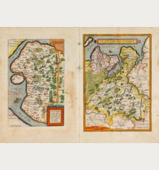
![Westfalia cum Dioecesi Bremensi [2 Karten] Westfalia cum Dioecesi Bremensi [2 Karten]](https://www.vintage-maps.com/4256-home_default/mercator-germany-lower-saxony-1633.jpg)


![Lubeca, Lvbeck [Lübeck], Luneburgum, Lüneburg Lubeca, Lvbeck [Lübeck], Luneburgum, Lüneburg](https://www.vintage-maps.com/3153-home_default/saur-germany-schleswig-holstein-luebeck-lueneburg-1595.jpg)
![Bravnsweich [Braunsweich], Rostochium [Rostock] Bravnsweich [Braunsweich], Rostochium [Rostock]](https://www.vintage-maps.com/3155-home_default/saur-germany-lower-saxony-braunschweig-rostock-1595.jpg)
![Aldenburg [Aldenbvrg] Aldenburg [Aldenbvrg]](https://www.vintage-maps.com/2177-home_default/muenster-germany-lower-saxony-stade-1574.jpg)
